Download
1 / 78
780 likes | 1.04k Views
Create garage location where you park buses, using the school location ... Garages are added differently from stops and are only 3 characters, ...

E N D
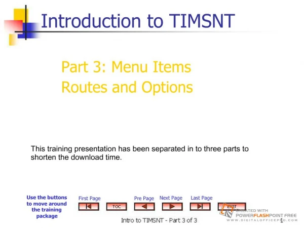
Slide 1:Introduction to TIMSNT
Use the buttons to move around the training package First Page Pre Page Next Page Last Page Part 3: Menu Items Routes and Options This training presentation has been separated in to three parts to shorten the download time.
Slide 2:Table of Contents
Part 3
Slide 3:Examples
The examples in this online training presentation were prepared with previous data from Johnston County and are merely a guide. You can apply the instructions and use your own county data to practice the step-by-step process, but first perform a backup of your data.
Slide 4:Routes Menu
Garage You will need to make a Garage at every place buses are parked
Slide 5:Deadheads
NEW: The system automatically creates a �deadhead� run between the end of the morning runs and the beginning of the afternoon runs If this is a different location than where the run ends, you will need to change this as well using the garage feature of route
Slide 6:Deadheads
Create garage location where you park buses, using the school location Add the garage location to the route This will link your runs together The system creates a �deadhead run� for these records and noted with a �-� symbol in the reports How To:
Slide 7:AM Routes: Garage, Loaded & Deadhead Runs
Garage runs are to or from parking location, here is a garage at school 1 Deadheads are between runs
Slide 8:PM Routes: Loaded, Deadhead & Garages
The first Deadhead in PM gets the bus from the end of AM activity to the beginning of PM activity Run 1 The final Garage runs gets you to parking for the evening
Slide 9:Working With Garages
Garages are added differently from stops and are only 3 characters, preceded by a �*� School locations are very simple to add as garages and you will need to add schools as garages to reflect the mileage between your runs and the location the buses park Non-school garages (drivers homes) must also be added, and given a number or letter ID� they are no longer created as regular stops using stop numbers
Slide 10:Adding a Garage Location
TIMS.NT\routes\garage Add the ID; if it is not found, it will be added. You will need to know the location or node number Confirm
Slide 11:Adding a Garage Location
Select the appropriate route number and determine the position in the route to place the �garage� location
Slide 12:Adding Garage Locations
School codes remain garage IDs when actually parking at a school location Non-school garages allow you to create your own numbering system (alpha or numeric) Start with 100�s for ID�s that need to be created at a driver�s residence � remember you will have to keep up with them or view reports to obtain the numbers later
Slide 13:Adding Garage to Route
Bring up your route display Choose Add Garage
Slide 14:Garage Run has now been added
The route display shows the garage added as a separate run, both a.m. and p.m.
Slide 15:Garage and Deadhead Directions
Directions for loaded runs are generated under Runs Directions for garage runs and deadhead runs are generated by accessing the Route menu This is the only area you are able to obtain run directions linking up garage and deadhead runs to reflect the total bus miles for the day
Slide 16:Getting Started
Create a list of routes Load the list you want to work with as a work list
Slide 17:Processing Directions for Routes
Routes>Group Processes>Directions Select list, set parameters Begin processing
Slide 18:Results
Until you add garage runs, routes do not �link� together to give you the miles between trips. Routes ? Tabular ? Worklist ? Select list
Slide 19:Route Timeline
TIMS.NT does not have a graphic component to display routes as they are linked from garage runs to the first and last runs of the route A route timeline is available You can not obtain run directions using this component; only make run or time modifications
Slide 20:Route Timeline
The route timeline is accessed via
Slide 21:Route Timeline
Select Route Select and load a worklist You may have to reset the window times to display the timeline properly You may insert runs on routes, add garage runs and the other route functions here as well EXCEPT obtain run directions
Slide 22:Route Timeline
Slide 23:Post Run Directions Utilities
After you have processed your new run directions, run these utilities in the following order: Updatetime1and2 Updaterunmileage Computetimeatstop
(UpdateTIme1andTime2) This utility processes each stop record and updates the time 1 and time 2 fields if they have changed. Start Utility.Slide 24: Update Time1 and Time2 Fields
(Updaterunmileage) Updates the loaded mileage field in run from the run directions. Currently this is the only place you can fill this field other than conversions. Run UtilitySlide 25: Update Loaded Mileage Field in Runs
Slide 26:COMPUTETIMEATSTOP
Use this utility to have the system determine the time when buses should arrive at stops on their runs. If problems happen, view the error files to find out what happened
Slide 27:Reporting Run Directions
The utility Dumpall is also required if reports will be produced
Troubleshooting Run Directions ProblemsSlide 29:Run Directions � What Can Go Wrong �
Once again, run direction files contain information about street segments � meaning a difference of good or bad run directions: Speed � a segment with �0� speed = no bus travel Length � is the segment to scale and drawn correctly to determine proper mileage? Angles � a segment with an incorrect angle causes run directions to say �turnaround� or make wrong turns
Slide 30:Run Directions � What Can Go Wrong �
Adjacencies (connections to other segments) � are streets where they need to be? Names � Popular name vs. name on street sign Addresses � are the ranges correct so students and stops located correctly in order to generate correct turns? Travel time � this is based on all of the above being accurate!
Slide 31:Run Directions � Common Problems
Stops may be located on a no-travel segment; check the direction in Maris Stops may be located on a segment with a speed of �0� which means no bus travel A segment may be coded no-travel that really needs to be a travel segment by a bus � you may need to do some investigation here � is the street state-maintained?, etc. A turnaround may be missing and need to be added A key system maintenance operation was not performed that linked up pieces of information to give good run directions
Slide 32:What Do I Do??
Think! Look at the problem; is it a stop problem? It is due to a Geocode problem? Did you run system maintenance?
Slide 33:EMU � Improved Problem Solving Features
These maintenance utilities (previously called system maintenance) are started via EMU, and allow you to specify them individually or in a batch process Many of these utilities allow you to print error reports in order to take the necessary steps to correct the data
Slide 34:Viewing Audit Reports
To view audit files select the View Files button, then highlight the file you want to see and select View File
Slide 35:EMU - BADSTP
Badstp Use this utility to verify the location of stops. This utility also corrects distance errors and produces a report listing any location errors. It only checks to see if the node pair is valid. It does not detect errors created by address range changes that cause the stop to be located on a different segment. You should run this utility: After making Geocode edits If stops cannot be �reached� when creating run directions Stops appear in the lower left corner of the map display After running STPUPD (batch change of stop addresses) to make sure the new stop locations are valid.
Slide 36:EMU - BADSTP
The report, BADSTP.AUD is created and you may click on the file and print the output in order to make the necessary corrections to the stop locations
Slide 37:STPCHK (Stop Check)
This utility checks for stops that are located on nonexistent segments or on segments that cannot be traveled. It also checks for stops located on hazard segments. Always run this utility if you have made significant Geocode modifications or if a stop is not recognized in run directions
Slide 38:STPCHK Audit File
After processing, use the �View Files� toolbar to view STPCHK.ERR file; you will have an option to send the report to your printer.
Slide 39:Ok, I did all of these and still have run direction problems, what do I do next?
You may need to make actual changes in your geocode or make a change in your mapseg file. We will always recommend that you make the changes using these features vs. a �cosmetic change� that will get wiped out each time you perform system maintenance
Slide 40:Don�t take the easy way!
Don�t edit run directions when you actually need to edit your geocode to accurately reflect the path the bus should take!
Slide 41:Run Directions � Hints and Tips
Something different in TIMS.NT � There is no display warning when a stop is created on a no-travel segment. You will see the normal error message �No Path found� after stop XXX when generating run directions. It is helpful to have an updated no-travel segment overlay displayed when working with stops and runs! There is an EMU maintenance program that will check for stops that are located on non-existing or no-travel segments (STPCHK) � run this frequently to avoid having run direction problems
Stops on No Travel Segments � Watch out! This is what you will seeSlide 43:Run Directions � Hints and Tips
This screen will be a clue that you have a stop located on a no travel segment when trying to obtain run directions
Slide 44:Options Menu
Configure Zoom Levels Adjust the amount of zoom per miles by adding a new zoom level or delete a zoom level.
Slide 45:Options Menu
Stop Symbols Select the type symbol you want to use.
Slide 46:Options Menu
Slide 47:Help Menu and About TIMS.NT
Type in your search
Slide 48:Example: Student Edit Creating Common Destinations
Common destination: shortcut for pick-up or drop-off location To create: Go to Students- Tabular and select the student Go to Trips-Edit Choose CmnDst from the Trip Data Entry Form Enter description and location and confirm. Automatically creates common destination for school and home Good for only that student!
TIMSNT Advanced Information Advanced Run DirectionsSlide 51:Run Directions � How are they calculated?
When calculating Run Directions, the program looks for the minimum amount of time based on the segment attributes found in the run direction files Basic travel time equals distance/speed Example � a segment that is .42 miles long with a travel speed of 25 miles per hour will take 1.008 minutes to travel; .42 / 25 = .0168 hours (.0168 x 60 minutes = 1.008 minutes)
Slide 52:More on Calculating Run Directions
Penalties for turns and turnarounds are added to this basic travel time .14 minutes for a right turn .39 minutes for a left turn 1.14 minutes for a turnaround
Slide 53:Calculating Run Directions
Turns and turnarounds are identified by finding the difference in the angles of adjacent or connecting segments Segment angles are determined by the positions of the end nodes
Slide 54:How direction is Calculated
To determine the number of degrees in an angle, think of a circle =360 degrees The segment between 901 and 902 has an angle of about 50 degrees The segment between 902 and 903 has an angle of about 40 degrees To find the angle, subtract the smaller angle from the larger If the difference is greater than 180 degrees, subtract 180 from the difference
Slide 55:How direction is Calculated
To determine the number of degrees in an angle, think of a circle =360 degrees A Difference of 0 � 20 degrees results in �proceed� A difference of 21 � 170 degrees results in a turn A difference of 171 � 180 degrees results in a turnaround If you determine that a run direction is a turn, you can decide whether or not is right or left by looking at the street network
Slide 56:How direction is Calculated
The angle of a segment can be calculated in both directions and the two angles always differ by 180 degrees
Slide 57:Run Direction Files
Geocode Portions of the geocode files and all of the mapseg file components are a part of the run direction files. Run Direction Files Mapseg
Slide 58:Files Used for Run Directions
Geocode files: MAPSEK, NODSEK, COORD MAPSEG ARCADJ ARCDST ARCLEN ARCTIM
Slide 59:Rebuild the Adjacency File (NTADJANG)
Use this utility to update information on street segment adjacencies in the geographic files after you have added or deleted street segments, moved segments end nodes, or changed the shape of segments. You do not need to rebuild this file after changing address ranges or segment attributes. There is no dialog box for this utility since you have no options to select from.
Slide 60:NTADJANG
Use this utility to update information on street segment adjacencies in the geographic files after you have added or deleted street segments, moved segment end nodes or changed the shape of segments You do not need to rebuild this file after changing address ranges or segments attributes There is no dialog box for this utility since you have no options to select from
Slide 61:Rebuild the Shortest Distance File -MAKSHT
This utility updates the files that determine the closest bus stop for each student The system determines the shortest distance from individual student locations to each stop to which those students may be assigned Student locations need to be matched to the geocode to be included in the short files Run this utility after you change the hazard status of segments. Also run as preventative maintenance before assigning students to stops in batch mode
Slide 62:MAKSHT
Choose Edit or new from the Edit Utility Configuration Box Under Hazard Data Set, select the hazard level (1-4) you want to use Under Blocks Per Node select the number of blocks If you find that the system does not provide a sufficient number of stops for student assignments, try a larger number of blocks per node Confirm when finished
Compare Addresses to Geocode (ADDCMP) This utility checks addresses in your system to find any errors, such as overlaps, ranges, and invalid parity (odd numbered on one side of the street and even numbered addresses on the other). The utility records the results in a file called Addcmp.rpt. There is no dialog box for this utility since you have no options to select from. Update Run Directions from Geographic Files (MAPSEGUP) Use this utility to make any changes to the geocode (such as speed and direction updates) available to the run direction files. You should run this utility after you have added or deleted nodes or segments in your geocode, or after you have changes street speeds, directions, or non-travel designations. Update Run Directions from Geographic Files (MAPSEGUP) Choose Edit or New from the Edit Utility Configuration dialog box. If you want to update all of the streets in the geocode, leave the Beginning and Ending street name fields blank. Otherwise, enter the Beginning street name that you want to update, then enter the Ending street name. CAUTION STATEMENT TO FOLLOW ! Update Run Directions from Geographic Files (MAPSEGUP) Select any or all of the following options: Delete Segments no Longer in the Geocode Database � removes any street segment no longer in the geocode from the run directions files. WARNING: DO NOT select this check box if you have entered beginning and ending street names. The utility will DELETE all street segments not included in the range of street names. Update Run Directions from Geographic Files (MAPSEGUP) Select any or all of the following options: Update Speed or Length of Existing Segments � makes any speed or length changes in the geocode available to the run directions files. Choose Confirm when finished. Update Routing Data (UPDTADTM) This utility takes the information provided by the Update Run Directions from Geographic Files Utility and updates the files relating to run directions. If you have made changes using Mapseg functions in Maris (such as prohibiting a left turn or creating a turnaround), you should run this utility so that those changes can be recognized by the run direction files. There is no dialog box for this utility since you have no options to select from. Run Directions From Geographic Files (MAPSEGUP) utility in a batch process, EMU will automatically run the Update Routing Data utility afterwards.Slide 69:Match Stop Locations (STPSCN)
This utility is similar to the Student Address Matching Utility It examines stops to determine if the location of the stop matches the geocode A report is produced listing any stops that are currently unmatched or that the system cannot match
Slide 70:STPSCN
Choose Edit or New from the Edit Utility Configuration dialog box. Choose Confirm when finished Select any or all of the following options:
Slide 71:STPSCN Audit File
This is an error report displaying stop description information that has changed due to a geocode segment name change
Slide 72:REBLDKEY, The New, Super #33
This set of utility programs is used to rebuild key files in the transportation database and others You will be asked to configure the utilities you wish to rebuild Choose Transportation files Stops � rebuilds stop files Stptrn � rebuilds stop transportation files (linking tables � students to stops Runtrn � rebuilds run transportation files (linking tables- stops to runs Rundir � rebuilds run direction files Route � rebuilds route files Rtetrn � rebuilds route transportation files (linking tables � runs to routes)
Slide 73:Rebuild Keys
Check all of the boxes under Transportation Files NOTE: It never hurts to rebuild all the keys, but all users should be out of the system
Slide 74:Last word on EMU
The last maintenance you will want to run is DUMPALL This process �dumps� the updated data to the report writer from the actual transportation file It is a good idea to �dump� the files on a very regular basis throughout the day in order for your reports to accurately reflect any changes made If you are not doing reporting, this is not as critical, and can be done when you are finished with edits or groups of edits
Slide 75:Remember EMU ..once again
If you make changes by adding garage locations to your routes, you will need to run the necessary maintenance to update the run direction files in order to accurately accumulate the miles between the runs You must also run DUMPALL to get any accurate reporting of the changes you have made
Slide 76:Run Directions Maintenance
Run direction files are updated by running the following EMU (Edulog Maintenance Utilities) after Maris Geocode or Mapseg edits. It is easy to set them up as batch processes to run automatically NTADJANG if you added or deleted segments MAPSEGUP if you changed speed or direction attributes UPDTADTIM to update your routing data � if you include this in the batch process while doing MAPSEGUP, you won�t have to do this process separately
Slide 77:Hint: If you lose your screen
Open �Other Fields� Click anywhere on the map area Your Student Data screen disappears <ctrl> tab to bring the window you want back to the front
Slide 78:Introduction to TIMSNT
Exit the presentation. This concludes Part 3 of the training session. Please do one of the following: Student Edit Create Common Destinations Go back and review areas that interest you. Try the example session.