Services Cluster in Urban Downtowns: Patterns and Reasons
670 likes | 698 Views
This chapter explores why services tend to cluster in downtown areas of urban spaces. It examines the distribution of people and activities within urban spaces and discusses the CBD land uses, retail services in the CBD, changing shopping habits, and residential patterns. The chapter also discusses the competition for land in CBDs, intensive land use, skyscrapers, and the exclusion of industrial and residential activities from downtown areas. Furthermore, it explores different models of urban structure, including the concentric zone model.

Services Cluster in Urban Downtowns: Patterns and Reasons
E N D
Presentation Transcript
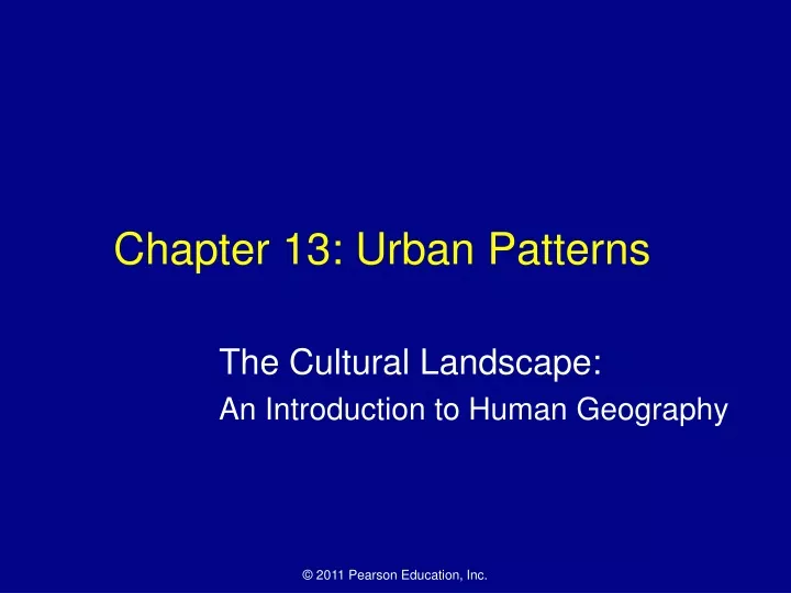
Chapter 13: Urban Patterns The Cultural Landscape: An Introduction to Human Geography
Why Do Services Cluster Downtown? • The previous chapter examined the distribution of urban settlements at national and global scales. • This chapter looks at where people and activities are distributed w/in urban spaces. • CBD Land Uses • Downtown is known to geographers by the more precise term, central business district. The CBD is compact—less than 1% of urban land area—but contains a large % of shops, offices, and public institutions. • Retail Services in the CBD • In the past, 3 types of retail services clustered in the CBD b/c they required accessibility to everyone in the region—retailers with a high threshold, those with a long range, and those that served people who worked in the CBD. • Changing shopping habits and residential patterns have reduced the importance of retail services in the CBD.
Retailers with a High Threshold • Example—department stores • Traditionally preferred a CBD location in order to be accessible to many people. In recent years, many high threshold stores have closed their downtown branches. • Department stores are now more likely to be in suburban malls. • Retailers with a High Range • Often specialty companies who are visited infrequently (i.e. jewelry or clothing stores). Used to prefer CBD locations b/c customers were scattered over a wide area. • These have now moved to more suburban locations as well. • Retailers serving Downtown Workers • These shops are now expanding in the CBD in part b/c the number of downtown workers has increased b/c downtown offices now require more services.
CBD of Charlotte, NC—Dominated by retail and office buildings. Also clustered in the downtown area are public and semipublic buildings, such as the city hall, government office buildings, and the central post office. Figure 13-1
Why Do Services Cluster Downtown? • Competition for land in the CBD • High land costs • Tokyo’s CBD contains some of Earth’s most expensive land, around $15,000 per square meter ($60 million per acre). • Two distinctive characteristics of the CBD follow from the high land cost. • Intensive Land Use • Compared to other parts of the city, the CBD uses more space below and above ground level. • The typical “underground city” includes parking garages, utility lines, subways, pedestrian passages, and sometimes even malls.
Skyscrapers • Demand for space in CBD has made high-rise structures more economically feasible. • The first skyscrapers were built in Chicago in the 1880s, made possible by two inventions—the elevator and iron-frame building construction. • These are examples of “vertical geography” • Retailers pay high rents for street-level space to entice customers • Professional offices, less dependent on walk-in trade, occupy the middle levels at lower rents. • Apartments in the upper floors take advantage of lower noise levels and panoramic views.
Why Do Services Cluster Downtown? • Activities excluded from the CBD • High rents and land shortage discourage two principal activities in the CBD—industrial and residential. • Lack of Industry in the CBD • Modern factories require large parcels of land to spread operations among one-story buildings, land which isn’t available or is too expensive in the CBD. • Lack of Residents in CBD • Many people used to live downtown. Poorer people jammed into tiny apartments and richer people built mansions downtown. • In 21st century, most residents abandoned downtown living. They were pulled to the suburbs that offered larger homes with private yards and modern schools. They were pushed from CBDs by high rents and by the dirt crime, congestion, and poverty that they experienced by living downtown.
Where Are People Distributed in Urban Areas? • Models of urban structure • Three models have been developed to help explain where different types of people tend to live in an urban area—the concentric zone, sector, and multiple nuclei models. • Concentric Zone Model • Created by E.W. Burgess—Was the first to explain the distribution of different social groups w/in urban areas. • States that a city grows outward from a central area in a series of concentric rings, like the growth rings of a tree. • The precise size and width of the rings vary from one city to another, but the same basic types of rings appear in all cities in the same order.
Concentric Zone Model • Back in 1920s, Burgess identified five rings: • CBD—the innermost ring, where nonresidential activities are concentrated. • A zone in transition, which contains industry and poorer-quality housing. • A zone of working-class homes, which contains modest older houses occupied by stable, working-class families. • A zone of better residences, which contains newer and more spacious houses for middle-class families. • A commuters’ zone, beyond the continuous built-up area of the city. Some people who work in the center nonetheless choose to live in small villages that have become dormitory towns for commuters.
Concentric Zone Model Figure 13-4
Burgess’ Model • Type of land use • Urban/City • Relative location and how it affects land-use patterns • Intensive land use near CBD b/c of high costs of land/accessibility • Intensity/density of residential land use decreases w/ distance away from CBD b/c households and other land uses located away from CBD, as they can afford transportation. • High socioeconomic class at edge of the city b/c households in this range can afford larger homes and acreage, as well as transportation. Von Thunen • Type of land use • Agricultural, Farming, or Rural • Relative location and how it affects land-use patterns • Intensive land-use near market b/c high profits are needed to pay rent. • Wood and perishable/fragile products near market b/c they need frequent transportation to market • Extensive agriculture (grain crops/grazing) at the periphery b/c there is lower land rent and lower transportation costs.
Assumptions that are shared by Burgess’ Model and Von Thunen Model • Flat plain or uniform surface; featureless • Importance of centrality (i.e. accessibility to market; CBD) • Individuals maximize profit/minimize costs/maximize use • Transportation costs are proportional to distance in all directions • Single market or CBD (i.e. isolated state)
Sector Model • Developed in 1939 by Homer Hoyt • States that the city develops in a series of sectors, not rings • Certain areas of the city are more attractive for various activities. As a city grows, activities expand outward in a wedge, or sector, from center. • Once a district with high-class housing is established, the most expensive new housing is built on the outer edge of that district, farther out from the center. • The best housing is therefore found in a corridor extending from downtown to the outer edge of the city. Industrial activities develop in other sectors, usually along good transportation lines • This is a refinement of concentric zone model, not a complete change.
Sector Model Figure 13-5
Multiple Nuclei Model • States that a city is a complex structure that includes more than one center around which activities revolve. • Examples include a port, university, airport, and park. • States that some activities are attracted to particular nodes, whereas others try to avoid them. • Example: A university may attract well-educated residents, pizzerias, and bookstores, whereas an airport may attract hotels and warehouses. • On the other hand, incompatible land use activities will aboid clustering in the same locations. For example, heavy industry and high-class housing rarely exist in the same neighborhood.
Multiple Nuclei Model Figure 13-6
Where Are People Distributed in Urban Areas? • Geographic Application of the Models • None of the three models taken individually completely explains why different types of people live in distinctive parts of the city. • Critics point out: • The models are too simple and fail to consider the variety of reasons that lead people to select particular residential locations. • The three models are all based on conditions that existed in US cities between the two world wars, so their relevance to contemporary urban patterns in US or elsewhere is questionable. • If the models are combined, they help geographers explain where different types of people live in a city.
Applying Concentric Zone Model—Consider two families with the same income and ethnic background. One family owns its home, whereas the other rents. The owner-occupant is much more likely to live in an outer ring and the renter in an inner ring. • In this map, the % of household that own their home is greater in the outer rings of the city.
Applying the Sector Model—Given two families who own their homes, the family with the higher income will not live in the same sector of the city as the family w/ lower income. In Dallas, the median household income is the highest in a sector to the north.
Applying the Multiple Nuclei Model—People with the same ethnic or racial background are likely to live near each other. In Dallas, African Americans and Hispanics occupy nodes to the south and west of downtown, respectively
Where Are People Distributed in Urban Areas? • Applying the models outside North America • In LDCs, as in Europe, the poor are in the suburbs, whereas the wealthy live near the center of cities. • The similarity between European and LDC cities is not a coincidence: European colonial policies left a heavy mark on the development of cities in LDCs. • Precolonial Cities • Few cities existed in Africa, Asia, and Latin America before the Europeans established colonies. • Cities were often laid out surrounding a religious core
Income Distribution in Paris Incomes are higher in the inner city of Paris than in the suburbs, with the exception of a high-income sector to the southwest. The inner city features sidewalk cafes and fancy housing. Suburbs have high-rise apartments for low-income people. Figure 13-10
Where Are People Distributed in Urban Areas? • Colonial Cities • When Europeans gained control of Africa, Asia, and Latin America, they expanded existing cities to provide colonial services, such as administration, military command, and int’l trade. • Existing native towns were left to one side or demolished b/c they were totally different from the European ideas of cities. • Cities Since Independence • Following independence, cities have become the focal points of change in LDCs. Millions of people have migrated to cities in search of work. • In Latin American cities, wealthy people push out from the center in a well-defined elite residential sector. The elite sector forms on either side of a narrow spine that contains offices, shops and amenities attractive to wealthy people, such as restaurants, theaters, parks, and zoos.
Model of Latin American City Wealthy people live in the inner city and a sector extending along a commercial spine.
Squatter Settlements • LDCs are unable to house the rapidly growing number of poor people (this is a result of them being in what stage???) • Because of the housing shortage, a large % of poor people living in urban areas in LDCs live in squatter settlements. • The UN estimated that 175 million people worldwide lived in squatter settlements in 2003. • These settlements usually lack schools, paved roads, telephones, or sewers. In absence of bus service, a resident may have to walk two hours to reach work. • At first, squatters do little more than camp on the land or sleep on street. • Families then erect primitive shelters with scavenged cardboard, wood boxes, or crushed cans. As they find new bits of material, they add them to their shacks. After a few years, they may build a tin roof and partition the space into rooms, and the structure will then acquire a more permanent appearance.
Characteristics of a typical squatter settlement w/in urban areas of megacities on the global periphery • Located on edge of the city • Vacant or undesirable land, such as steep hillsides, floodplains, dumps/landfills, cemeteries, close to industries • Factors that contribute to formation of squatter settlements • Large-scale rural to urban migration • Lack of affordable housing • Failure to enforce land use policy • Consequences of the rapid growth of squatter settlements • Unhealthy living conditions lead to high mortality rates • Increase in crime and development of gangs • Increased water pollution from lack of sanitation facilities • Increased soil erosion on hillsides as vegetation is removed • Increased risk of disasters, such as fires, industrial accidents, mudslides
In Rio de Janeiro, Brazil, most of the squatter settlements, known as favelas, are on hillsides on the edge of the city. Rio’s highest income areas are near the CBD in sectors along the ocean.
Why Do Inner Cities Face Distinctive Challenges? • Inner-city physical issues • The major physical problem faced by inner-city neighborhoods is the poor condition of the housing. • Process of Deterioration • Neighborhoods can shift from predominantly middle-class to low-income occupants w/in a few years. Middle-class families often move out to newer housing farther from the center and sell or rent their houses to lower-income families. • Filtering—Occurs when large houses built by wealthy families are subdivided by absentee landlords into smaller dwellings for low-income families. B/c the landlords do not pay for necessary maintenance, the building deteriorates and grows unfit for living. • Although it is illegal, some banks engage in redlining—drawing lines on a map to identify areas in which they will refuse to loan money. This makes it difficult for people to fix up the houses in this area.
Urban Renewal • North American and European cities have demolished much of their substandard inner-city housing through urban renewal programs. • This has been criticized for destroying the social cohesion of older neighborhoods and reducing the supply of low-cost housing. • B/c African Americans comprised a large % of the displaced population in US cities, urban renewal was often called “Negro Removal” during the 1960s. US has turned away from this since the 1970s.
Public Housing • Many inner-city houses have been demolished and replaced w/ public housing. • In US, public housing is reserved for low-income households, who must pay 30% of their income for rent. A housing authority, established by the local gov’t, manages the buildings, and the federal gov’t pays the cost of construction and maintenance, repair, etc. that are not covered by rent. • In US, public housing accounts for only 1% of all dwellings, compared to 14% in the United Kingdom. • With less funding, the supply of public housing in the US diminished by about 1 million units between 1980 and 2000; however, the number of households that needed low-rent dwellings increased by more than 2 million during this period.
Renovated Housing • This is an alternative to demolishing deteriorated inner-city houses. • More often that not, this attracts middle-class people. • The process by which middle-class people move into deteriorated inner-city neighborhoods and renovate the housing is known as gentrification. • Middle-class people are attracted to inner-city housing b/c: Housing may be cheaper, Houses may possess attractive architectural features, People may work downtown and want to be close, People may want to be close to theaters, bars, restaurants, and other fun activities. • Renovated inner-city housing attracts single people and couples w/o children b/c they are not concerned w/ the quality of schools there. • Cities have encouraged the gentrification process by providing low-cost loans and tax breaks to willing people. • This has aided in dispersing low-income families throughout the city instead of concentrating them in large inner-city public housing projects.
Factors that have contributed to the revitalization process of central business & residential districts • Economic • Expansion of service sector, research facilities • Investment opportunities, places of profit • Importance of face-to-face interaction • Entrepreneurship; growth in small businesses • Tourism and Demand for housing in downtowns and inner-city neighborhoods due to economic growth. • Demographic • Contributed b/c of changing patterns of household composition, age composition, and residential location, including migration/immigration. (i.e. Single-person households and aging of baby boomers)
Factors that have contributed to the revitalization process of central business & residential districts • Urban Policy • This has contributed to the revitalization process b/c governments and Nonprofit organizations have assisted in revitalizing central cities through public policies and incentives • Subsidies/Tax Incentives, Sports Facilities, & Historic Preservation • Sense of Place • This has contributed to the revitalization process b/c of people’s emotional attachment to central-city locations based on cultural amenities, landscape features, and other lifestyle factors. • Distinctiveness of inner cities, Cultural Amenities (theater, museums, sports venues), Acceptance of diversity, Community pride
Racial Change in Chicago Dots represent where the population of each ethnicity increased between 1980 and 2000. Note growth of the white population in the inner city and North Side, while the African American and Hispanic populations have been increasing in the outer city and inner suburbs.
Why Do Inner Cities Face Distinctive Challenges? • Inner-city social issues • Inner-city residents are frequently referred to as a permanent underclass b/c they are trapped in an unending cycle of economic and social problems. • Their neighborhoods lack adequate police and fire protection, shops, hospitals, etc. • Despite the importance of education, many in the underclass live in an atmosphere that ignores good learning habits, such as regular attendance and completing homework. • The gap between skills demanded by employers and training possessed by underclass is widening. In the past, people w/ limited education could become factory workers, but today these jobs require electronic skills. Also, most underclass do not have access to the jobs as custodians and fast-food servers in distant suburbs.
Why Do Inner Cities Face Distinctive Challenges? • Culture of Poverty • Inner-city residents are trapped as a permanent underclass b/c they live in a culture of poverty. Unwed mothers give birth to ¾ of the babies in US inner-city neighborhoods. • Some in inner cities turn to drugs. Rates of drug use in recent years has increased most rapidly in the inner city (compared to suburbs). • Some drug users obtain money through criminal activities. Gangs form in inner-city neighborhoods to control drug distribution. Violence erupts when two gangs fight over boundaries between their drug distribution areas. • Many neighborhoods in the US are segregated by ethnicity. African Americans and Hispanics concentrate in one or two large continuous areas of the inner city, whereas whites live in the suburbs.
Dallas Murders 2008—Most murders were on the south and east sides of the city, which are mainly low-income minority areas. Most of the victims, as well as those arrested for murder in Dallas, were minorities.
Why Do Inner Cities Face Distinctive Challenges? • Inner-city economic issues • Eroding Tax Base • Low-income inner-city residents require public services, but they can pay very little of the taxes necessary to support these services. • A city has two choices for closing the gap between the cost of services and the funding available from taxes: • Reduce Services—Close libraries, collect trash less often, eliminate bus routes. • Raise Tax Revenues—Provide tax revenues for downtown offices, luxury hotels, restaurants, and shops. These businesses pay more taxes than the buildings demolished to make way for them, and they provide minimum-wage jobs for residents.
Why Do Inner Cities Face Distinctive Challenges? • Impact of the Recession • One of the principal causes of the severe recession was a collapse in the housing market, primarily in inner city. • In the years leading up to the recession, banks sharply increased # of loans to low-income inner-city households. • Despite having poor credit histories, first-time home buyers were approved for mortgages w/o background checks. These were known as subprime mortgages. • When people are unable to repay their loans, lenders can take over the property in what is called a foreclosure. • In the first year of the recession, 10% of all Americans w/ mortgages were behind in their payments or already in foreclosure. With falling house prices, some people were paying more for their mortgages than the value of the house.
Foreclosures in Baltimore—Foreclosures are clustered in the inner city and in a sector to the northwest where the African American population has increased in recent years.
Why Do Suburbs Face Distinctive Challenges? • In 1950, only 20% of Americans lived in suburbs compared to 40% in cities and 40% in small towns and rural areas. • In 2000, after a half-century of rapid suburban growth, 50% of Americans lived in suburbs compared to only 30% in cities and 20% in small towns or rural areas. • Urban Expansion • Until recently in the US, as cities grew, they expanded by adding peripheral land. Now cities are surrounded by a collection of suburban jurisdictions whose residents prefer to remain legally independent of the large city.
Annexation in Chicago During the 19th century, the city of Chicago grew rapidly through annexation of peripheral land. Relatively little land was annexed during the 20th century; the major annexation was on the northwest side for O’Hare Airport. The inset shows that the city of Chicago covers only a small portion of the Chicago metropolitan statistical area.
Why Do Suburbs Face Distinctive Challenges? • Urban Expansion • The City • City—defines an urban settlement that has been legally incorporated into an independent, self-governing unit. • Urbanized Area • The city and the surrounding built-up suburbs are called an urbanized area. • Metropolitan Area • Urbanized area is a limited concept b/c the area of influence of a city extends beyond legal boundaries and adjacent built-up jurisdictions. • US Bureau of the Census created a method of measuring the functional area of a city, known as the metropolitan statistical area (MSA).
Why Do Suburbs Face Distinctive Challenges? • MSA includes the following: • An urbanized area w/ a population of at least 50,000 • The county w/in which the city is located • Adjacent counties w/ a high population density and a large percentage of residents working in the central city’s county.
St. Louis Surrounding the city of is an urbanized area that spreads westward into St. Louis County and eastward across the MS River into Illinois. The St. Louis metropolitan statistical area includes seven Missouri counties and eight in Illinois.
Why Do Suburbs Face Distinctive Challenges? • Local Government Fragmentation • The fragmentation of local government in the US makes it difficult to solve regional problems of traffic, solid waste disposal, and the building of affordable housing. • Ex: Long Island (90 miles long to east of NYC)—contains nearly 800 local governments. Includes 2 counties, 13 towns, 127 school districts • The large numbers of local governments have led to calls for a metropolitan gov’t that could coordinate or replace these. • Most US metropolitan areas have a council of gov’t, which is a cooperative agency consisting of representatives of the various local gov’t in the region.
Overlapping Metropolitan Areas • Some adjacent MSAs overlap. A county between two central cities may send a large # of commuters to jobs in each. • In NE US, large metropolitan areas are so close together that they now form one continuous urban complex, extending from north of Boston to south of Washington, thus giving this region the name Megalopolis, a Greek word meaning “great city”
Megalopolis Also known as the Boswash corridor, Megalopolis extends more than 440 miles from Boston on the NE to Washington on the SW. Megalopolis contains one-fourth of the US population on 2% of the country’s total land area.
Why Do Suburbs Face Distinctive Challenges? • Peripheral model • According to this model, an urban area consists of an inner city surrounded by large suburban residential and business areas tied together by a beltway or ring road. • Peripheral areas lack the sever physical, social, and economic problems of inner-city neighborhoods. • Around the beltway are nodes of consumer and business services, called edge cities. • Edge cities originated as suburban residences for people who worked in the central city, and then shopping malls were built to be near residents. • Now edge cities contain manufacturing centers spread out over a single story for more efficient operations and office parks where producer services cluster.