Download
1 / 21
210 likes | 320 Views
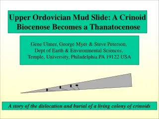
Upper Ordovician Mud Slide: A Crinoid Biocenose Becomes a Thanatocenose. Gene Ulmer, George Myer & Steve Peterson, Dept of Earth & Environmental Sciences, Temple, University, Philadelphia PA 19122 USA. A story of the dislocation and burial of a living colony of crinoids.

E N D
Upper Ordovician Mud Slide: A Crinoid Biocenose Becomes a Thanatocenose Gene Ulmer, George Myer & Steve Peterson, Dept of Earth & Environmental Sciences, Temple, University, Philadelphia PA 19122 USA A story of the dislocation and burial of a living colony of crinoids
Oval is Ordovician outcrop in Ohio area Ohio Ohio 100km Oval is Ordovician Outcrop Cincinnati, Ohio 100km Pink is Ordovician
Very thin (~1 cm)brown limestone with Reserella & Rafinesquina H G F E D Gray limestone with Isotelus parts Shaly brown limestone with Platystrophia ponderosa Gray limestone with Calymene parts Brown Limestone Bryozoan fauna Vegatative cover North Stratigraphy of an Ordovician/Richmond outcrop at Dent, Ohio
H M’ G F N E D N’ M Northeast Schematic of cross-cutting, sediment-filled trough that ended as Shown in a three-toe geometry. Cross-sections along M-M’ and N-N’ are presented in later figures. Scale given by MM’ which is ~17 meters.
Unit G at surface at N-N’ G F E Cross-cutting, sediment-filled trough ~30cm D N’ N 2m Schematic section along line N-N’ which is about 2.0m long
Topographic slope from construction lot-leveling H G F ? ~0.6 m E D Sediment filled trough ? Toe M’ M 20m Schematic section along line M-M’
H M’ G F N E D N’ M Northeast Schematic of cross-cutting, sediment-filled trough that ended as shown in a three-toe geometry. Cross-sections along M-M’ and N-N’ are presented in later figures. Scale given by MM’ which is ~17 meters.
Pinnae Ambulacrals, arms Calyx, head, flower Integumen Columnals, stem Hold fast, anchor, root Glyptocrinus:Ord/Sil FromGeo/Univ Texas.edu
Arrows showing layout direction of fronds. Note near vertical orientations marked O 2.54 cm
Evidence for mild motion with little shear: • Few columnals still attached •Dislocation of longer columnal stems that are missing •Two orientations with fragile fronds bent under but not torn off Channel infill: Subtle bedding Two basic orientations of buried crinoids calyxes: Vertical with bent-under fronds(left) and horizontal with sub-horizontal fronds(right)
Apex of calyx (A) Note that branching within calyx was not used Branching at edge of calyx (B) Basis of size measurements reported was from point A to point B
Histogram of sizes & orientations of crinoids involved in this study X represents horizontally-oriented samples O represents near vertically-oriented samples Note: several vertical sample are still buried too deep to measure Population density of crinoids X X O X X X X O X X O O X O 9 10 11 12 13 14 15 16 17 18 19 20 21 22 Size in mm: distance measured from point A to point B
Photo of Dent, Ohio Crinoid from A SEA WITHOUT FISH Figure 12.9 B, p 176 Indiana University Press (2009) Since the snails are found in the inter-ambulacral area and near the anus of the calyx, one must break such unique samples to expose the presence of the snail. The slab featured in this manuscript has not been cleaned in such a way as to show snails, but smaller slabs from the same channel toes did allow non-destructive observations that suggest at least 10% of the calyxes are showing snails in this anal-feeding position
A few initial observations from the paleobiology: •Note the wide range of sizes may substantiate a living colony assemblage •The final orientation of any sample seems to be independent of it’s size •The missing columnals & missing evidence of hold fasts lends support to relocation theories •The symbiotic feeding of Cyclonema Gastropods in anal calyx positions also has been literature-accredited as being a living-assemblage feature
Stokes Law Velocity settling= 2/9 sin θ(δparticle –δfluid) g r2/μ θ is the slope angle for the flowing fluid; (δparticle –δfluid) is the density contrast between the sediment particle and the fluid; G is gravitational constant; r2 is the square of the effective particle diameter and μ is the viscosity (fluidity) of the fluid If the mud slide is too slow, the crinoids would not be pushed along, but settle out before the toe end of the channel. If the mud slide is too fast, turbulence would shear not just the columnals, but tear up the fragility of the arms and make the resting orientations much more chaotic than observed.
Type of Stokes Law parameters utilized to try to define the range of possible velocities involved in this modelled crinoid transport: •Density of the columnals being Calcitic •The effective diameter of the columnal’s individual sections •The shuttle-cock like shape of the calyx with fronds attached •The effective density of non-muddy saline sea water •The effective density of sediment-slurry mixtures •Viscosity slurry ranges from 1 poise to 5 poise (oil to thick milk shake) •Slope of ocean floor, far from continental- or basin-margin Examining these variables in many various sensible combinations with Stoke’s Law shows a probable range : From 50 cm/sec to 254 cm/ sec Which in more familiar daily terms is ~1 mph to ~5.5 mph
Channel infilling material Physical Characteristics: Light grey, almost white (cross-cut beds are dark grey to light brown) Sub micron to micron size, unconsolidated particles XRD analyses: No dolomite, nor bentonite, nor clay Very well crystallized qtz + Cc= Major Hydrogrossularite garnet = Minor Zeolite (Gusmiondine) = Trace Illite = trace Conclusion: This in not a mineralogy of fluvial sediments, but rather more typical for aeolian sources, such as ash or loess. Since there is no bentonite, nor meta-bentonite, loess seems most likely !
Ordovician Glaciation and Loess ? Wikipedia: “ As the Ordovician progressed we see evidence of glaciers on the lands now known as Africa and South America. … These land masses at that time were at the South Pole and covered with ice caps. This ice age probably was of a short duration only from 0.5 to 1.5 million years long Channel-fill Mineralogy: Submicron to micron size Major: qtz, cc Minor: hydrogrossularite garnet Traces: illite zeolite(gismondine) No: Dolomite
Mineralogy of Channel-Filling Material The sediment in the cross-cutting channel is light gray, almost white, in sharp contrast to the dark grey to light brown colors of the units that are cross-cut. The sediment particle size is sub-micron to a few microns. XRD examination shows: Major: calcite and quartz Minor: hydro-grossualite garnet and zeolite (gismondine) Trace: Illite No clays, nor dolomite This suggests an aeolian, non-fluvial source. Volcanic ash or loess are likely sediment sources, and the mineralogy argues most strongly for loess which is known in the Ordovician literature.