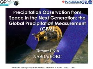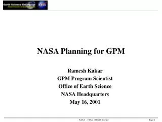
NASDA Planning for GPM
140 likes | 340 Views
NASDA Planning for GPM. Riko Oki National Space Development Agency (NASDA) Office of Satellite Technology, Research and Applications Satellite Program and Planning Department. Background. TRMM. Launched in November 1997. Nominal mission life : 3yr 2mo.

NASDA Planning for GPM
E N D
Presentation Transcript
NASDA Planning for GPM Riko Oki National Space Development Agency (NASDA) Office of Satellite Technology, Research and Applications Satellite Program and Planning Department
Background • TRMM Launched in November 1997. Nominal mission life : 3yr 2mo. First spaceborne Precipitation Radar (PR) in the world. Demonstrated the usefulness of PR for global rain observation • Expectation of TRMM Follow-on (F/O) Extension of observation area. Observation of global rain/snow. Successive observation to TRMM. Launch target FY 2007 (earliest). More frequent observation. Application for weather forecasting. Plans for TRMM F/O ATMOS-A (JAPAN) ---- DPR, TMI, VIRS GPM (USA) --- DPR, TMI (Core), 8 small satellites
ATMOS-A1 Mission Concept Follow-on mission to TRMM Observing precipitation, including solid precipitation (snow/ice) andhigh-latitude regionsDual frequency precipitation radar to increase sensitivities • Orbit: • Altitude: 412.6 km- Inclination: 55 degTotal mass: approx. 2.5 ton • Lifetime: 5 years • Launch period: 2006 • Sensor: • Precipitation Radar Frequency: 14/35 GHz • Microwave Radiometer similar to TRMM TMI • - Visible-infrared radiometer, Lightning sensor desirable Microwave Radiometer Precipitation Radar(35GHz) Visible-infrared Radiometer Precipitation Radar(14GHz) GPM/ATMOS-A1 GPM
Current scenario of Earth Observation(2002~2017) ADEOS-II ILAS-II GLI SeaWinds DCS AMSR POLDER GCOM-A1 ODUS SOFIS SWIFT GCOM-A2 CO2 observation, From Stratosphere to Troposphere GCOM-B1 SGLI,AMSR, AlphaSCAT GCOM-B2 More accurate observation TRMM PR GPM DPR、TMI Operational System EarthCARE CPR, LIDAR, FTS ALOS PALSAR ALOS-F/O
GCOM and GPM/ATMOS-A1 • GCOM: global change observation mission. • GCOM is a mission concept of NASDA’s Earth Observation programs extending over more than 15 years, not a single satellite program • GPM/ATMOS-A1 is also considered under ‘GCOM’ umbrella
GCOM Configuration (Proposal) Global Change Observation Mission GCOM-A2 2012(TBD)~2017 GCOM-A1 Ozone・GHG observation mission 2007/1(TBD)~2012/11 COP3 Assessment Period ADEOS ADEOS-II GCOM-B2 2001/11 ~ 2006/11 1996/2 ~ 1997/6 2012(TBD)~2017 GCOM-B1 Material・energy cycle observation Contribution to research and prediction of global change and protection of global environment 2007/8(TBD)~2021/8 Second satellites First satellites
GPM Concept and NASDA’s participation • Core Satellite • OBJECTIVE: Understand the Horizontal and Vertical Structure of Rainfall and Its Microphysical Element. Provide Training for Constellation Radiometers. • Dual Frequency Radar • Multi-frequency Radiometer • H2-A Launch • TRMM-like Spacecraft • Non-Sun Synchronous Orbit • ~70° Inclination • ~400 - 500 km Altitude • ~4 km Horizontal Resolution • 250 m Vertical Resolution • Constellation Satellites • OBJECTIVE: Provide Enough Sampling to Reduce Uncertainty in Short-term Rainfall Accumulations. Extend Scientific and Societal Applications. • Small Satellites with Microwave Radiometers • Aggregate Revisit Time, • 3 Hour goal • Sun-Synchronous Polar Orbits • ~600 km Altitude
Conceptual Image of GPM Core (ATMOS-A1) TMI Type Microwave Radiometer Ka-band Radar (Active Phased Array) Ku-band Radar (TRMM/PR Type, Active Phased Array) (from NASA’s GPM conceptual study)
Dual-Frequency Precipitation Radar (DPR) 1. Ka-band radar: sensitive measurement of weak rainfall and snowfall. 2. Dual-frequency analysis: accurate quantitative measurement. • Combination of reflectivity and attenuation. • Estimation of drop size distribution. • Discrimination of rain and ice 3. Improvement of radiometer algorithms
DPR study status • Ku-band radar: phase A study by NASDA. NASDA would like to start phase B study in JFY2002. PRR#1 in 2001(?) • Ka-band radar: CRL started phase A DPR study in JFY2000.
Launch Option by H-IIA • H-IIA Dual Launch • GCOM-A1 : 650Km / GPM core : 400Km • NASDA wants to avoid multiple 2nd stage engine ignition to inject GCOM-A1 in a certain altitude after injecting GPM core satellite. (Too risky) • Option 1 : Inject both GCOM-A1 and GPM core to about 400 km circular orbit and then transfer GCOM-A1 to 650 km • Option 2 : Inject both GCOM-A1 and GPM core to 650 km circular orbit and then transfer GPM to 400km • Option 3: Inject both GCOM-A1 and GPM core to 400 x 650 km elliptic orbit and then transfer GPM core to 400 km and GCOM-A1 to 650 km
H2-A Dual launch Configuration GPM Core(H-IIA upper) GCOM-A1(H-IIA lower)
Summary • NASDA’s ATMOS-A1 and NASA’s GPM are complementary missions and should be merged. • NASDA intends to provide NASA with the DPR and a launcher (H-IIA). • Targeted date of launch in Feb. 2007. (Dual launch with GCOM-A1) • NASDA and CRL are jointly developing DPR for sensitive and accurate measurement of global precipitation. • Currently in Phase A. Mission requirements have to pass PRR#1 to move into the development phase (Phase B).