Download
1 / 27
340 likes | 665 Views
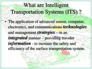
What are Intelligent Transportation Systems (ITS) ?.

E N D
What are Intelligent Transportation Systems (ITS) ? • The application of advanced sensor, computer, electronics, and communications technologies and management strategies – in an integrated manner – providing traveler information - to increase the safety and efficiency of the surface transportation system.
Smart cards Cheaper Fasterprocessors Largerstorage Flat, high-resolution screens Voice/writing input High-quality video and graphics Current Technology Innovation
(k-baud/sec.) 33.3 56.0 Text great, Pictures OK Narrowband (Today) Modem, ISDN ISDN, PC cable modem Pictures great, Video OK Midband (1-2 years) 100-400 Broadband (2+ years) 1500+ Internet 2 Video great Future Wide Area Bandwidth Generation Speed Technology Application
Johnson City MPO Background • Established: 1982 • Staff: 3 Full-Time Personnel • Housed with GIS and Public Transportation Staffs • Established: 1982 • Staff: 3 Full-Time Personnel • Housed with GIS and Public Transportation Staffs
Johnson City Project Scale • ITS “Lite” • Urban Metro Setting < 200,000 population • Identify larger statewide ITS initiatives for “mainstreaming” and tests • Emphasize “practical side” of ITS (Internet, GIS, lower cost sensors, etc.) • Software Integration • Focus on SR 381 Medical Corridor and New Interstate 26 Extension to Asheville, NC
Traffic Signal Monitoring System: • Linked Through Fiber Optics • Based on Siemens/ACTRA • Links to Other Sensor Elements • GIS Links • Opticom • Variable Message Signs
Traffic Monitoring Sensors • Based upon Active Microwave Sensors (RTMS) • Multipurpose Functionality • GIS Links • Real Time Data for Traffic/Transit Managers • Mounted Overhead: Reduced Maintenance Costs
Integration with Traffic Monitoring Sensors • Permanent and Mobile Locations • Traffic Signal Integration • Incident Detection and Management • TDOT Count Stations
Transit/Paratransit Management • Routing/Scheduling: ADA Clients • Real-Time Monitoring/GPS • GIS Integration • Coordination Among Providers • Access to Real-Time Traffic Data
Incident Management • Integration of ACTRA, RTMS, GIS, Real-Time Access • I-26 Importance • Links to TDOT
Strategic Approach • GIS as the “Core”: Why? • Seamless Data Integration • Spatially-Based Information • Open Systems • Existing Tools, Easy-To-Use Interfaces • Customizable
The “Integrating” Nature of Present-Day GIS • GIS in the Mainstream: • Data Integration • Delivery Mechanisms (Internet) • Improved Interfaces • Lower Cost • “Toolbox” Approach
GIS-ITS Integration • GIS Elements: • ESRI, Intergraph Products • ArcView, ARC/INFO, MapObjects, GeoMedia ,Web Tools • Database Flexibility (Access, etc.) • Data Availability Locally • Relationships with TDOT (TransCAD modeling)
GIS Base Data • Extensive Sources: • City has Long-Term GIS (15 Years) • Transit - 1 of the First Users of GIS • High-Quality Transportation Data • Recent Digital Orthos, Planimetrics • Tested Data Exchange with TDOT • Section 15 Data • Development of Custom Interfaces for Users
Internet/Visualization/ATIS: • Public Access • GIS/Web Tools • 3-D Visualization Tools • Real-Time Data Display and Query • Future Bandwidth: Internet 2 • Kiosks or Publicly Accessible Computer Terminals for Transit
ITS National/Regional Architecture • Purpose: Promotes ITS Integration Nationally and Regionally • Provides a Framework, Standardized Approach for Development • Adaptable and Customizable “Integration Strategy”
GIS Summary/Significance • GIS As a Central, Integrating Technology • Mainstream Maturity of GIS • High-Tech, Leading Edge Possible in Smaller Areas • For MPOs & Transit Systems…. • Many Possibilities
Contacts: • Alan Bridwell, Johnson City MPO • 137 W. Market Street, Johnson City, TN 37604 (423) 434-6272 atb@tricon.net http://www.jcmpo.org • Don Kiel, Geo Decisions • 101 Innovation Blvd., Suite 213, State College, PA 16803 (814) 234-8625 dkiel@gfnet.com http://www.geodecisions.com • Glenn Berry, Geo Decisions • 605 N. Baxter Street, Johnson City, TN 37601 (423) 434-2233 gberry@gfnet.com