Download
1 / 12
120 likes | 222 Views
Satellite Air Quality Proving Ground. Ray Hoff (UMBC) Amy Huff (Battelle Memorial Inst.) Shobha Kondragunta (NESDIS). AQPG is in its third year. Two Workshops have followed this paradigm:. 3 rd AQPG Workshop.

E N D
Satellite Air Quality Proving Ground Ray Hoff (UMBC) Amy Huff (Battelle Memorial Inst.) ShobhaKondragunta (NESDIS)
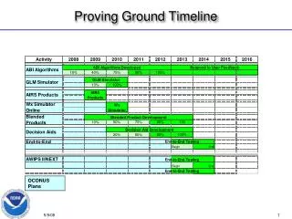
AQPG is in its third year Two Workshops have followed this paradigm:
3rd AQPG Workshop • Was to be held on November 1, 2012, but defeated by Sandy… now will be held March 14, 2013 • Our Air Quality User Group needed to be exposed to: • Feedback on the 2nd workshop suggestions • New satellites in NOAA’s stable (VIIRS) • The concept of a combined Proving Ground
New AQPG paradigm See Huff et al, EM Magazine, October 2012
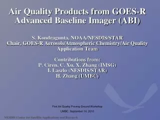
2nd Workshop Suggestions • Enhance visualization options for ABI products (e.g., AOD, AT, NCI): • Overlay of fire “hotspots” • Overlay of major cities • NCI/AOD “slider bar” • kml/kmz format for visualization in Google Earth • Create 3-hr composites of AOD • Increase threshold for AT (e.g., to 0.3 or 0.4) and replace hourly AT with daily composite to remove noisiness • Revise AQI-derived-from-AOD product to represent daily average of PM2.5 concentrations (in µg/m3), not hourly AQI estimations, and add overlay of AIRNow observed AQI values
Enhance Visualization OptionsFire hotspotsOverlay of counties, major citiesNCI/AOD “slider bar” kml/kmz format for visualization in Google Earth
Workshop will also discuss VIIRS • Overview talk on SNPP VIIRS aerosol products (Lorraine Remer) • Discussion of the satellite proving ground concept (Goldberg and Kondragunta) • Discussion of data access by state/local forecasters
AWIPSII migration of ABI products • Hoff attended GEMPAK workshop at Boulder • Pretty clear that Unidata AWIPSII availability to non-NOAA locations (i.e. not WSO’s) will not occur in 2013 (probably 2014) • We have an understanding of the pipeline for AWIPSII Java scripts or .GEM bundles for the ABI products which we can look at in 2013.