Download
1 / 20
200 likes | 327 Views
Air Quality Products from GOES-R Advanced Baseline Imager (ABI) S. Kondragunta, NOAA/NESDIS/STAR Chair, GOES-R Aerosols/Atmospheric Chemistry/Air Quality Application Team Contributions from: P. Ciren, C. Xu, X. Zhang (IMSG) I. Laszlo (NESDIS/STAR) H. Zhang (UMBC).

E N D
Air Quality Products from GOES-R Advanced Baseline Imager (ABI)S. Kondragunta, NOAA/NESDIS/STARChair, GOES-R Aerosols/Atmospheric Chemistry/Air Quality Application TeamContributions from:P. Ciren, C. Xu, X. Zhang (IMSG) I. Laszlo (NESDIS/STAR) H. Zhang (UMBC) First Air Quality Proving Ground Workshop UMBC, September 14, 2010
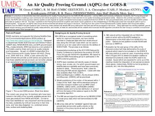
Outline • Air Quality Products from current operational GOES satellites • Examples of user applications • Limitations of current GOES • GOES-R Products and capabilities
Aerosol Retrievals from a Geostationary Platform Composite image from multiple snap shots of GOES-12 Single snap shot of MODIS • Quantitative measure of atmospheric aerosol loading that has been shown to be a proxy for surface particulate matter pollution, PM2.5 (aerosol mass in µg/m3). • Single channel retrieval using measured visible channel reflectances from GOES Imager. • IR channels used in identifying clouds. • Physical retrieval that separates contribution of surface from aerosols. • Retrievals over clear sky and dark vegetative pixels only. • Product specifications • Name: GOES Aerosol and Smoke Product (GASP) • Satellites: GOES-East and GOES-West • Accuracy: 0.04 (GOES-E) ; 0.06 (GOES-W) • Spatial resolution: 4 km at nadir • Temporal resolution: 30 min. • Latency:within one hour of data capture • Data format: binary file and JPEG imagery • Data availability: 2003 – present Example Image of GOES AOD Full Disk
PM2.5 Monitoring using GOES AOD Data http://www.star.nesdis.noaa.gov/smcd/spb/aq/ 2008 2008 Figures courtesy of Philip Morefield, EPA
Aerosol Retrievals from a Geostationary Platform (cont.) GOES AOD Validation • GOES vs AERONET AOD comparisons for 10 eastern US stations show retrievals have: • 0.13 rmse • Absolute bias less than 30% when AOD is > 0.1 • Results are similar to MODIS vs AERONET • On average, 39% of days in a month of have good retrievals compared to 11% for MODIS and 5% for MISR. Percent Good Retrievals Paciorek et al., Envin. Sci. and Tech., 2008 Prados et al., JGR, 2007
Biomass Burning Products Seasonal Burned Area over Alaska from GOES-11 in 2009 5-yr mean over CONUS Fuel Load (kgC/ha) • Fire hot spots • Detection and instantaneous fire size from GOES • Burned area • Based on algorithm that combines GOES and MODIS/AVHRR fire hot spots/sizes in a fourier model to compute burned area • Fuel load • Based on MODIS land products • Emissions • Product of burned area (ha), fuel load KgC/ha), emissions factors (g/KgC) • Product specifications • Name:GBBEP • Satellites: GOES-East and GOES-West • Accuracy:30% • Spatial resolution:4 km at nadir • Temporal resolution:houtly • Latency:one day • Data format:binary file and JPEG imagery • Data availability:2002 – present
GOES Smoke Concentration Product (1) • Semi-quantitative retrieval of column average smoke concentration (µg/m3) using AOD and fire hot spots from GOES • Uses source apportionment and pattern recognition techniques to isolate smoke aerosols from other type of aerosols • Smoke mass concentration (mc) is obtained using AOD (τ), mass extinction efficiency (k), and aerosol height (h) • Product specifications • Name:ASDTA • Satellites:GOES-East and GOES-West (includes Alaska and Hawaii) • Accuracy: 40% • Spatial resolution:0.15o • Temporal resolution: hourly • Latency: one day • Data format:binary file, GRIB file, JPEG imagery • Data availability:2007 - present Animation of Smoke Plume Detection Smoke AOD Image Original AOD Image
GOES Smoke Concentration Product (2) NWS testing of smoke verification for Alaska using NESDIS GOES-W smoke product
Geostationary Satellite Platform Challenges Visible Shortwave IR GOES-12: • Navigation errors are a big problem for current GOES satellites as shown in adjacent figure for a fire event • Spacecraft jitter despite 3-axes stabilization • Recently launched GOES-13 (new spacecraft) has less jitter GOES-13:
Geostationary Satellite Platform Challenges(cont.) GOES-West GOES-W AOD sector does not have coverage Viewing Geometry: GOES-West (135oW) and GOES-E (75oW) observing the same location on the Earth can provide totally different AODs. In this example, GOES-W views in a forward scattering mode (scattering angles less than 90o) whereas GOES-E views in a backward scattering mode (scattering angles greater than 90o). Since sensitivity (change in top of the atmosphere reflectance to change in AOD) is greater for forward scattering mode, retrievals are more accurate for those conditions. GOES-East Optimum scattering angle retrieval range UTC 14:45 07/20/2008
Geostationary Satellite Platform Challenges (cont.) UTC:1415 UTC:2315 Bad retrievals due to viewing geometry effects etc. can be removed in post-processing of data. NESDIS developed a data quality flag based on scattering angle and spatial variability tests. Only data for viewing geometry corresponding to scattering angles greater than 70o and less than 150o are retained. Before screening After screening
What about GOES-R? GOES-R ABI in five minutes Current GOES in five minutes • Similar and some new products but with enhanced accuracy, spatial resolution, and temporal resolution. • 2-km resolution allows picking up localized events; • 5-min resolution allows peeking through clouds, now-casting; • Night-time retrievals (except for dust) not possible due to reliance on visible channels 24 April, 2004, Central America, 5 minute resolution loop Note black dots that are fire detections
Aerosol Retrievals from Next Generation Geostationary Satellite Illustration of aerosol retrieval concept aerosol model 1 aerosol model 2 TOA reflectance in red band Residual 1 Observation Residual 2 Retrieved AOD550 TOA reflectance in blue band • GOES-R capabilities • 16 channel Advanced Baseline Imager. • AOD at 2 X 2 km resolution at nadir • 5-min CONUS, 30-sec mesoscale, 15-min full disk modes or full disk in five minutes. • AOD retrieval is a multi-channel MODIS/VIIRS type retrieval. Current GASP retrieval is a single channel retrieval. Laszlo et al., Advances in Space Research, 2007 http://www.orbit.nesdis.noaa.gov/smcd/spb/pubu/validation_new/index.php
Aerosol Retrievals from Next Generation Geostationary Satellite (cont.) ±0.12 ±0.05 ±0.04 ±0.02 ±0.1 AOD Accuracy • GOES-R ABI products • AOD • Aerosol Particle Size • Smoke/dust mask • Fire hot spots and emissions Dust Mask Smoke Mask AOD
Proving Ground Experiments with the National Weather Service (1) H • NESDIS/STAR is developing a global biomass burning emissions product from a network of geostationary satellite sensors using GOES-R emissions algorithm. • STAR scientists are working closely with NWS/NCEP scientists in validating and testing the product. • Adjacent figure shows an example of seasonal mean Fire Radiative Power (FRP) for Fall 2009. FRP is used to compute trace gas and aerosol emissions that are used in the model to improve forecasts. Funded by Joint Center for Satellite Data Assimilation (JCSDA) but the concept is similar to AQPG
Proving Ground Experiments with the National Weather Service (2) H Version 3 Version 5 STAR scientists worked closely with the NWS scientists in testing the use of satellite-derived dust mask (MODIS used as a proxy for GOES-R Advanced Baseline Imager) in verifying dust forecasts. In working with the NWS, we learned that the algorithm is flagging some of the thin dust plumes (localized) as clouds. Algorithm (V3) was changed (V5) to rectify the identification of dust as cloud.
Proving Ground Experiments with the National Weather Service (3) Funded by GOES-R program office and National Weather Service Office of Science and Technology but the concept is similar to AQPG V3 V3 V5
GOES-R ABI Suspended Matter ABI AOD and Aerosol Model GOES AOD UMCP aircraft spirals ABI Suspended Matter (µg/m3) Method 1 Method 2 ABI AOD
Preliminary Validaiton of GOES-R ABI Suspended Matter AOD Suspended Matter ABI AOD Derived using MODIS radiances as proxy
Conclusions • Air quality products from GOES-R ABI have been in the development at NOAA/NESDIS for the past three years. • Algorithms built based on experience with GOES and MODIS. MODIS and model simulated data are being used as proxy data. • Algorithm developers working closely with NWS. • Algorithm developers would like to work closely, through the proving ground, with EPA, state/local air quality forecasters. • User/focus group feedback very critical for improving product quality, usage, distribution, and the development of new applications including specific data formats.