Download
1 / 27
270 likes | 293 Views
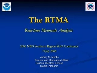
The RTMA. Real-time Mesoscale Analysis. 2006 NWS Southern Region SOO Conference 11July 2006. Jeffrey M. Medlin Science and Operations Officer National Weather Service Mobile, Alabama. Outline. Presentation Overview What is the RTMA? RTMA Procedure Outline RTMA Details

E N D
The RTMA Real-time Mesoscale Analysis 2006 NWS Southern Region SOO Conference 11July 2006 • Jeffrey M. Medlin • Science and Operations Officer • National Weather Service • Mobile, Alabama
Outline Presentation Overview • What is the RTMA? • RTMA Procedure Outline • RTMA Details • Individual Element Examples • Access and Where We’re Headed next? • Discussion (5 min)
Analysis of Record “A comprehensive set of the best possible analyses of the atmosphere at high spatial and temporal resolution with particular attention placed on weather and climate conditions near the surface.”
Three Phases of AOR • Phase I – Real-time Mesoscale Analysis • Hourly within 30 minutes • Prototype for AOR • NCEP and FSL volunteer to build first phase • Phase II – Analysis of Record • Best analysis possible • Time is no object • Phase III – Reanalysis • Apply mature AOR retrospectively • 30 year time history of AORs This talk
Phase I: RTMA The RTMA is a fast-track, proof-of-concept effort intended to: • Enhance existing analysis capabilities in order to generate and establish a real-time process that delivers a subset of fields to allow for comparisons between CONUS-scale NDFD forecast and observed grids • Establish benchmark for future AOR efforts. • Build constituency for subsequent AOR development activities. *** Primary contact: Stan Benjamin (FSL) *** Implemented by Geoff Manikin (EMC/NCEP)
Why not another solution? • Overarching Constraints: • No funding available – must rely on volunteered resources • Need to generate centrally as part of NCEP operations • RSAS, OI, SCM or Barnes – legacy techniques with known issues where obs density changes • ADAS, LAPS or STMAS – built around non-NCEP environments, too long & costly to adapt, no expertise at NCEP (for O&M and evolution) • Ensemble Kalman Filter – brand new technique (risk), does not scale to large number of obs, too long & costly to adapt, no expertise at NCEP
RTMA – Basic Procedure Outline • 2m Temperature and Dewpoint&10m wind • RUC forecast/analysis (13 km) is downscaled by FSL to a 5 km NDFD grid (FSL-developed Procedure). • Downscaled RUC is used as first-guess in NCEP’s 2DVar analysis of ALL surface observations. • Estimate of analysis error/uncertainty provided. • Precipitation – Derived from NCEP Stage II analysis. • Sky cover – Derived form NESDIS GOES sounder effective cloud amount (ECA). • Archived at NCDC
Why 2DVar solution? • 2DVar is subset of NCEP’s more general 3DVar Grid-point Statistical Interpolation (GSI). • Connected to state-of-the-art unified GSI development. • 2DVar is already running in NAM (low risk). • Anisotropy built into 2DVar provides way to restrict influence of obs based on: • Elevation (terrain height – NAM & ADAS in WR) • Flow (wind) • Air mass (potential temperature) • 2DVar is more than fast enough to run overtop of hourly RUC in tight NCEP Production suite. • Can provide estimate of analysis error as well as “accuracy” via built-in cross-validation.
RTMA Details- Mesonet Issues - • NCEP currently honors FSL-MADIS quality markers. FSL has constructed a “Uselist” of acceptable networks based on overall siting strategies etc. • Bad quality marks can be put on the mesonet data based on the SDM’s reject-list. • Some gross checks result in bad quality marks for data that are outside reasonable limits, data with missing lat./lon., etc..
Background error treatment • Old:Downscaled version of background error derived from NCEP global model. • New:Background error computed from auto-covariances based on 8 km forecasts of WRF-NMM (W.-S. Wu 2005, personal communication).
H, the forward model • Description: • Converts analysis variables to the observation type and location. • The quality of simulated observation depends on the accuracy of the forward operator: • In turn, the accuracy of the analysis depends upon the effectiveness of the algorithm used to match obs with the background values. ***Realized in the MM5-3DVAR system (Barker et al. 2004). It has been used for surface data assimilation in operational analysis systems and has proven to be encouraging in many contexts (e.g., Shin et al. 2002; Hwang 2005).
H, the forward model Number of sites with large innovations (Observed-Guess) is reduced! Oldsimpleinterpol. Newfwdmodel
Element Examples Downscaled 2 m Temperature Original 13 km Downscaled 5 km
Problems with Land-Water Interface Element Examples • Found in some Areas where water is on land (i.e., boundary not well-defined) • UP Michigan
Problems with Land-Water Interface Element Examples • …but Not Others. • Mobile Bay
Problems with Land-Water Interface Element Examples • A new technique to revise the RTMA downscaling of the RUC data. Geoff Manikin put it in on 28 June 2006. Note sharpening of coastline. Source:Stan Benjamin (FSL) Change - Coast Implemented 28 June 2006
Element Examples Downscaled 2 m Dewpoint Temperature L Color Curve Courtesy - J. Medlin ***Noted dry bias exists (2-6F) depending on US Region
Element Examples Downscaled 10 m Wind Original 13 km Downscaled 5 km CO CO
Element Examples Mobile Bay
Element Examples - ECA (a) • Effective Cloud Amount (ECA, %) • Derived from GOES sounder • Mapped onto 5-km NDFD grid • Converted to GRIB2 for NDGD • Contact: Robert Aune, Advanced Satellite Products Branch, NESDIS (Madison, WI) GOES-12 IR image (11um) (b) (c) ECA from GRIB2 file – 5km grid Derived ECA from GOES-12
NCEP RTMA Precipitation Analysis • NCEP Stage II (real-time) and Stage IV (delayed) precipitation analyses are produced on the 4-km Hydrologic Rainfall Analysis Project grid • Existing multi-sensor (gauge and radar) Stage II precipitation analysis available 35 minutes past the hour • RTMA is mapped to the 5 km NDFD grid and converted to GRIB2 • Upgrade plan including OHD analysis + improved gauge QC from FSL • Primary contact: Ying Lin, NCEP/EMC • http://wwwt.emc.ncep.noaa.gov/mmb/ylin/pcpanl/ ORIGINAL NDFD GRIB2
RTMA Access and Where We’re Headed Next? • Access- SR Server to push to WFOS via LDM – Use AWIPS D2D Volume Browser • Prior to ‘widespread’ advertisement, NCEP is tying up a few loose ends which includes: • Fixing Td Problems (something implemented 1 Jun 2006) • ECA • 1h Pcpn Accumulation not showing up in AWIPS VB • RTMA SMARTINITs soon to be made available from Tim Barker. Can use first few hours of GFE forecsat. • RTMA Survey – conducted by ISST (J. Medlin operational processing feedback forms).
Questions? 1900 UTC - 01 Jun 2006 MODIS 250m VIS / MTRs / MADIS / C-MAN / RTMA Temps (cyan) and Winds (magenta)
Slide Credits Brad Colman NOAA/National Weather Service -- Seattle brad.colman@noaa.gov John Horel NOAA Cooperative Institute for Regional Prediction Department of Meteorology -- University of Utah jhorel@met.utah.edu and Lee Anderson Office of Science and Technology NOAA/National Weather Service -- Silver Spring, MD Lee.Anderson@noaa.gov Geoff DiMego, Ying Lin, Manuel Pondeca, Seung-Jae Lee, Wan-Shu Wu, David Parrsh, and Stacie Bender Mesoscale Modeling Branch National Centers for Environmental Prediction