Download
1 / 20
200 likes | 363 Views
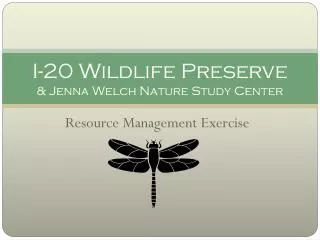
I-20 Wildlife Preserve & Jenna Welch Nature Study Center. Resource Management Exercise. Congratulations !.

E N D
I-20 Wildlife Preserve & Jenna Welch Nature Study Center Resource Management Exercise
Congratulations ! You have recently completed your study to become a resource management specialist. You first assignment is to evaluate the I-20 playa and adjacent wildlife preserve for the City of Midland and develop a management plan for the playa. Your work will be used to guide the restoration of the playa and to secure funding to carry out your plan. Your first job will be to evaluate the state of the playa. You will need to: • identify the supporting, regulating, and cultural services of the playa, • identify three (two human caused) disturbances to the playa ecosystem, and • estimate the resilience of this playa ecosystem. To undertake this first part, you will: • take a crash course in playas and complete the questions on pages 2-3 in your journals, and • visit the four playa stations to learn about the I-20 playa in detail. To finish your assignment, you will apply what you have learned to suggest some management steps for I-20. To do this you will need to: • prioritize the services that I-20 as an urban playa provides, and • suggest three steps to maintain or increase the functioning of this playa. GOOD LUCK and may Nature be your guide!
What do I need? So What is I-20? I-20 is… a playa lake! a protected area for organisms and people. a wet area in dry Midland a rich center of biodiversity a wild place in nature a place to visit over and over again. • Wear appropriate clothing: it could be warm, cold, wet or windy. Closed toed shoes are a must! • Bring water, you will be there for a while! • Remember the quieter you are the more you will see! • Follow docent instructions.
Photo by Malcolm McElvaney WHAT IS A PLAYA LAKE?
What is a Playa Lake? • Spanish explorers in the1500’s called them Playas… • Playa: Spanish for beach or shore • Francisco Vasquez de Coronado and his men described them as ponds, round like plates, a stone-throw wide or larger, some containing fresh water, and others salt. • Also called “Buffalo Wallows” • Watering holes for native mammals • Important hunting grounds for Native Americans, early explorers, and settlers.
What is a Playa Lake? • A naturally occurring small, shallow wetland • Playa lakes average less than 30 acres and 1-2 feet deep • Contain water only seasonally, depending on rainfall • Due to the dry and wet cycles, they are a rich center for biodiversity Photo by Nathan Knowles
Where are Playa Lakes and How did they Form? Playa lakes in Scott County, Kansas (photo by William C. Johnson)
Where are Playa Lakes Found? • Most playa lakes are located in the Great Plains of… • Colorado • Nebraska • Kansas • New Mexico • Oklahoma • Texas • High Plains of Texas has the highest concentration of playas • Areas with playa lakes usually have long periods of drought– receive less than 20 inches of rainfall per year
How Did Playa Lakes Form? • Playa Lakes form in generally flat land where a watershed is present • A watershed is the area of land where all of the water that is under it or drains off of it goes to the same place • Low spots in the land collect water from rainfall • As the water flows into small caliche-lined basins, it brings with it organic materials • These organic materials break-down to form carbonic acid • When carbonic acid meets the caliche (calcium carbonate), the caliche dissolves • The low spot sinks even lower, creating a playa. • Clay particles eventually build up in the depression, creating an impermeable layer which allows playas to retain water better than the surrounding land.
Photo by Malcolm McElvaney Why Are Playa Lakes Important?
What Lives in & Around a Playa? • Playa Lakes are rich centers of biodiversity • Playas are typically the home for… • 200 species of birds • 9 amphibian species • A minimum of 37 species of mammals • Several species of reptiles • A wide array of insects • Many aquatic and non-aquatic plants
How Playas are Key to Bird Survival • Playas are critical stops along the central flyway • Migratory birds pass through • Some birds winter in the playa • For birds, playas are the most important of all the wetlands. • Provide an assortment of plants, insects, and other invertebrates important to the diet of many different species of birds • Wet and Dry Stages–prevents diseases and bacteria in water • Birds that make stops in or live in playas tend to be healthier and have a higher rate of survival than birds that don’t.
Playa Lakes & the Ogallala Aquifer • The Ogallala Aquifer is a 10 million year old underground source of water underlying the great plains • Reaches from South Dakota down to western Texas). • The inhabitants of the Great Plains depend on the Ogallala Aquifer as a source of fresh water • Farming irrigation accounts for 96% of the water used • The levels of the aquifer are rapidly dropping • Hundreds of years ago, the aquifer water was naturally replenished, or recharged, by streams in the Rocky Mountains • Erosion has blocked the path of water from these streams to the aquifer • Scientists believed the Ogallala Aquifer would be completely drained by the end of WWII…
Photo by Malcolm McElvaney How does the Ogallala Aquifer still provide water? • Playa Lakes • Dry playas are the primary recharge bases for the Ogallala Aquifer • 80% of the recharge water for the Ogallala comes from playa lakes
Photo by Wyman Meinzer Protecting Playa Lakes
Threats to the Playa Lakes • Agriculture • Farming • Cause: Many farmers see playas as an obstacle for planting crops • Effect: Playas are filled with dirt in order to make space for more crops • Ranching • Cause: Ranchers may see wet playas as a good watering hole for livestock • Effect: The waste from livestock contaminates playas for plants and animals, as well as polluting the water that recharges the Ogallala Aquifer • Sedimentation • Cause: While erosion is a natural process, poor farming practices and development result in eroded soils are also a large contributor. • Effect: Eroded soils are carried by water or carried in the wind and can fill playa lakes. This is the biggest cause for the loss of playas, leaving what are called “fossil playas.” • LOSS OF A PLAYA = LOSS OF BIODIVERSITY
Protecting the Playa Lakes • Education is the answer to protecting these rich centers for biodiversity • Since most playa lakes are located on farmland, land owners must be informed about how valuable playa lakes are, not only to migratory birds and other wildlife, but to all people who live in the Great Plains Region and depend on the Ogallala Aquifer as a source of water. • Encouraging playa-owning citizens to maintain the natural prairie grasses around the playa is the best way to avoid sedimentation and the formation of “fossil playas.” • Become Involved
Photo by Malcolm McElvaney What Makes Midland’s Playa Lake Unique?
The I-20 Wildlife Preserve & Jenna Welch Nature Study Center • The I-20 Wildlife Preserve & Jenna Welch Nature Study Center • Our playa is in an urban setting, increasing stressors on the ecosystem, including invasive species (ie. fish & cattails & bullfrogs & saltcedar), modification of hydrology and watershed, man-made inputs (trash, debris) • The I-20 is within city limits and is protected by the city. • It has increased diversity in wildlife due to the urban setting. • Higher concentration of wildlife b/c best place for them when it’s close to the city- wildlife safe-haven.
Sources • Playa Lakes Joint Venture Film: Playas, Reflections of Life on the Plains. • Playa Wetlands. Texas Tech University.<http://courses. ttu.edu/thomas/wetlands/>