Download

1 / 20
200 likes | 359 Views
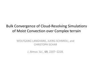
Bulk Convergence of Cloud-Resolving Simulations of Moist Convection over Complex terrain. WOLFGANG LANGHANS, JUERG SCHMIDLI, and CHRISTOPH SCHAR J. Atmos. Sci., 69 , 2207–2228. Large eddy simulation (LES). 大渦模擬 Large eddy simulation

E N D
Bulk Convergence of Cloud-Resolving Simulations of Moist Convection over Complex terrain WOLFGANG LANGHANS, JUERG SCHMIDLI, and CHRISTOPH SCHARJ. Atmos. Sci.,69, 2207–2228.
Large eddy simulation(LES) • 大渦模擬Large eddy simulation • 大渦模擬Large eddy simulation(LES)是一種計算法用來解決湍流流體計算偏微分方程式。這個計算法在1960年代末期廣為流行,最早由Joseph Smagorinsky用這套方程式來模擬大氣氣流,所以在當時主要被使用在氣象計算和預測。在80年代和90年代被廣泛使用於工程領域。 • 大漩渦是透過較小的漩渦數學模式計算所推導出來的。因此,較小規模的渦旋會用網格尺度(sub-grid scale; SGS)來模擬出來;最常用的SGS模式為Smagorinsky模式,經由在方程式中添加“渦粘度”(eddy viscosity)係數,以分解出適當的湍流尺度。
Bell-shaped mountainH: 10-km half-wide mountainV: 1-m high mountainL2: RMSE
General description Horizontal: 1100 × 990 km2 Vertical levels: 46 terrain-following Model top: 20 hPa Simulation time: 2006/07/11/0000 ~ 07/20/0600 UTC 970 km 352 km 515 km 352 km NonhydrosaticCOSMO (Consortium for Small-Scale Modeling model)
Topography LF: low-passed filtered topography (5th order low-pass filter to the 4.4-km topography and interpolating to higher resolution)
Turbulent diffusion : vertical diffusion in NC_1D & PC_1D (100 m)
2006/07/14/1400 UTC @ z=6km 352 km 352 km
ResultsNumerical convergence (NC_1D) 4.4 km ADV: advectionRAD: radiativeTURB: sensible heat flux convergenceMIC: latent heating 4.4 km
QAM AM AM: mean fluxAGS: turbulent fluxTTOP: unresolved turbulent flux through top of the volume vflx= AM+AGS+TTOP
Bell-shaped mountainH: 10-km half-wide mountainV: 1-m high mountainL2: RMSE
QAM AM AM: mean fluxAGS: turbulent fluxTTOP: unresolved turbulent flux through top of the volume vflx= AM+AGS+TTOP
QAM AM AM: mean fluxAGS: turbulent fluxTTOP: unresolved turbulent flux through top of the volume vflx= AM+AGS+TTOP
Summary • NC1D using a fixed turbulent length scale, all bulk properties converge systematically toward the 0.55-km solution. • PC is found to decrease systematically with smaller grid spacings, a less obvious physical convergence behavior was found for the PC3D. PC3D closure is explained by an increased latent heat release that balances the decreased turbulent heat entrainment with higher resolution. • Surface precipitation decreases continuously with higher resolution for PC1D. PC3D closure did not involve an increased resolution sensitivity of the net heating/moistening and of surface precipitation. • The consideration of one single synoptic episode domainted by thermally driven orographic convection.