Download
1 / 46
470 likes | 503 Views
This study delves into predicting fluid systems' range of predictability based on error growth, energy spectrum analysis, and sensitivity to initial conditions and soundings. It explores the limited and unlimited predictability of turbulence for different scales of motion.

E N D
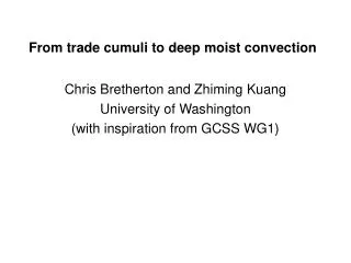
Moist Convection and Mesoscale Predictability* Rich Rotunno NCAR *based on work / C. Snyder, NCAR F. Zhang, Texas A&M
Predictability is… Range of Predictability Certain fluid systems “…have a intrinsic finite range of predictability, which cannot be lengthened by bettering the observations.” (Lorenz, Tellus, 1969)
For example… limited if
The Predictability of Flows with Many Scales of Motion larger scale, slower growth smaller scale, faster growth (Lorenz 1996)
The Predictability of Flows with Many Scales of Motion Energy Spectrum Error Energy Spectrum (Lorenz Tellus 1969)
A Dimensional Argument Energy Spectrum Error Growth Time Scale Lilly (Geo. Fluid Dyn., 1972; QJRMS 1990)
A Dimensional Argument Range of Predictability n=3 n=5/3 Lilly, Geo. Fluid Dyn., 1972; QJRMS 1990 Lilly (Geo. Fluid Dyn., 1972; QJRMS 1990)
Predictability of Turbulence / EDQNM* Limited Predictability Unlimited Predictability Leith and Kraichnan (JAS 1972) *Métais and Lesieur (JAS 1986)
Observed Energy Spectra Nastrom and Gage (1985) spectra computed from GASP observations (commercial aircraft) Lindborg (1999) functional fit from MOZAIC observations (aircraft) Skamarock (MWR, 2004)
Predictability? Implications for Predictability?
Day 1,2 Error Growth Rate Increased with Improved ECMWF Modeling System QJRMS 2002
Mesoscale Predictability? Scenario 1 L
Mesoscale Predictability? Scenario 2 L
NCEP Operational Eta Forecasts vs. Observations 12-36h precipitation forecast valid at 12Z 25 Jan 2000 DC RDU Zhang, Snyder, Rotunno (MWR, 2002)
MM5 Configurations MM5 Control Experiments and Configurations Zhang, Snyder, Rotunno (MWR, 2002)
Control Simulation vs. Observations MM5 Zhang, Snyder, Rotunno (MWR, 2002)
Experimental Design 4 initial conditions at 0Z 24 Jan 2000: • Control (MM5 reanalysis using Eta analysis as first guess) • Eta • ECMWF • Control + temperature perturbation, 120-km wavelength 2 resolutions: • 30 km, parameterized convection • 3 km (inner grid), explicit “convection” Consider differences between Control and other solutions Zhang, Snyder, Rotunno (MWR, 2002)
Sensitivity to Initial Conditions Zhang, Snyder, Rotunno (MWR, 2002)
Scale Dependence of Error Growth Zhang, Snyder, Rotunno (MWR, 2002)
Sensitivity to Individual Soundings 300 hPa wind difference at 0 and 36 h Contour interval: 3m/s (0 h in gray and 36 h in dark)
Idealized Initial Perturbations 300mb temperature difference |T’|max ~ 0.5K |T’|max ~ 4.0K Zhang, Snyder, Rotunno (JAS, 2003)
Idealized Initial Perturbations Energy spectra at various times 36 h 12 h 6 h 3 h 0 h Zhang, Snyder, Rotunno (JAS, 2003)
Idealized Initial Perturbations high vs. low resolution simulations 12 h 12 h 6 h 6 h 3 h 3 h 0 h 0 h 3.3-km Run 30-km Run Zhang, Snyder, Rotunno (JAS, 2003)
Forecast Sensitivity for “Surprise” Snowstorm MM5 Simulated (dx=3.3km) MSLP and Reflectivity, t=30h Control Perturbed 30h Lp Lc Lc • Rapid Initial Error Growth in Regions of Moist Instability • Upscale Error Growth Modifies Position of Surface Low Zhang, Snyder, Rotunno (JAS, 2003)
Baroclinic Waves / Moist Convection white noise added to D2 at t = 36h Zhang et al. (2006)
Evolution of Difference Field 500 hPa height (solid), v’ (color, c.i.=2m/s), 3h precip (shaded > 3mm) CAPE > 50J/Kg Zhang et al. (2006)
Evolution of Difference Field 500 hPa height (solid), v’ (color, c.i.=2m/s), 3h precip (shaded > 3mm) CAPE > 50J/Kg Zhang et al. (2006)
Evolution of Difference Field 500 hPa height (solid), v’ (color, c.i.=2m/s), 3h precip (shaded > 3mm) CAPE > 50J/Kg Zhang et al. (2006)
Evolution of Difference Field 500 hPa height (solid), v’ (color, c.i.=2m/s), 3h precip (shaded > 3mm) CAPE > 50J/Kg Zhang et al. (2006)
Evolution of Difference Field 500 hPa height (solid), v’ (color, c.i.=2m/s), 3h precip (shaded > 3mm) CAPE > 50J/Kg Zhang et al. (2006)
Evolution of Difference Field 500 hPa height (solid), v’ (color, c.i.=2m/s), 3h precip (shaded > 3mm) CAPE > 50J/Kg Zhang et al. (2006)
Difference Energy of Band-Pass Filtered Fields Zhang et al. (2006)
Summary Limited predictability for flows / decreases with increasing Consistent with predictability of various idealized turbulent flows (2D, 3D, QG, sQG) Wrt atmospheric predictability: Large scale like 2D turb in that independent of Small scale like 3D turb in that decreases with increasing Atmospheric spectra suggest transition in predictability in the mesoscale: Numerical sims mesocale predictability as in 3D turb , but moist instability is critical Examples from real-time high-resolution convective weather forecasts
Real-time WRF 4 km Forecast Initialized 04 June 2005 00 UTC Composite NEXRAD Radar Reflectivity forecast M. Weisman
June 5, 2005 Radar 03 GMT 4 km WRF-ARW 12 km ETA 06 GMT prec. 30 hr 03 GMT 27 hr M. Weisman
May 20, 2005 Radar 03 GMT 4 km WRF-ARW 12 km ETA 03 GMT 27 hr 06 GMT prec. 30 hr M. Weisman
May 30, 2004 Radar 03 GMT 4 km WRF-ARW 12 km ETA 03 GMT 27 hr 06 GMT prec. 30 hr M. Weisman
Spectra for WRF-ARW BAMEX Forecasts, 5 May – 14 July 2003 Average over approx. 4 – 9 km height, on model surfaces. 4 km WRF-ARW: 12 - 36 h forecast avg. Skamarock (MWR, 2004)
Outlook Mesoscale predictability limited for where But…high resolution beneficial to capture small-scale structure and allow correct response to larger mesoscale Improvement of i.c. at the larger mesoscale worthwhile