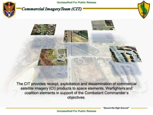
Download
1 / 26
300 likes | 796 Views
High Resolution Satellite Imagery. DigitalGlobe QuickBird. Phil Poole & Matt Egan SKM. WALIS, 2005. Agenda. Welcome Overview - SKM DigitalGlobe QuickBird What's Next? Tomorrow is here today. Sinclair Knight Merz. Spatial Services Business valued at $A20m Local office in Perth

E N D
High Resolution Satellite Imagery DigitalGlobe QuickBird Phil Poole & Matt Egan SKM WALIS, 2005
Agenda • Welcome • Overview - SKM DigitalGlobe • QuickBird • What's Next? • Tomorrow is here today
Sinclair Knight Merz • Spatial Services Business valued at $A20m • Local office in Perth • DG Team (Melbourne) - DigitalGlobe Distributor for Australia, New Zealand and the Pacific Islands. E-Cognition Reseller • Representatives in Perth, Hobart, Brisbane, Sydney, Darwin and New Zealand • Find out More: www.skmconsulting.com www.digitalglobe.com.au(coming soon)
DigitalGlobe • DigitalGlobe – formerly EarthWatch • DigitalGlobe is an Imaging and Information Company • Delivering information products worldwide • Providing solutions for your information needs • Business Strategy • Serve the worldwide GIS data market • Sub-meter resolution QuickBird satellites • www.digitalglobe.com web-enabled database • Global partnerships for sales and marketing • QuickBird Satellite Imagery • World’s highest resolution commercial imaging satellite. Find out more: www.digitalglobe.com
The Beginning • QuickBird launched on Oct. 18, 2001 • Placed in 98 degree inclination, polar, sun synchronous, low earth orbit at 450 km altitude • Based on a new 0.5 meter US Government operating license received December 2000 • Satellite is in optimal health and has commenced imaging upon completion of a verification and calibration period as of 1 February 2002.
QuickBird Spacecraft Specifications • 61-centimetre panchromatic Resolution • 2.44-metre Multispectral Resolution • 11 bit dynamic range • 10.7 Meter RMSE Relative Accuracy • 57 scenes per orbit • 0 – 25 off-nadir • 4 seconds to per Scene • 16.5 km swath • Push broom sensor • 98 sun-sync orbit • 1 - 6 day revisit • 14 orbits/day • 57 Scenes Per Orbit
Panchromatic - Black and White Multispectral – Used for Analysis Pan-sharpened Natural color (R,G,B) - Similar to Aerial Photography Color infrared (NIR,R,G) – False Colour Multispectral 4 Band - Higher Resolution MS Standard Popular Products Riverside, California
2 Weeks 1 Week 3 Days Hours Daily 150 km 1 km 30 m 10 m 5 m 1 m High Resolution Satellites Superiority Better Resolution and Faster Delivery NOAA Weather Satellites Digital Globe OrbView-3 / 4 Space Imaging OrbView-1 OrbView-2 NASA Environmental Satellites ImageSat SPOT Image Collection Time Aerial Photography Landsat RadarSat Indian Satellite Russian Satellite 4 Weeks 0.5 m Resolution Source: C.E. Unterberg, Towbin 1999 F14G\182953\06-18-1999
Widest Scene More targets per scene Builds archive faster Easier Mosaicking Fewer GCPs Faster large area collections Aerial Photography QuickBird – 16.5km Ikonos – 11km Quickbird Imagery ~ LargestFootprint
Latest News • 2 New Satellites in Build – Launch dates in 2006 – 46cm Resolution • CitySphere to be Launched – Perth Included • EPP – Launch of Energy Partner Program – BHP, Apache & Marathon on board • Worldview Ground systems in place and stabilized – • Archive growing • Google vs Microsoft – Geo Search engine war • Orthorectifed imagery now available as an official product • SKM sign Reseller Agreement with Definiens as eCognition Reseller – July 1st 2005
.. Tromso, Norway Wilkes-Barre, PA. Expanding DigitalGlobe Infrastructure Three remote ground terminals (Alaska, Norway,Pa) North Pole, Alaska
Imagery for Parcel Mapping & Code Enforcement “One of the most important uses for QuickBird imagery is for property tax revenue (parcel mapping) and building code enforcement purposes”. Nale Report, 2002
Storm Water Runoff Individual parcels taxed according to amount of impervious surfaces
Vegetation Index Harvard 17th Ave.
Update GIS Databases Automatic Land Cover feature extraction based on multispectral imagery
eCognition – Automated Feature Extraction FCC Raster to Vector Conversion and Semi-Automated Clean Up Raster Roads
QuickBird Imagery is Cost Effective • Many municipalities update 0.25-0.5m imagery every 3-4 years • Municipalities cannot afford to acquire 0.25 imagery annually • For many purposes, higher resolution aerial photography is not necessary • Satellite imagery is a cost-effective solution for current land base updates in interim years • Find the change with satellite orthoimagery on an annual basis, focus on the change with higher resolution aerial orthophotos • Satellite imagery provides current and accurate data needed for planning and management decisions • Important for an enterprise GIS to link timely image information with other current city-wide databases, especially for fast growing areas • A whole State Coverage Approach will bring cost savings to every organisation involved as well as reducing the overall spend on imagery from Government each year. • Once used additional benefits will be found for the imagery such as those demostrated today
Websites of interest www.skmconsulting.com/digitalglobewww.digitalglobe.comhttp://www.definiens-imaging.comwww.gim.act.gov.auwww.earthetc.comhttp://earth.google.comhttp://maps.google.comwww.digitalglobe.com.au(Coming soon) www.thelist.gov.tas.au