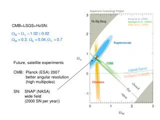
Download
1 / 10
100 likes | 116 Views
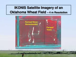
Explore IKONIS satellite imagery of an Oklahoma wheat field with 4m resolution. Identify soil moisture, spreader speed, alkalai spots, and fertilizer application.

E N D
IKONIS Satellite Imagery of an Oklahoma Wheat Field– 4 m Resolution Farmed Since Homesteaded Farmed Years
IKONIS Satellite Imagery of an Oklahoma Wheat Field– 4 m Resolution Higher soil moisture in terrace channels Streaking due to inadequate spreader spinner speed Alkalai spots
Farm Rate 100 lb/ac N-Rich Rate 200 lb/ac Farm Yield 50 bu/ac
Farm Rate 100 lb/ac N-Rich Rate 200 lb/ac Yield 40 bu/ac
N-Rich 140 lb/ac Farm Rate 70 lb/ac 44 bu/ac farm Alfalfa Field Yield bu/ac Eroded Hillside Bottom Formerly in Alfalfa
Fallowed Previous Year – not moisture limited N-Rich 140 lb/ac Farm Rate 70 lb/ac
GreenSeekerTM Sensor NDVI Output Displayed in an Agricultural GIS SSToolbox GIS Software Courtesy of SST Development Group, Stillwater, OK
Granular Fertilizer Streaking Terraces GreenSeekerTM NDVI Map Showing Fertilizer Application Terminated on Salt Contaminated Area