Download
1 / 40
400 likes | 429 Views
Explore the use of time series of coarse-resolution satellite imagery for classification and charting of global vegetation patterns, with considerations for phenology and land-cover discrimination.

E N D
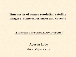
Time series of coarse resolution satellite imagery: some experiences and caveats Agustín Lobo alobo@ija.csic.es A contribution to the GLOBAL LAND COVER 2000
A. Lobo. Time series of coarse-resolution satellite imagery Classification of time series of Vegetation Index have produced vegetation charts at regional to global scales that are in general agreement with charts produced by compilation.
A. Lobo. Time series of coarse-resolution satellite imagery Summer-peaking vegetation Spring-peaking vegetation
A. Lobo. Time series of coarse-resolution satellite imagery Summer-peaking vegetation Spring-peaking vegetation
A. Lobo. Time series of coarse-resolution satellite imagery Summer-peaking vegetation Spring-peaking vegetation
A. Lobo. Time series of coarse-resolution satellite imagery Summer-peaking vegetation Spring-peaking vegetation
A. Lobo. Time series of coarse-resolution satellite imagery Single-date imagery would never produce such a result, no matter how many spectral bands would be considered...
A. Lobo. Time series of coarse-resolution satellite imagery ...because time series of Vegetation Index are an estimate of the phenolgy of fPAR, which is a fundamental property of vegetation.
A. Lobo. Time series of coarse-resolution satellite imagery Phenolgy of fPAR is shaped by climatic constraints (temperature and water availability) acting on the trade-offs of leaf maintenance, which implies that time series of Vegetation Index respond to climate.
A. Lobo. Time series of coarse-resolution satellite imagery Nevertheless, there are two important shortcomings to be considered: 1. Phenology is also fine-tuned by meteorological conditions, which implies that there is significant inter-annual variation and, therefore, mean annual series should be preferred for land-cover classification.
A. Lobo. Time series of coarse-resolution satellite imagery 2. Although an important property, Phenology of fPAR is not enough to discriminate among some important land-cover types. Other properties should be measured from RS, such are:
A. Lobo. Time series of coarse-resolution satellite imagery • Leaf/wood biomass ratio (“woodiness”) • Leaf type and size • Total biomass • Height of dominant canopy • “Layering” (vertical profile of leaf biomass)
A. Lobo. Time series of coarse-resolution satellite imagery • Leaf type and size Important to estimate the relative abundance of coastal conifers (i.e. P. halepensis) and evergreen oaks, because of their different behavior against fire. Note that vegetation changes due to increased aridity in the Mediterranean will be mediated through wildfires. RS Methods: angular effects? • Total biomass • Height of dominant canopy • “Layering” (vertical profile of leaf biomass) RS Methods: Perhaps with SAR?
A. Lobo. Time series of coarse-resolution satellite imagery Other important properties for vegetation functioning (but not for land-cover discrimination): • Phenology of photosynthetic activity (PRI) • Phenology of evapotranspiration • Canopy roughness
A. Lobo. Time series of coarse-resolution satellite imagery • Leaf/wood biomass ratio Important for the C budget, to estimate fuel load, and for land-cover identification. Methods: SWIR ?
A. Lobo. Time series of coarse-resolution satellite imagery • In High resolution imagery, SWIR has been found to be important to discriminate forest types CAN-1 (%) CAN-2 (%) green 0.0435 (16.4) - 0.0448 (14.3) red 0.0915 (34.5) 0.0190 ( 6.1) nir -0.0447 (16.8) - 0.2027 (64.6) swir 0.0855 (32.2) 0.0472 (15.0)
A. Lobo. Time series of coarse-resolution satellite imagery burned forest • Using VEGETATION imagery, SWIR has been found also to be important to discriminate land cover types: forest arid vegetation irrigated fields
A. Lobo. Time series of coarse-resolution satellite imagery Pastures
A. Lobo. Time series of coarse-resolution satellite imagery Cistus and broom dry garrigues
A. Lobo. Time series of coarse-resolution satellite imagery Quercus ilex forest and shrubland
A. Lobo. Time series of coarse-resolution satellite imagery Quercus rotundifolia shrubland
A. Lobo. Time series of coarse-resolution satellite imagery P. halepensis with Q. rotundifolia understorey
A. Lobo. Time series of coarse-resolution satellite imagery P. uncinata mountain forests
A. Lobo. Time series of coarse-resolution satellite imagery Therefore, although there is some sensitivity to the wood/leaf ratio, the eventual presence of water complicates the problem.
A. Lobo. Time series of coarse-resolution satellite imagery P-OVNI, S-NDVI, S-OVNI? 21 images 1999-09-16 to 1999-12-13 Burkina-Faso (Lobo & Bartholome)
A. Lobo. Time series of coarse-resolution satellite imagery P-OVNI S-NDVI
“S-OVNI” A. Lobo. Time series of coarse-resolution satellite imagery P-OVNI S-NDVI