Chapter 10:
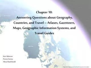
Chapter 10: Answering Questions about Geography, Countries, and Travel – Atlases, Gazetteers, Maps, Geographic I nformation S ystems, and Travel G uides. Kari Atkinson Penny Feeney Alicia MacDonald. http://www.fileguru.com/Earth-3D-Screensaver/screenshot. History.

Chapter 10:
E N D
Presentation Transcript
Chapter 10: Answering Questions about Geography, Countries, and Travel – Atlases, Gazetteers, Maps, Geographic Information Systems, and Travel Guides Kari Atkinson Penny Feeney Alicia MacDonald http://www.fileguru.com/Earth-3D-Screensaver/screenshot
History • Egyptian Papyrus Geological & Topographical Map • Oldest Surviving Geological & Topographical Map • Circa 1150 BCE • Maps Use • Foreign Conquest • Economic Exploitation • National Defense • The invention of printing made maps more easily produced and distributed. Turin Papyrus Map, located in the Egyptian Museum in Turin, Italy. http://en.wikipedia.org/wiki/Turin_Papyrus_Map
Map Formats Gores Digital Paper Globes http://www.spin3d.com/, http://www.citejournal.org/, http://www.1ststoptravelstore.com/, & http://www.nationalparks.gov.uk/
Map Types Topographic Cartogram Climatic Economic http://www.excelgeophysics.com/, http://www.scientificamerican.com/, http://www.squidoo.com/zone5, & http://www.squidoo.com/zone5
Map Types Continued Agricultural Ancient Road 3D http://agro.biodiver.se/, http://www.newyorkstatesearch.com/, http://blog.metrotwin.com/, & http://travelintospain.blogspot.com/
University of Texas Perry-CastaÑeda Library The Perry-Castaῆeda map collection provides 5,000 digitized maps, with a strong emphasis on historical maps. It is the fifth largest library among academic institutions, and the thirteenth largest in the US. http://www.flickr.com/photos/bharadwaj/3541223212/
Evaluating Geographic Resources • Standard Evaluation Criteria • Currency • Accuracy • Authority • Price Unique Evaluation Criteria • Legibility • Scale & Projection • Color • Symbols • Format • Index
Selection & Keeping Current • Geographical sources are regularly reviewed in the following journals • Booklist • Choice • Library Journal • American Reference Books Annual • The American Library Association’s Map & Geography Round Table is a bibliographical resource which also provides information on currency
Resources • Bird Library Map Room • David Rumsey Historical Map Collection – http://www.davidrumsey.com/ • Google Earth - http://www.google.com/earth/index.html • James Ford Bell Library - http://www.lib.umn.edu/apps/bell/map/index.html • Library of Congress – http://memory.loc.gov/ammem/gmdhtml/ • National Geographic Society - www.nationalgeographic.com • Best Us Adventures – http://adventure.nationalgeographic.com/adventure/trips/americas-best-adventures/map/ • Expeditions – http://nationalgeographic.com/xpeditions • Perry-Castaneda Collection - http://www.lib.utexas.edu/maps/ • U.S. Geological Survey - www.usgs.gov
What Kind of Questions Might a Reference Librarian Get? ? http://www.usafa.edu/df/dfh/intl_hist_crs.cfm
Google Earth • Google Earth allows you to view the Earth, Mars, the Moon, or the Sky in 3D, offering panoramic views, photographs, 3D models and much more. • Earth • “Fly” anywhere on Earth • View satellite imagery, maps, terrain, or 3D buildings/cities • View beneath the ocean surface • Find shipwrecks or current exploration projects • Track marine migrations • Moon • Explore the Moon in 3D • Find landed spacecrafts, astronauts’ footprints • View Apollo missions • Mars • Explore Mars in 3D • Sky • Explore distant galaxies • View constellations • Listen to astronomy podcasts http://www.csam.montclair.edu/earth/
Bibliography • Cassell, K. A. & Hiremath, U. (2009). Reference and Information Services in the 21st Century. (2 ed., 213-231). New York: Neal-Schuman Publishers, Inc. • Harrell, J. A. & Brown, V. M. (1992). The World’s Oldest Surviving Geological Map: The 1150 B.C. Turin Papyrus from Egypt. The Journal of Geology, 100(1), 3-18. Retrieved from http://www.jstor.org/stable/30082315 • Harrell, J. A. & Brown, V. M. (1992). The Oldest Surviving Topographical Map from Ancient Egypt: (Turin Papyri 1879, 1899, and 1969). The Journal of the American Research Center in Egypt, 29, 81-105. Retrieved from http://www.jstor.org/stable/40000486 http://www.qandj.info/the-reference-librarian/