River Mapping for Endangered Species Habitat and Streambank Erosion Assessment
This study showcases the use of innovative technologies to map aquatic habitats and streambank erosion for endangered species conservation. Techniques include underwater videomapping, snorkel mapping, and GPS-based mapping to assess critical habitats. Case studies at Fort Benning and Camp Atterbury demonstrate the effectiveness of these methods in identifying optimal habitats for endangered species and assessing erosion risks in river ecosystems.

River Mapping for Endangered Species Habitat and Streambank Erosion Assessment
E N D
Presentation Transcript
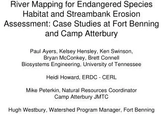
River Mapping for Endangered Species Habitat and Streambank Erosion Assessment: Case Studies at Fort Benning and Camp AtterburyPaul Ayers, Kelsey Hensley, Ken Swinson, Bryan McConkey, Brett ConnellBiosystems Engineering, University of TennesseeHeidi Howard, ERDC - CERLMike Peterkin, Natural Resources CoordinatorCamp Atterbury JMTCHugh Westbury, Watershed Program Manager, Fort Benning
Objectives • Use canoe and kayak-mounted underwater videomapping system • Develop aquatic habitat maps for the Driftwood River (20 miles) • Develop optimum habitat maps for Rayed Bean (Villosa fabalis) mussel - PWTB 200-1-114 • Snorkel and sneak peek mapping • Streambank mapping (erosion) - Legacy • Ocean/coral reef aquatic habitat maps
WATERPROOF CASE SONAR TRANSDUCER LASERS VIDEO CAMERAS
GPS Audio Encoder Audio output (GPS output) Audio Input (GPS input) Splash Cam Video input Geo-referenced Image Recording GPS NMEA Data (ASCII) DVD Recorder
GIS Attributes Defined • GPS Position • Depth • Width • Substrate • River Characteristic • Embeddedness • Streambank Erosion (bank height, bank angle, riparian diversity, river sinuosity)
Using underwater lasers to determine Substrate scale (dot spacing is 7.75 inches)
Some Substrate Types Sand Cobble Small Gravel Small Boulder Large Boulder Bedrock
RiverSurfaceCharacteristics Run Pool Riffle
Driftwood River River Characteristics 20 mile 38,503 Sample Points
Driftwood River Thalweg Depth 20 mile 38,053 Sample Points
Driftwood River Substrate 20 mile 38,053 Sample Points
Species at Risk Habitat Maps • Rayed Bean (Villosa fabalis) mussel • Develop Optimum Habitat Criteria
Rayed Bean (Villosa fabalis) Habitat Criteria • primarily found in small, shallow rivers • usually about 4 feet in depth or less • in and near riffles/runs • usually found deeply buried in sand and gravel substrates • often in and around aquatic vegetation Search • (Depth <= 4 feet) • River Characteristic = riffle/run • Substrate = sand or gravel
Rayed Bean (Villosa fabalis) 6.7% Optimum Habitat
Summary - River Habitat Videomapping for Aquatic Species at Risk (SAR) Habitat • Cover large reaches (10 miles/day) - continuous • Non-intrusive, no access required • Determine above and below water features • Develop total river habitat suitability index • By mapping every foot of the river, the total amount and location of optimum habitat can be determined (development occupancy model) • Provides permanent historical video database to evaluate changing habitat conditions
Legacy FY 2015 Proposal • Species At-Risk, Species of Concern and Declining Species and Habitat (Natural) Pilot or demonstration efforts of new techniques, methodologies, and management practices, including the implementation of new or innovative monitoring and predictive modeling techniques. • Ken Oristaglio – Fort Picket (Nottoway River) • Roanoke Logperch • Atlantic Pigtoe Others?
Snorkel mapping for Species counts Embedded video recorder and GPS on back strap
Georeferenced manual underwater recording video for observing under rocks
Legacy Project (Year 1) GIS-based streambank mapping to identify areas of erosion potential on rivers/streams within military installations (Camp Atterbury and Fort Benning) Mapping Site-specific Streambank Erosion
Streambank Erosion Videomapping • Determine erodibility and erosivity • Identify areas of restoration needs • Cover large areas (10 miles/day) - continuous • Non-intrusive, no access required • Permanent video database and virtual tour capability • Uses EPA Bank Assessment of Non-point source Consequences of Sediment (BANCS) for annual total streambank erosion prediction • Used to determine sediment TMDL’s.
THE END -Questions? Paul Ayers, University of Tennessee - ayers@utk.edu