Download
1 / 12
210 likes | 648 Views
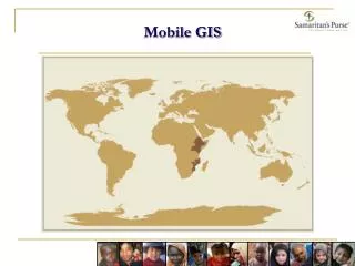
Mobile GIS. Dr Adrian Johnson. Outline. Handheld computers What do PDAs provide? Uses in the field An example with 14 year olds Examples of other applications Learning promoted Further reading Questions and discussion Contact details. 1. Handheld computers.

E N D
Mobile GIS Dr Adrian Johnson
Outline • Handheld computers • What do PDAs provide? • Uses in the field • An example with 14 year olds • Examples of other applications • Learning promoted • Further reading • Questions and discussion • Contact details
1. Handheld computers • Involves a GPS-enabled PDA (personal digital assistant) • Diluted desktop GIS software; for example, ESRI UK’s ArcPad • Data; ideally, MasterMap from Ordnance Survey
2. What do PDAs provide? • A voice recorder • Word processor • Spreadsheet • Data logger • Graphic calculator • Digital camera • Mobile phone • Personal organiser • Wireless communication device • Email service
3. Uses in the field • New shapefiles can be created • Photographs can be linked to locations • Field data can be entered
4. An example with 14 year olds • 4th form CBD study • Survey points selected • Pedestrians counted over time
5. Examples of other applications • Tree surveys • Estimation of footpath trip hazards • Location of road potholes • Updating electronic maps of the campus or CBD • Examination of urban heat islands
6. Learning promoted Learning takes place at a number of levels: • the ability to work within a team • the use of technology • project management • high level cartography and presentation skills • spatial analysis • report writing
7. Further reading • http://www.geography.org.uk/download/GA_PRSSBedford.doc • http://eduscapes.com/tap/topic78.htm#2 • http://www.lbs360.net/articles/index.php?article_id=572
8. Questions and discussion “The teacher acts as a communications hub, managing a classroom where learning is a partnership and information flows in both directions between teacher and students.” Fillmore, C., Flegg, R., Muller, F., Cakacaka, J. and Hawkins, R. August 2005 PPCs in the classroom: propagating pupil’s cognition. Professional Educator4(3): 22 – 25.
9. Contact details Dr Adrian Johnson Head of Pastoral Care Ibstock Place School Roehampton SW15 5PY Email: ajohnson@ibstockplaceschool.co.uk