Download

1 / 8
80 likes | 180 Views
Discover political, physical, and topographical maps with state and city boundaries, elevation colors, contour lines, and more. Learn about climate, economy, roads, and thematic maps. Understand latitude, longitude, scale, oceans, and continents.

E N D
ALL ABOUT MAPS BY PIPER WELCH 10/23/13
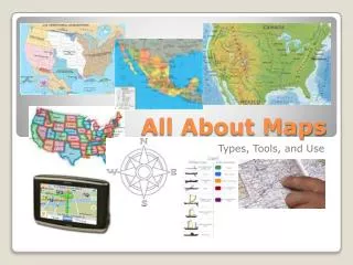
Political Map, Physical Map, Topographical Map • Show state and national boundaries, locations of cities. Example:50 u.s state with its borders. Shows mountains, rivers, and lakes different colors to show elevation. Example: u.smap with colors to show elevation. Has contour lines instead of colors to show land scape. Examlpe:close together line= steep elevation spread out lines= flat, coastal area.
Political Map • Physical Map • Topographical Map
Climate map, Economic map, Road map, Thematic or Resource map.Shows weather of an area climate zones. Example: Australian map shows color for desert region. Type of natural resource in an area. Shows major and road. Example: NY map with a wide red line to or specific theme. Example: populatoin change is a place.
All About Latitude and Longitude- Longitude – lines that run north to south- Latitude – lines that run east to west
Scale • Scale measures the distance between two places
Oceans and Continents • Oceans: • Indian Ocean • Pacific Ocean • Atlantic Ocean • Arctic Ocean Continents: North America Africa South America Asia Europe Australia Antarctica