Download
1 / 25
250 likes | 382 Views
The Roan Plateau Proposed Plan aims to balance energy development with environmental preservation. Encompassing 73,602 acres, it highlights the natural gas potential, with 8.9 trillion cubic feet of recoverable federal gas. Strategic measures include deferred leasing on the plateau's surface, minimizing disturbance to 1% of the area, safeguarding wildlife habitats, protecting water resources, and preserving scenic views. Structured in collaboration with local agencies, the plan emphasizes limited surface occupancy and careful management of motorized travel, ensuring a sustainable approach to oil and gas exploration while prioritizing ecological integrity.

E N D
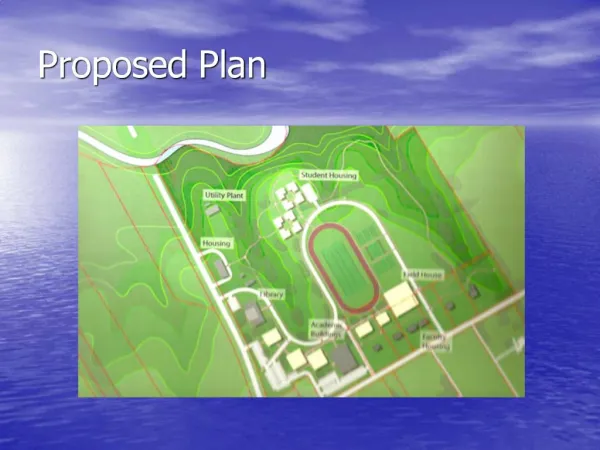
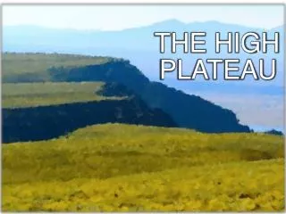
Roan Plateau Proposed Plan Garfield County Energy Advisory Board Oct. 5, 2006
73,602 acres • 34,758 on top • 38,844 below
Roan History • 1910s – Naval Oil Shale Reserves 1 and 3 created • 1977 – Transferred from Navy to DOE • DOE develops 24 wells below the Rim • 1997 – Act of Congress transfers NOSRs to DOI/BLM
Transfer Act “Beginning on the date of enactment … or as soon as practicable, the Secretary of Interior shall enter into leases with one or more private entities for the purpose of exploration for, and development and production of petroleum located on the public domain lands in the Oil Shale Reserves Numbered 1 and 3.”
Transfer Act • Secretary of Interior shall manage NOSRs 1 and 3 through BLM under the Federal Lands Management and Policy Act • i.e. manage for multiple use, develop Resource Management Plan
Tremendous natural gas potential • 8.9 TCF of recoverable federal gas • 4.2 TCF under the top of the Plateau
Roan Plan • Draft Plan released in Nov. 2004 • Preferred Alternative deferred leasing on top until most of resource below recovered • 120-day public comment period • Almost 75,000 comment letters/e-mails
Roan Plan • Cooperating Agencies: • Colorado Department of Natural Resources • Garfield County • Rio Blanco County • City of Rifle • Town of Parachute • City of Glenwood Springs
Proposed Plan • Innovative approach to oil and gas development • Provides protection for fish and wildlife habitat • Protects water resources • Protects scenic views • Allows access to 90 percent of recoverable natural gas
Surface disturbance minimized • Limits surface disturbance on top to no more than 1 percent (350 acres) total at any one time • Well pads no closer than ½ mile apart • Ridge-by-ridge development (no development in canyons)
Federal Unit on top • Entire top leased at once • One lessee conducts operations on behalf of all lessees • Eliminates need for duplicative infrastructure • Allows BLM greater control of how, when and where development occurs
Stipulations • More than 50 percent no surface occupancy throughout planning area • Timing limitations on 35,000 acres
Wildlife Protections • 23,000 acres identified as big game security areas (above and below) • Habitat fragmentation limited • Timing limitations
Cutthroat trout/Water Resources • NSO stipulations • Development on ridges • Strict requirements on road and well-pad construction
Scenic protections • Scenic views protected from I-70, Highway 13, local communities • Ridge development protects scenic views
East Fork • Waterfall and box canyon designated Visual Resource Management Class I • Protects visual experience
Travel Management • Limits motorized travel to designated routes • Creates 2,460-acre OHV Riding Area on Hubbard Mesa (below the rim)
Route Designations • 259 miles of motorized routes existing • 157 miles existing on top • Plan closes and reclaims 28 miles (19) • Designates 68 miles admin use only (52) • 163 open to motorized travel (86) • Miles on top limited to 138
Additional management • Creates four ACECs: 21,000 acres • Creates 33,575-acre Parachute Creek Watershed Management Area
What’s next? • Protest period ends Oct. 16 • Governor has 60-days to review • Resolve protests • Leasing process • Site-specific GAPs required