Download
1 / 28
290 likes | 448 Views
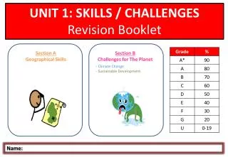
UNIT 1: SKILLS / CHALLENGES Revision Booklet. Section A Geographical Skills. Section B Challenges for The Planet Climate Change Sustainable Development. Name:. A. GEOGRAPHICAL SKILLS. BASIC SKILLS. How to draw, label and annotate sketches

E N D
UNIT 1: SKILLS / CHALLENGES Revision Booklet Section A Geographical Skills • Section B • Challenges for The Planet • Climate Change • Sustainable Development Name:
BASIC SKILLS • How to draw, label and annotate sketches • You may be asked to complete a sketch (lack of time means it is unlikely you’ll be asked to complete a whole one). • Some of the most important lines such as rivers, coastline and the outline of hills will have been drawn for you. You could be asked to complete them. • You could then be asked to add certain features such as woodlands, settlements or roads. • You may possibly then be asked to label and annotate your sketch. How to interpret aerial, oblique and satellite photographs Photographs show features of the landscape that are not on OS maps, such as the crops being grown in the fields. You may be asked to interpret aerial, oblique or satellite photographs. Aerial photographs – taken directly above (bird’s eye view). Oblique photographs – taken at an angle. Show details of buildings etc. Satellite photographs – Images taken from space. Show patterns of features such as street lights in an urban area. When a photograph is interpreted, it involves describing and explaining the physical and human geography which can be seen on it. Remember! A label is a simple descriptive point. An annotation is a label with more detailed description or an explanatory point.
CARTOGRAPHIC SKILLS: ATLAS maps How to draw, label and annotate and interpret sketch maps In the exam you will usually be COMPLETING sketch maps. Remember the examiner isn’t looking for a perfect replica of the map, but accuracy with the location of roads, woodlands or other features will be expected. If you are asked to complete a sketch map but not told what to include, just include the important features such as roads, railway lines, settlements and woods. TIP! It is best to use a pencil or black pen to complete your sketch map. Use different types of lines (e.g. Dashed or dots) to show different features. Don;t forget to include a key! Describing the distribution (pattern) of physical or human features on a map..... 1. State the obvious! (One sentence – give the general trend/pattern). E.g. Even/Uneven, Clustered/Linear, Dense/Sparse etc. 2. Give an example/examples to support 1. (Name places/features from the map), Compass directions). 3. Describe any anomalies/Extremes (something that doesn’t fit the pattern). E.g. All/None, Highest/Lowest etc. * Refer to ALL information given on the map (place names, numbers, compass directions etc.).
CARTOGRAPHIC SKILLS: OS maps • Straight line and winding distances • To measure a straight line use a ruler to masure the distance between the points you need. Use the scale to convert this into the ‘real-life’ distance. • To measure a winding distance, split the route into a number of straight sections then add up these distances and use the scale to convert these into km. • Scale = 1:50,000. • Therefore 2cm = 1km. (Each square on your OS map measures 2cm x 2cm). Do I need to learn all of the symbols? You will always be given a key with an OS extract so you don't need to know all symbols......if you can learn some of them it will save you time so you don't need to keep looking them up. Remember! If you’re asked to complete a sketch map use the correct symbols from the key. You may be asked to estimate the area of a feature. This is simple – just count the number of grid squares that are at least half full • Cross-sections • It is unlikely that You would be asked to draw a cross-section but you may be asked to complete and/or annotate one: • If the land is steep the contours will be close together. • If the contours are far apart the land is gently sloping. • An absence of contours indicates flat land. It’s useful to have a piece of string in the exam to measure winding distances! Patterns of physical features Relief – the shape of the land. Are the contours close together or far apart? (Are there any?) Have I included any figures from the map? Vegetation What type is in the extract? How much of the area is taken up with woodland? What other land use is in the area? Rivers and their valleys Are there any rivers /lakes? Which direction are they flowing? Is there any human activity/interference?
CARTOGRAPHIC SKILLS: OS maps Site and Situation of Settlements You need to be able to describe the site and situation of settlements on a map. Site Factors S – Shelter from strong winds/storms H – Height above sea level A – Aspect (the way that the slope faces) W – Water supply L – Land that the settlement is built on (fertile, type of slope) Situation Factors The situation of a settlement is its position in relation to its surroundings. When you are describing the situation of a settlement on an OS map you should describe the human and physical features around it. P – Places A – Accessibility R – Relief C - Communications Patterns of human features Land use What type of settlement is in the area? What percentage of the area is taken up with settlement? Communications Are the roads and railway lines in the river valleys? Are the railway lines close to the roads? Shape of Settlements The shape of the settlement is the pattern that it makes (the away the buildings are arranged). Settlement shape is concentrated usually on villages. Linear Buildings in a line along a road, valley or coast. Dispersed Individual buildings are spread out, there is no obvious village centre. Nucleated Buildings are grouped together (around a crossroads). • Human activity from map evidence • Services in settlements (churches, post offices, public houses). • land features (windmills, wind generators). • - Communication routes (roads, railways – with associated features such as tunnels and level crossings). • Settlement size 9shown by the area they cover). • Tourist information (information centres, parking, camp sites etc.).
GRAPHICAL SKILLS Line-type Graphs Line graphs are used to show data that is continuous (e.g. A country's GDP over time). The information is continuous because there is not a break in the years. Flow lines are usually used to display some kind of movement such as pedestrian or traffic flows over time. Isolines are lines which join places which are equal (e.g. Contours which join places of equal height). Ray / Rose diagrams tend to be used to show the direction of movement of groups of people. The length of the arrow would be the number of people and the direction shows where the people came from. Compound line graphs show continuous data for a number of variables – they can be some of the hardest graphs to interpret. Triangular graphs show three variables on one graph (e.g. Primary, secondary and tertiary industry for different countries). Bar-type graphs Bar charts and histograms can be drawn horizontally or vertically. Other bar graphs are more difficult, such as compound bar graphs and bar graphs located on maps. A compound bar graph has a number of different pieces of information in each column (e.g. The % of a country’s population employed in each sector). Other Graphs Pie Diagrams Pictograms Scatter graphs Dispersion graphs Choropleth maps
GIS (Geographical Information Systems) SKILLS - What is GIS? - Who uses GIS? - What is layering? - How is GIS used? - How can GIS improve data presentation? - What are the advantages and disadvantages of GIS? GIS is a way of using maps digitally to make our lives easier. It allows large amounts of information to be seen by layering one set of information on to another. The base information is abase map of the area being studied. • The ambulance service: • A call comes into ambulance central control. The call-handler uses GIS to quickly find where the patient is located. • The next map layer tells central control where all the other ambulance crews are at the moment. • The next layer on the map is traffic congestion. June 2010 Describe what is meant by layering information. (4)
HOW climate has changed since the last Ice Age HOW has the world’s climate changed since the last Ice Age? Describing a graph...... 1. State the obvious! (One sentence – give the general trend/pattern). E.g. Increasing/Decreasing, Positive/Negative Correlation etc. 2. Pick out detail from the graph – use adjectives/adverbs. E.g. Increasing quickly, Gradually decreasing etc. 3. Quote figures/data from the graph – use numbers/dates. 4. Name any anomalies or anything that stands out on graph). E.g. Highest/lowest values, sudden decreases/increases etc. * Refer to ALL information given on the graph (years, place names, numbers, percentages , and...don’t forget the units! Since the end of the last Ice Age (~10,000 years ago) global temperature has increased by 6°C. Within this trend, however, there have been a number of fluctuations. In the past 100 years the temperature has begun to rise steadily, with greater increases since the 1960s. The temperature is projected to increase much more rapidly in the coming years, being 5°C warmer in 2100 than it is now. Remember the rules for how to describe a graph!
WHY climate has changed since the last Ice Age EXTERNAL FACTORS • ORBITAL GEOMETRY • The shape of the earth’s orbit around the Sun varies from nearly circular to elliptical and back again every 95,000 years. Cold glacial periods have occurred when the Earth’s orbit is circular and warmer periods when it is more elliptical. • The tilt of the earth’s axis varies over time from 21.5° and 24.5°. The greater the angle of tilt, the hotter the summers are and the colder the winters are. When the angle is greater the Earth usually experiences warmer periods. • - The Earth ‘wobbles’ on its axis a little. • These variations in orbit as known as the Milankovitch Mechanism. SOLAR OUTPUT Energy from the sun changes over time. 1% change in solar output could make the temperature rise/fall by between 0.5 and 1.0°C. It is thought that the activity of sunspots on the Sun’s surface affects solar output. (reduced activity = cooler temperatures). TECTONIC ACTIVITY The movement of the continents by plate tectonics (continental drift) affects the global pattern of atmospheric and ocean circulation, and the changing shape of the Earth’s surface causes winds and ocean current to change. This process is too slow to have much effect on climate over the relatively short geological timer span of the last 10,000 years, however. CHANGE IN ATMOSPHERIC GAS There is a clear relationship between the amount of Coᴤ in the atmosphere and temperature variations. The Greenhouse Effect keeps heat within the Earth’s atmosphere by absorbing longwave radiation. Without this global temperature of the Earth would be minus 18°C rather than the present 15°C (i.e. 33°C colder). VOLCANIC ACTIVITY Volcanic eruptions release large amounts of sulphur dioxide and ash into the atmosphere. These act as a cloak and reduce the amount of solar (radiation) energy reaching the Earth’s surface. SURFACE REFLECTION During cooler periods when there is a larger amount of snow and ice on the earth, global temperature will drop due to the snow and ice reflecting sunlight back to space. INTERNAL FACTORS Jan 2011 Explain 2 causes of climate change since the last Ice Age. (4)
The causes of current climate change Burning of Fossil Fuels Greenhouse gases absorb radiation going back out from Earth, ‘trapping’ it making life on Earth possible (it would be too cold otherwise). Too high a level of these gases would make temperatures too high for life – the range within which life is possible is quite narrow so the level needs to stay relatively stable. The most important greenhouse gases are: Water Vapour Methane Carbon Dioxide Nitrous Oxide CFCs In recent years almost all climate experts have agreed that global temperatures are increasing. Most (not ALL) blame human activity for most of this increase – focusing attention on rising levels of CO₂ and methane. Most of this comes from burning fossil fuels (coal, oil, natural gas). Increase of Methane in the Atmosphere Methane is 24x more potent a greenhouse gas than CO₂. Methane levels have risen as the number of livestock animals has increased. Rising incomes throughout the world have increased the demand for meat, meaning that the numbers of animals reared (especially cattle and sheep) have soared in the last few decades. Where does methane come from? Livestock animals produce methane as part of their digestive process – belching it out while chewing cud and excreting it in their waste. About 15-20% of global methane emissions come from livestock. Wetlands (including marshes and swamps). Growing of rice. Landfills which contain rotting vegetable matter. Burning vegetation. Vast majority comes from increases in wealth around the world leading to increased demand for energy, food, consumer goods, transport. Jan 2011 Outline how fossil fuels have caused the increase in CO₂ emissions . (4) June 2010 Explain how burning of fossil fuels contributes to current climate change. (4)
The causes of current climate change The Greenhouse Effect Greenhouse gases are gases in the atmosphere that absorb and emit radiation. This process is the fundamental cause of the greenhouse effect. Most greenhouse gases come from the combustion of fossil fuels in cars, factories and electricity production. Different gases have different heat-trapping abilities: Methane = 20x Nitrous Oxide = 300x CFCs = >1000x But...CO₂ is present in much greater concentrations and is therefore the most responsible. Same passes through the atmosphere and is lost in space. Heat energy from the Sun (shortwave radiation) beams down onto the earth. Some of it passes through a blanket of gases in our atmosphere. Some solar radiation is reflected by the earth’s atmosphere and surface. Some solar energy is absorbed by the Earth’s surface and converted into heat (infrared - longwave radiation). Infrared radiation is re-emitted from the Earth’s surface. Some is absorbed by greenhouse gas molecules, heating the Earth again.
The negative effects climate change is having on people and the environment CHANGING PATTERN OF CROP YIELDS RISING SEA LEVELS RETREATING GLACIERS The world’s most important foods are rice and wheat – and these are grown in distinct regions. The wheat ‘belts’ (where wheat is grown) in countries such as the USA, Canada and Russia are in regions that are likely to experience changes in their climate. What is much less clear is whether these impacts will be negative or not. Any changes will need a speedy response by governments and farmers...almost every country depends on food imports and at any moment the world has about 40 days’ worth of food supply in store. If climate change reduces harvests significantly then food prices will rise and some populations will be very badly affected – especially in sub-Saharan Africa. Rising sea level is caused by two processes: 1. The addition of water from melting of land-based ice sheets. 2. Expansion of sea water itself as it gets warmer (‘thermal expansion’). Predictions about sea-level change depend on the various #models’ used to predict the rates of global warming. The most pessimistic forecast shows sea levels rising by nearly 1metre by the end of the century. The most optimistic shows a rise of less than 20cm. Between 1993 and 2006 sea levels rose 3.3mm a year. This will lead to an 88cm rise in sea levels by the end of the century. The majority of the world’s glaciers ate retreating (i.e. melting), some more quickly than others. This is thought by some to be due to the increase in temperatures caused by climate change. Many islands in the Pacific Ocean are already being affected by riding sea levels – 2 of the Kiribati islands are now covered with sea water. Loss of sea ice is a problem for polar bears of Wrangel Island (Russian nature reserve) because they cannot travel over land to catch their prey. In the Colca region of Peru villages have been abandoned – they no longer have a water supply because of the lack of snow falling on the mountains. Bangladesh is one of the most vulnerable countries in the world. Tropical cyclones and river flooding pose a threat to its population, many of whom live ion the fertile floodplains and deltas of the Ganges and Brahmaputra rivers. If sea level rises by 1m Bangladesh will lose 17.5% of its land. In Kenya droughts now happen every 3 years instead of every 10 years. In 2006 Kenya suffered its worst drought for 80 years. Many farmers lost all of their cattle. Melting of glaciers at the Poles could affect ocean water movement – melting ice in the Arctic could cause the gulf Stream to be diverted further south, leading to colder temperatures in western Europe. There will be more storms and floods in the UK, if homes and factories continue to be built on floodplains the cost of flood damage will increase. Countries closest to the equator are likely to suffer the most as their crop yields would decrease. Countries such as Tanzania and Mozambique will have longer periods of drought and shorter growing seasons. They could lose almost 1/3 of their maize crop. Due to rising sea levels Tuvalu (a group of 9 coral atolls in the pacific ocean) has started to evacuate its population to New Zealand, with 75 people moving each year. In India there will be a 50% decrease in the amount of land available to grow wheat due to hotter, drier weather. Rising sea levels threaten the survival of small low-lying islands and coral reefs. A Greenpeace report predicts that the great barrier reef in Australia will be dead within 30 years due to rising sea temperatures. June 2010 Describe the negative effects that climate change is having on the environment. Use examples in your answer. (4) Research has shown that 90% of the glaciers in Antarctica are retreating.
Responses to climate change GLOBAL Agreements between nations 1988 Global concern about climate change has been mounting since the late 1980s. In 1988, the UN Environmental Programme and the World Meteorological Organisation set up the Inter-governmental Panel on Climate Change (IPCC) which began detailed research of the enhanced greenhouse effect and the role played by human activities in driving up atmospheric levels of carbon dioxide, methane and nitrous oxide. EARTH SUMMIT, RIO DE JANEIRO 1992 In June 1992 the UN held a meeting in Rio de Janeiro which has since been called the Earth Summit. This was the first meeting that a number of decisions were made by the most powerful countries in the world about their response to climate change. The result was the first international environment treaty which aimed to stabilise greenhouse gas emissions. The United nations Framework Convention on Climate Change (UNFCC) was signed by 154 nations agreeing to prevent ‘dangerous’ warming from greenhouse gases. It set voluntary targets for the reduction of these emissions. KYOTO PROTOCOL 1997 The UNFCC’s voluntary targets were replaced by legally binding controls on emissions. This was signed at the Kyoto conference in December 1997 and came into force in February 2005. Countries that signed and ratified the protocol agreed to cut greenhouse gas emissions by 5.2% compared with 1990 levels globally. Each country agreed to a national limit on emissions which ranged from 8% for the EU, 7% for the USA, 6% for Japan and 0% for Russia. It also allowed increases of 10% for Iceland and 8% for Australia because they were not using all of their carbon allowance. To achieve their targets countries could either cut their emissions or trade with other countries in carbon. This means a country could buy carbon credits from another country. E.g. Iceland could trade 2% of its carbon credits with the EU to enable the EU to meet its target of 8%. By 2008 181 countries had signed the Kyoto protocol. It failed to achieve its full effect partly because it was not originally supported by the USA. The exemption of emerging economies from seeking binding targets became a serious weakness when China overtook the USA to become the world’s largest carbon emitter. The Kyoto protocol expires in 2012. Any new pact will be ground-breaking if it can bring together for the first time developed and rapidly emerging economies with legally binding targets to reduce greenhouse gas emissions. Any agreement that does not include China as a signatory risks losing the support of other key players. • UN Cancun Talks 2010 • Governments ended the 2010 UN Cancún talks (in Mexico) with a series of agreements: • - A “green fund” will distribute money to help poor countries cope with climate change - it should eventually supply $100bn a year to developing countries, but the question of how the money for it will be raised has still not been resolved. It remains an aspiration. • - Increased international co-operation on low-carbon technology - the idea of transferring knowledge of clean technology between countries. • - A way to help developing nations preserve their forests - formal backing was given for the UN's deforestation scheme, Redd (reducing emissions from deforestation and degradation), under which rich countries pay poorer nations not to chop down forests and so lock away carbon emissions. But details on when and exactly what form the scheme will take are still vague. • Countries agreed to the principle of having their emissions cuts inspected. Such "monitoring, reporting and verification" will depend on the size of the country's economy, though who will carry out the inspections – the country itself, the UN or another body – was not specified. BALI CONFERENCE 1997 The IPCC Confirmed that there is a greater than 90% chance that global warming in the past 50 years has been caused by human activity. Representatives of more than 180 countries were present at a conference in Bali (Indonesia) which resulted in the Bali Roadmap. In this initiatives were agreed to try t reach a secure future climate. All nations agreed to negotiate a deal to tackle climate change but were unable to agree the details at Bali – they promised to finalise the details by 2009 but this has not yet happened. • COPENHAGEN CLIMATE SUMMIT 2009 • Governments agreed to try to prevent temperatures rising more than 2°C above [re-industrial levels - that figure is still adopted by governments as the limit of safety (beyond which the effects of climate change may become catastrophic). • The Copenhagen Accord (that the governments signed) formed the basis of the 2010 deal at Cancun. • However, the pledges made were not legally binding.
Pledges of the Global Superpowers European Unionhas made a binding pledge to cut its emissions by 20% by 2020 (compared with 1990 levels) and is willing to raise the target to 30% if other developed countries agree to a bigger commitment too. United States Is still the world’s second biggest carbon dioxide emitter, producing 5,900 million tonnes of CO2each year. No binding pledge yet – a Bill mandating proposed cuts of 17% by 2020, compared with 2005 levels, has yet to pass through the US Senate. China has a 2020 target to reduce the carbon intensity of its fast-growing GDP. GHG emissions in 2020 will be 40% higher than today, but lower than they might otherwise be. China’s main priority is a massive programme of poverty alleviation that requires greater energy use. India has seta non-binding target of 24% reduction in emissions intensity is sought by 2024, equal to savings of nearly 2000 mtCO2(e). India’s rulers agree that the world must limit its temperature rise to 2°C but believe developed nations should do more than the emerging economies. Responses to climate change GLOBAL Agreements between nations
Responses to climate change GLOBAL actions of non-governmental organisations NGOs like Greenpeace are focusing their campaign against climate change on the use of fossil fuels. They are trying to get governments, especially the UK government to change their policies so that energy is produced in a more sustainable way. They have a number of solutions on their website: www.greenpeace.org.uk. A lot of energy is wasted when it is being produced in inefficient power stations – approximately 2/3 is lost in waste heat in cooling towers. If this waste heat was captured the amount of fuel needed to produce energy would be reduced. E.g. Combined heat and power systems – Eastcroft, Nottingham. From 2005 industry has been required to reduce its emissions or buy carbon credits from other companies if they exceed their targets. Transport produces 22% of the UK#’s carbon emissions. Low carbon cars need to be produced and public transport made more efficient. Air traffic produces an even larger amount of our carbon emissions than cars. If the government did not allow any more airports to be built and raised taxes on flights to make them more expensive this would reduce the amount of carbon emissions.
Responses to climate change LOCAL responses SCHOOLS ‘Livesimply’ is a campaign which ran throughout the whole of 2007. It was initiated by the catholic Church to encourage students to consider how they make choices in life. It provided a number of resources for schools which made students think about their impact on the worlds and sustainability. Many schools are introducing energy efficient water and central heating systems run from renewable sources such as wind turbines or solar panels. LOCAL COUNCILS The UK’s target is to cut carbon emissions to 15% below the 1990 levels by 2010 and 20% by 2020. The government believes that local councils are important in the reduction of carbon emissions as they have an influence on local home owners (15% of UK carbon emissions are produced by courses). Since April 2008 local councils’ success in cutting down carbon emissions have been one of their targets. To hep them meet these targets the government has given them £4million. The idea is for those local councils that have already introduced ideas to cut carbon emissions to help those that haven’t. LOCAL INTEREST GROUPS ‘Manchester Is My Planet’ This group is running a pledge campaign to encourage individuals to reduce their carbon footprint and become involved in a number of green energy projects. The group started in 2005 and works with the local council. There are now more than 20,000 individuals who have pledged to work towards a low carbon future. One of the initiatives is the Green Badge Parking Permit. People who own cars which have been recognised as having low carbon emissions can apply for a Green Badge parking permit which allows car owners to buy an annual parking permit for NCP car parks within Greater Manchester at a 25% discount. • Are you living simply? • Use local farmers’ markets – do you really need imported food? • Reduce the unnecessary luxuries in your life – how many pairs of shoes do you have? • Get on your bike. • Recycle.
Definitions and interpretations of sustainable development In the UK four key sustainable areas have been identified: 1.Climate change and energy: Reducing greenhouse gas emissions in the UK and worldwide while at the same time preparing for the climate change that cannot be avoided. 2.Natural resources: The limits of the natural resources that sustain life, i.e. Water, air and soil are understood so that they can be used most efficiently. 3.Sustainable communities: Places that people live and work in need to be looked after by implementing ideas such as ecotowns ands green energy. 4.Sustainable consumption and production: The ways that products are designed, produced, used and disposed of should be carefully controlled. • 1980 – the United Nations released the Brundtland Report: • ‘Development which meets the needs of the present without compromising the ability of future generations to meet their own needs’ • The report focused on three areas: • Conservation and enhancement of the environment by the development of new technologies. • Achievement of social equality by developing countries being allowed to meet their basic needs of employment, food, energy, water and sanitation in a sustainable way. • Economic growth of all countries in the world. Most large TNCs claim to have adopted the idea of ‘sustainable development’ – but their interpretations may differ from the ‘official’ UN definition. For some ‘sustainable’ means ‘responsible’.
The development of policies by large organisations to make them more sustainable • Large companies have realised that they must be more sustainable. They can achieve this in many different ways: • During the manufacturing of the products. • In the recycling of packaging material. • By encouraging customers to recycle products. • By encouraging employees to be more sustainable in the workplace. COMMUNICATIONS Industry: Nokia Nokia are concerned that people do not recycle old mobile phones. This is an issue because >50% of users change their phone every year (44% of these old phones are left in a drawer and never used). Nokia are trying to persuade people to recycle old phones as 100% of them can be recycled (e.g. To make trumpets, park benches or even gold rings). If every mobile user recycled it would save 240,000 tonnes of raw materials. Nokia promote their campaign in all stores and on their website (www.nokia.com) which gives information on where to find recycling points. FOOD Industry: Asda / Wal-Mart Products sold in Asda stores have travelled many miles. The last part of their journey is from a regional distribution centre (a large warehouse where they are stored until the local stores need them). When they arrive here they are packed in polythene and shrink wrap – one distribution centre in Oxfordshire was filling a skip 4x per week with this material, costing the company a lot of money. They have now installed machines that crush the waste plastic to 10% of its original size which are then collected once per week by a firm which recycles plastic. This benefits Asda who now receive payment for their plastic, and benefits the environment because plastic so not being sent to landfill. • GLOBAL Company: Unilever • www.unilver.com/ourvalues • Kenya, - a branch of the company (Unilver Tea Kenya) is looking again at how to use wood from eucalyptus trees as fuel to dry the picked tea-leaves. The company has: • Changed its tree planting policy, introducing coppicing which cuts back the tree to stimulate growth (will increase wood supply by 15%). • Improved wood burning techniques by drying the wood for longer – with more efficient boilers this will reduce wood consumption by about 25%. Jan 2011 Dartmoor National Park Authority is one large organisation that is being more sustainable. Explain the policies of one other organisation that has developed to make it more sustainable. (3)
Management of transport in urban areas Sustainable transport involves maintaining the standard of transport that is required for society and the economy to function efficiently without placing too much pressure on the environment. In the Sustainable Development Strategy for the UK the government has stated that it will need to take action to control the rate of traffic growth, improve the performance of vehicles and make the public aware about the environmental impacts of polluting emissions from transport. People need to be encouraged to reduce their dependency on cars, but affordable alternative public transport systems must be available to allow them to do this. There are two ways to manage traffic in urban areas: Respond to the increasing demand by building more roads. Reduce traffic with range of sustainable schemes. • Park and Ride • Park and Ride schemes allow shoppers to park their cars in large designated parking areas on the edge of the urban area and catch a bus intro the town centre. Park and Ride operates in 87 towns and cities sin the UK (e.g. Durham). • Parking is free but there is often a charge for the bus travel to the city centre. Park and Ride sites are usually located on the main routes coming into the urban area, so they are easily accessible for the greatest number of car users. • Cambridge park and Ride: • 5 P&R sites covering all main routes coming into the city. • 4,500 parking spaces available. • Double-decker buses carrying up to 70 passengers leave the parks every 10 minutes during the day Mon – Sat. • Costs £2.20 per day to catch the bus into the city centre. • Sites are well lit and have security systems opening during opening hours – waiting rooms, toilets, baby changing facilities. • Congestion Charging • The practice of making motorists pay to travel into large urban areas during periods of heaviest use. The aim is to reduce the number of vehicles entering the city which will ease traffic congestion and therefore lower pollution emissions. It will hopefully lead to more sustainable forms of transport like walking, cycling or public transport being used. • The first city to introduce a congestion charge was Singapore. Motorists have been charged to go into the central city area since 1974. A number of other cities have now introduced congestion charging zones including Oslo, London and Stockholm. • London introduced the congestion charge in 2003. By 2008 it had had the following beneficial effects: • Traffic levels have been reduced by 21%. • 65,000 fewer car journeys a day. • An increase of 29,000 bus passengers entering the zone during the morning peak rush period. • 12% increase in cycle journeys within the zone. • 12% reduction in the emission of nitrous oxide and fine particulates. • Durham, which introduced a congestion charge in 2002, has seen an 85% drop in traffic entering the paying zone. • Other Sustainable Transport Schemes • - Car sharing where workers share lifts to work using their own cars. If half of UK motorists received a lift one day a week vehicle congestion and pollution would be reduced by 10% and traffic jams by 20%. • Designated cycle and walking paths within the urban area. E.g. Milton Keynes = 273km of cycle paths. • Road lanes that only allow cars with at least two passengers to use them. • Pedestrianised areas which restrict private vehicle access but allow buses and trams to operate. • Road lanes which give priority to buses ensuring they get an easy passage through congested areas. • Restricting car parking in central urban areas so motorists are forced to use public transport.; June 2010 Explain how transport is being managed in urban areas. You should refer to a number of different sustainable schemes in your answer. (6)
The effects of resource extraction from TRFs and their management EFFECTS Tropical Rainforests are lightly populated regions, often inhabited by groups who have little power in the capital city. These peoples have often lived sustainably in the rainforest for many thousands of years, living off its resources without plundering them. Rainforests are ‘fragile’ because the vegetation grows very quickly but also breaks down very quickly. In the wet and hot conditions, leaves rot in days rather than weeks. As soon as they rot , the nutrients released are taken up by plant growth. If you remove this vegetation you remove the source of the nutrients and the soil rapidly becomes infertile and useless. In such ‘fragile’ environments the impacts of human activities are more obvious and the damage done is hard to reverse. DEFORESTATION To set up their operations, companies open roads through forests. These bring settlers who have access to timber and new land, and who may engage in slash-and-burn activities and logging. BIODIVERSITY LOSS Fragmentation of natural habitats caused by the installation of pipelines leads to species having smaller populations that are not viable in the long term. Companies operating close to (or even inside) protected areas don't always follow the rules laid down to maintain biodiversity. LOCAL CONFLICTS Indigenous and local people often gain the least from natural resources extracting but stand to lose the most. Compensation from energy firms and the government is often very small. In addition, local communities are not always informed of extraction projects. SOIL AND AQUATIC POLLUTION Many things can go wrong as oil is brought to the surface and processed. Soils and toxic by-products are sometimes dumped near the site or stored in open waste pits – polluting the surrounding lands and water. AIR POLLUTION Some of the by-products of natural gas are burned in the open air. The flames pollute the atmosphere and can cause fires, threatening the lives of local inhabitants.
The effects of resource extraction from TRFs and their management EFFECTS • LOGGING - CAMEROON • Large areas of the Cameroon have been cut down for commercial wood production. • Roads built by the logging companies have opened up the forest for illegal loggers and commercial hunting. This has led to slaughtering of animals such as elephant and gorilla. • The Baka pigmies are often employed for a few days to show logging companies the best trees which unwittingly lead to them causing the destruction of their own environment. • MINING - BRAZIL • A variety of minerals are extracted from the Amazon rainforest in Brazil: • The Carajas iron ore mining project uses wood from the forest to power its pig iron plants, resulting in annual deforestation of 6100km². • Mercury is used in gold mining – this is very toxic and is found in high concentration in fish. 90% of the fish caught in the gold mining region are decontaminated with mercury. If eaten it causes cancer and high miscarriage rates among local tribes people. • OIL EXTRACTION - ECUADOR • Oil is extracted from the Oriente region of Ecuador. • Toxic waste water mixed with crude oil seeps out of 600 unlined pits into the subsoil, polluting surrounding freshwater and farmland. • Hydrocarbons are concentrated 200-300x more in the water than is permissible in water used for human consumption. Stomach cancer is 5x more frequent in oil exploitation areas and there are may more miscarriages amongst indigenous people. • Many plants such as the periwinkle which can be used to cure childhood leukaemia are now an endangered species. • MINING - INDONESIA • The Freeport mining company mines gold and copper in West Papua, Indonesia since 1960. The company mines an area of 3.6 million hectares. • 285,000 tonnes of untreated mining waste is dumped into the River Aghawaghon every day. This pollutes the river and the coastal area by the river’s mouth. • Crocodiles and tortoises in the area are currently on the brink of extinction due to pollution. • Locals are exploited by being given the lowest paid jobs. • GAS PROJECT - PERU • In the Camisea region there is a large natural gas and pipeline project. This is home to many Amazonian tribes including the Yine, Nanti and Nahua. • Effects: • Deforestation has caused drainage to be altered, habitats destroyed and animal movements to be disturbed. • Soil erosion and landslides have been caused resulting in the silting up of local rivers – this has led to a decline in fish catches which has caused a rise in malnutrition. • Tribal people have caught diseases that they are not immune to. • Only ¼ of the Nanti live to be teenagers. June 2010 Outline the effects of resource extraction on tropical rainforest environments and the people who live there. Use examples in your answer. (4)
The effects of resource extraction from TRFs and their management MANAGEMENT FRENCH GUIANA The government of France, which controls the rainforest in French Guiana in South America, has refused to allow a gold mine. This was decided after an environmental assessment had been carried out. IAMGOLD, a Canadian mining company, wanted to mine gold in an area close to a rainforest reserve. This area is home to 700 plant species, 100 different animals and 254 bird species. The open-cast mine would have affected the biodiversity of the area and put water containing cyanide into the swamp. MADAGASCAR In 2001 a Swiss company (Givaudan) sent a team to Madagascar to survey for new fragrances. It developed 40 aromas which were then sold. The company shared the profits with local communities through conservation and development initiatives. • NATURE CONSERVANCY • Nature Conservancy is an NGO which works with indigenous people in the Amazon Rainforest. The indigenous people now have the right to their land which is 20% of the Amazon rainforest. Nature Conservancy works with these people to help them develop the forest sustainably. They involve the whole community ion their projects which usually start with ethnomapping...... • A satellite image of the area is drawn on by local people identifying natural resources, villages and areas where illegal logging or hunting takes place. • This is digitised and returned to the local people. • The whole community use the map to plan their use of the area. MALAYSIA In Malaysia the government has rejected plans to build a coal-fired power plant at Silam, on the island of Borneo. It decided that the site was too close to the ecologically sensitive areas of Darvel Bay and Danum Valley. The government decided that it did not want to pollute the area and more environmentally friendly forms of energy would need to be found. The government will not develop these resources at the expense of the rainforest which has many endangered species such as the orang-utan. VENEZUALA Since 2008 the government of Venezuela has not issued any more permits to mine gold or diamonds. The country does not need to exploit the minerals for economic reasons due to its oil reserves, therefore it can afford to conserve its forest area. The government now protect both the biodiversity and local people. Jan 2011 Explain the management initiatives used in rainforest areas where resources have been extracted. Use examples in your answer. (6)
Describing a map...... Describing a graph...... 1. State the obvious! (One sentence – give the general trend/pattern). E.g. Increasing/Decreasing, Positive/Negative Correlation etc. 2. Pick out detail from the graph – use adjectives/adverbs. E.g. Increasing quickly, Gradually decreasing etc. 3. Quote figures/data from the graph – use numbers/dates. 4. Name any anomalies or anything that stands out on graph). E.g. Highest/lowest values, sudden decreases/increases etc.. * Refer to ALL information given on the graph (years, place names, numbers, percentages , and...don’t forget the units! 1. State the obvious! (One sentence – give the general trend/pattern). E.g. Even/Uneven, Clustered/Linear, Dense/Sparse etc. 2. Give an example/examples to support 1. (Name places/features from the map), Compass directions). 3. Describe any anomalies/Extremes (something that doesn’t fit the pattern). E.g. All/None, Highest/Lowest etc. * Refer to ALL information given on the map (place names, numbers, compass directions etc.). Repeat as often as necessary Describing a photograph...... Answering GCSE Questions...... 1. Read the question carefully – in full. 2. Underline all command words and instructions E.g. Describe / Explain / Outline / Compare / Use examples / Use data 3. Look at how many marks the question is worth (see next page) 4. Answer the question (don’t include information that isn’t asked for – it won’t earn you any marks and will waste your time and space on the paper). This is an easy one! There’s only one thing to remember if given a photograph...... 1. Pick out features/activities that you can SEE in the photograph and refer to them specifically in your answer. I.e. Don’t describe things that you can’t see in the photograph just because you think it should be there.
1 Mark 2 Marks 3 Marks L1 L1 L1 1 1 2 1 2 3 4 Marks 6 Marks L1 2 Marks 1 L1 1-2 1x Generic Description 2x Generic Descriptions BASIC 1 2 L1 1-2 L2 1 2 2 L2 3-4 1x Generic Explanation AND 1x Specific point CLEAR 3x Specific Points OR 1x Specific Point + Explanation Of It 3 4 L2 3-4 3 4 4 Marks More Than 3x Specific Points Every Point Clearly Explained 3x Specific Points Every Point Clearly Explained EXPLICIT L3 5-6 L1 5 6 Answering Exam Questions...... 1 2 3 4