Download
1 / 44
440 likes | 466 Views
Explore the continent of Antarctica and learn why it is one of the coldest regions on Earth. Discover the impact of ice and the Earth's tilt on temperature patterns.

E N D
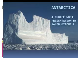
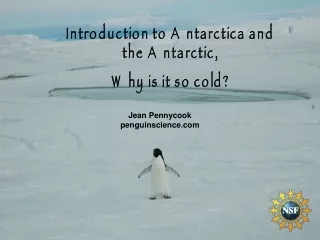
Introduction to Antarctica and the Antarctic, Why is it so cold? Jean Pennycook penguinscience.com
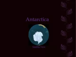
Antarctica or Antarctic? Antarctica is the 5th largest continent on earth and larger than the US and Mexico combined. The word, “Antarctica”, refers to the continent itself. “Antarctic” refers to the entire southern polar region, including the ocean that surrounds this continent.
Most of Antarctica is covered with over 2 km of snow and ice. These large glaciers move toward the coast under their enormous weight and the force of gravity. When a portion floats out over the ocean these extensions are called ice shelves. The Ross Ice Shelf is as large as Texas. Source of diagram unknown.but thank you!
Ross Ice Shelf This is the edge of a glacier that is floating on the water, but is connected to the remainder that is on the land. Picture courtesy of: usap.gov
The ice shelf from the ocean. What you see is only 10% of the height of this mass of ice. 90% is under the water. This is fresh water and was made from snow fall.
The amount of ice in Antarctica plays a very influential role in the Earth’s temperature. Ice reflects most of the sunlight back into the atmosphere without absorbing it. This helps keep the Earth cool.
This map shows the continent of Antarctica. The glaciers are white and the ice shelves are in gray. Red dots indicate a science research station. Map courtesy of Australian Antarctic Data Centre
So much for Antarctica but what about the Antarctic? It is best defined by ocean boundaries, although politicians usually define it by latitude for convenience. Here is one definition: Any place whose latitude is greater than 66.5o S. In this case here is a map of the Antarctic, defined by what is called the Antarctic Circle. It would include most of the continent of Antarctica and be defined as all places that receive at least one 24 hours of daylight period and one 24 hours of darkness once a year. This boundary would never change as it is defined by latitude. http//:www.en.wikipedia.org
Another definition, and the one used by scientists, would be everything south of the Antarctic Polar Front. The polar front or, Antarctic Convergence, is where the cold Southern Ocean, which encircles Antarctica, meets the warmer northern water. This is what the Antarctic defined in that way would look like. This boundary changes slightly seasonally and over the years. http//:www. maps.grida.no
You have two definitions of what “Antarctic” means and what area of the Earth would be included. Are there any other ways to define this region? How would you draw the map?
Why are the Polar regions colder than the rest of the Earth?
Consider the black line the total amount of sunlight energy received by the Earth
Is the amount of sun energy hitting the Earth more or less? Would the Earth be colder, warmer or the same?
Is the amount of energy more or less? Would the Earth be colder, warmer or the same? Hint: Is the black line bigger or smaller?
Each of these sun’s rays are equal in size and therefore amount of energy, but notice at 45o angle the amount of land covered by the ray is larger than when the angle is at 90o.
Translate what you just learned to the energy coming from the sun to our Earth’s surface. Where is the angle of the sun 90o and where is the angle very low or no sun at all? Source of diagram unknown
In this diagram you see the angle of the sun is marked for the various places on the Earth. The Earth is in this position with respect to the sun on the equinoxes. Source of diagram unknown
The Earth is tilted with respect to the sun and this is how the angles of the sun translate as the Earth rotates around it. These angles change with the season. Notice that the sun is at a 90o angle at latitude 23.5oN. This is the Tropic of Cancer and no place north of this line will ever see the sun at 90o. Source of diagram unknown
Position of the Earth on the Equinoxes Position of the Earth on the Solstices The angles of the sun’s rays rotate from the extremes of these two diagrams. Notice at the North and South Poles the angle of the sun never gets greater that 23.5o above the horizon. The latitudes where the sun’s angle is 0 at mid-winter are called the Arctic and Antarctic Circle, respectively (66.5 N & S). The low angle of the sun in the polar regions is one reason why these places are so cold. Source of diagram unknown
As the angle of the sun gets smaller towards the poles the amount of energy received by the earth is not a linear relationship. It is a function of the angle as you see in the chart below SIN 80 = 0.98 or 98% SIN 70 = 0.94 or 94% SIN 60 = 0.87 or 87% SIN 50 = 0.77 or 77% SIN 40 = 0.64 or 64% SIN 30 = 0.50 or 50% SIN 20 = 0.34 or 34% SIN 10 = 0.17 or 17% SIN 0 = 0.00 or 0% Translate: If the angle of the sun is 80o then that region receives 98% of the energy it would if the sun were 90o. Or places on the Earth where the sun is 60o above the horizon receive 87% of the energy that a place where the sun is straight up or 90o receives.
Insolation is the amount of sun energy hitting the earth at a given place. The total amount of energy hitting each of these latitudes in a year is represented by the number of boxes under the curve. Notice the amount hitting the poles is much smaller than the rest of the earth. This is another reason why the poles are so cold. Source of diagram unknown
Day / Night Cycle Graph noon midnight noon Before you go the next slide predict how this graph will change if you go north, say to Iceland where the latitude is 64.1o N, very near the Arctic Circle.
Did you guess right? Because Reykjavik is near the Arctic Circle there are periods of almost 24 hours sunlight and periods of almost darkness all night. Now let’s go to a place above the Circle say Thule, Greenland. Before you go to the next slide predict what the graph will look like.
Did you predict correctly? Since Thule is above the Arctic Circle there are days of 24 hours sunlight and nights of 24 hours of dark. How would this graph change if we went to a similar latitude in the South? Predict first then go the next slide.
How did you do? Believe it or not this is almost the exact same graph as the one for Thule only the seasons are reversed because McMurdo is in the Southern Hemisphere. Two more: Predict what this graph looks like at the Equator and at the South Pole.
At the South Pole the sun goes below the horizon on the spring solstice (March 21/22) and does not reappear until the fall solstice (Sept 21/22) The same happens at the North Pole only reversed. Six months of darkness is another reason the Polar regions are so cold.
You have seen how the orientation of the earth has made for unequal heating of the Earth’s surface. Because of the angle of the sunlight at the Poles they receive less energy and are therefore much colder than the rest of the Earth. You have also seen that the daytime-nighttime cycle provides long periods of darkness for the polar regions which also promote a colder climate Are the poles equally cold?
Compare the average T at the North and South Poles Notice that the South Pole average summer temperature is colder than the average winter temperature at the North Pole Come up with some ideas why this is so.
The Arctic is a large body of water surrounded by land, but the Antarctic is a large land mass surrounded by water. This is one reason the Antarctic is colder than the Artic.
http://www.whoi.edu/ http://www.aad.gov.au These maps show the ocean currents for both polar regions. Compare the patterns of the currents. The cold Antarctic water moves in a circular path around the continent and since there are no land masses to deflect it north there is little mixing with those warmer waters. This is quite different from the Arctic and is another reason the Antarctic is colder than the Arctic
Remember this slide? Another reason that the Antarctic is colder than the Arctic, is that the average altitude of Antarctica is almost 2 kilometers. All other things being equal, the Earth’s atmosphere decreases by 6.5oC for every 1000 m of altitude that you ascend ( or about 3.5oF per 1000 ft). Source of diagram unknown.but thank you!
The cold air descends and spreads across the surrounding sea… Cold air descending from the higher altitudes and blowing over the continent towards the coast is another reason why Antarctica is colder than the Arctic. From Parrish & Cassano 2001, J Climatology
In winter, the outward spreading cold winds help to freeze the ocean surface, and the “ice area” of Antarctica (land plus sea ice) doubles. In spring all this ice reflects sunlight, keeping the ocean colder for longer. Sea ice in August www.noaa.gov
During the summer, without the coldest winds and the Incessant sun, the sea ice melts around most of the continent, but only for a month before the ocean starts to freeze again as the sun dips lower and lower. Sea ice in February www.noaa.gov
To sum things up: • Antarctica is a continent almost completely covered with ice and snow and is influential in keeping our planet cool by reflecting the sun’s energy back into space. • The Antarctic is a region and has more than one definition. • Both Polar regions are colder than the rest of the Earth due to the reduced angle of the sun providing less energy, and long periods of darkness when no sun energy arrives. • Antarctica is a colder place than the Arctic because it is a land mass and surrounded by a very cold ocean that does not mix with warmer waters in the north. • Antarctica is also colder because it is so high in altitude.
Other Powerpoint presentations for you classroom: Introduction to the Polar regions, Why is Antarctica so cold? Introduction to Adelie Penguins, Adelie Penguins march into the classroom. Penguin Adaptations, This is a harsh continent Adelie Penguin Behavior, Good manners are always in style Penguin Predation and Competition, Life is tough for an Adelie Penguin Adelie Penguins Cope with Global Climate Change Did You Know, How researchers know what they know Penguin Quandaries, Can you answer these mysteries Fun pictures about Adelie Penguin Go to www.penguinscience.com The education page.