Download
1 / 18
180 likes | 317 Views
This presentation focuses on the operational status of the Tropical Cyclone Impact Graphics (TCIG) project, currently in an experimental phase, and explores the potential for continued development. It highlights the lessons learned from past hurricanes, including Hurricane Irene and Hurricane Floyd, and considers specific actions for improvement based on more than a decade of experiences. Emphasizing situational awareness and decision support services, the presentation aims to facilitate better preparation for tropical cyclone events through enhanced graphic tools.

E N D
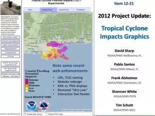
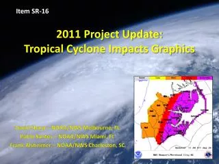
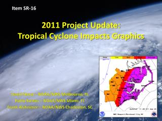
Item SR-16 2011 Project Update:Tropical Cyclone Impacts Graphics David Sharp – NOAA/NWS Melbourne, FL Pablo Santos – NOAA/NWS Miami, FL Frank Alsheimer – NOAA/NWS Charleston, SC
Presentation Goals Tropical Cyclone Impact Graphics • This presentation intends to do two things: • First, remind us that there remains an open action regarding the operable status of the Tropical Cyclone Impacts Graphics (TCIG). • The TCIG project is currently experimental • The Pending Decision: Continue? / Discontinue? • Cannot go official until the AWIPS II era. • All aspects base-lined, operations back-up functionality acquired, etc. • Second, set the stage for discussing specific action items as submitted for this year. • Consider: • Experiences of over a decade’s worth of events (2000-2010) • Experiences from Hurricane Irene (2011) http://www.weather.gov/ghls
Innovation ??? Tropical Cyclone Impact Graphics • Pre-dates AWIPS • Pre-dates GFE • Pre-dates Segmented HLS • Pre-dates Graphicasts • Pre-dates Private Sector Emulations • Pre-dates Weather Ready Nation (WRN) Buzz • “situational awareness” • “decision support services” Catalyst: Hurricane Floyd (1999) http://www.weather.gov/ghls
Innovation ??? Tropical Cyclone Impact Graphics • Pre-dates AWIPS • Pre-dates GFE • Pre-dates Segmented HLS • Pre-dates Graphicasts • Pre-dates Private Sector Emulations • Pre-dates Weather Ready Nation (WRN) Buzz • “situational awareness” • “decision support services” A New Era: Build a little… Test a little… Field a little. Catalyst: Hurricane Floyd (1999) http://www.weather.gov/ghls
Risk Management Tropical Cyclone Impact Graphics • Room Survey: • “During tropical cyclone events, what important question do the Tropical Cyclone Impact Graphics answer for the anxious user?” A.) What conditions should I expect? B.) What impacts should I prepare for? http://www.weather.gov/ghls
Risk Management Tropical Cyclone Impact Graphics • Room Survey: • “During tropical cyclone events, what important question do the Tropical Cyclone Impact Graphics answer for the anxious user?” A.) What conditions should I expect? NO B.) What impacts should I prepare for? CORRECT Note: Each graphic (by hazard) answers this singular question as to facilitate users in their preparations (e.g., not to under-prepare or over-prepare). http://www.weather.gov/ghls
Enhanced Web Pages Tropical Cyclone Impact Graphics • Some improvements were made for 2011. • General housekeeping • Disposition • Code Clean-up • Impacts Descriptions Audit • Pre-season Work Templates • Availability of KML files • In addition to netcdf files Intuitiveness (?) True DSS (?) http://www.weather.gov/ghls
Push Button Meteorology ??? Tropical Cyclone Impact Graphics • Room Survey: • “For WFO forecasters, what are the anticipated results when running the associated SmartTools?” A.) A finished depiction requiring no refinements. B.) A draft depiction awaiting approval and/or refinements through the application of forecaster expertise. http://www.weather.gov/ghls
Push Button Meteorology ??? Tropical Cyclone Impact Graphics • Room Survey: • “For WFO forecasters, what are the anticipated results when running the associated SmartTools?” A.) A finished depiction requiring no refinements. NO B.) A draft depiction awaiting approval and/or refinements through the application of forecaster expertise. CORRECT http://www.weather.gov/ghls
Improved Tools Tropical Cyclone Impact Graphics • High Wind Tool • WIKI Pages (all tools) • Developer’s Version • Final Version • Prepare for official • “Forecaster’s Dashboard” • Tool of tools ??? Not a deterministic wind swath !!! http://www.weather.gov/ghls
Maps & Keys Potential Wind Impacts for Coastal North Carolina
Improved Tools Tropical Cyclone Impact Graphics • Coastal Flood Tool • Developer’s Version • National Elevation Database • Land/sea mask; negative elevations • Final Version Note: Proper tide adjustments (datum); thoughtful edit areas with masks; future input of probabilistic inundation with tide. Not an inundation map !!! http://www.weather.gov/ghls
Maps & Keys Potential Surge Impacts for Coastal North Carolina
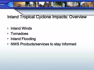
Improved Tools Tropical Cyclone Impact Graphics • Inland Flood & Tornado Tools • No Changes for 2011 • Planned changes for Inland Flood Tool • Take advantage of HPC’s PQPF • Draft logic already in works • Input Data Sets • Need to be base-lined • Logic Thresholds for Low vs. Very Low Levels • Ensure that ranges are extended downward • SPC Probabilities http://www.weather.gov/ghls
Usefulness of Gridded Data Tropical Cyclone Impact Graphics • Potential Impact Grids • Computed grid sets used by HLS Formatter • Availability to NDFD ??? • IMPACT vs. THREAT • Timing question ??? • Ensure to answer timing question with correct data • GIS Interfaces • Bulleted / Tabular Information • Other formatters • Complete the Picture http://www.weather.gov/ghls
Decision Support Tropical Cyclone Impact Graphics • Identity • TCIG or gHLS (it makes a difference) • More Comprehensive • Marine • Wind & Seas • Marine-only events http://www.weather.gov/ghls
Decision Support Tropical Cyclone Impact Graphics • Compare/Contrast Graphicasts and TCIGs • Local Information ??? • Objective Information ??? • GIS Intelligent Information ??? • Decision-making Information ??? • Are you answering important questions ??? • The Public Deserves Briefings Too • EM Briefings • Recorded Briefings • Point-n-Click Briefings (future; web interface) *** http://www.weather.gov/ghls
Recommendation • If continued, reconvene TCIG Team (in early 2012) to identify the list of required steps to move closer to official. • Prioritize tasking items and ascribe deadlines. • Additional technical assistance will likely be required from outside the team. • Web work (e.g., more comprehensive DSS Page) • Tool work (e.g., timing component)