Download
1 / 13
130 likes | 299 Views
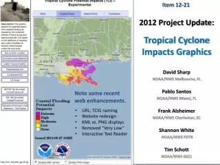
Item 12-21. 2012 Project Update: Tropical Cyclone Impacts Graphics. Note some recent web enhancements. David Sharp NOAA/NWS Melbourne, FL Pablo Santos NOAA/NWS Miami, FL Frank Alsheimer NOAA/NWS Charleston, SC Shannon White NOAA/NWS FDTB Tim Schott NOAA/NWS 0S21. URL; TCIG naming

E N D
Item 12-21 2012 Project Update:Tropical Cyclone Impacts Graphics Note some recent web enhancements. David Sharp NOAA/NWS Melbourne, FL Pablo Santos NOAA/NWS Miami, FL Frank Alsheimer NOAA/NWS Charleston, SC Shannon White NOAA/NWS FDTB Tim Schott NOAA/NWS 0S21 • URL; TCIG naming • Website redesign • KML vs. PNG displays • Removed “Very Low” • Interactive Text Reader http://w1.weather.gov/tcig/
Presentation Goal Tropical Cyclone Impact Graphics (TCIG) • This presentation intends to do one thing: • To support the recommendation for initiating and executing the necessary steps to transition the TCIG from experimental status to operational status for the 2014 season; • With an acceptable alternative being the 2015 season. • The associated Action Item is notably a “linchpin” for several other items and proposals as submitted to this year’s agenda; • A testament of realized value. • After 10+ years of development, and 6+ years of multi-regional/multi-WFO experimental provision, many feel that it is time to make an “across the board” commitment to take deliberate action. http://w1.weather.gov/tcig/
What Does This All Mean? Tropical Cyclone Impact Graphics (TCIG) • A decision to transition the TCIG to operational status will: • Green light the technical and developmental resources that have been waiting for the definitive “GO” signal. • A decision to transition the TCIG to operational status must: • Be accompanied by a comprehensive commitment by the agency, by the respective regions, and by each coastal WFO. So far, we have been voting on a year to year basis whether to remain experimental; that is, whether to continue or discontinue. http://w1.weather.gov/tcig/
Coming Off The Back Burner Tropical Cyclone Impact Graphics (TCIG) • We have been waiting for the AWIPS II era. • Current testing at WFO Houston • We have been acquiring WFO feedback. • A diversity of WFO locations and situations; NOAA Hurricane Conferences; ERMETs (Pilot Project sites) • We have been listening to our customers. • Through direct feedback, Social Scientists, and Service Assessments • We are consistent in direction with proposed decision support services and Weather-Ready Nation concepts. • Local; Regional; National WFO Key West, FL http://w1.weather.gov/tcig/
Moving To The Front Burner Tropical Cyclone Impact Graphics (TCIG) • Finalize baseline version 1.0 for release • Fully supported by agency • Program support, policy and directive, technical support, training support, etc. • Generally “freeze” experimental version • Implement minor enhancements as we go along, but major enhancements reserved for time of official release date. http://w1.weather.gov/tcig/
A “Linchpin” Item Tropical Cyclone Impact Graphics (TCIG) From the Hurricane Irene Service Assessment Isaac Irene Sandy http://w1.weather.gov/tcig/
Action Item (12-21) Tropical Cyclone Impact Graphics (TCIG) • List of Action Items which have contingencies upon: • Item 10-39 … explore elimination of text HLS in lieu of TCIG • Item 12-22 … standardize availability of TCIG on WFO homepages • Item 12-23 … reconsider use of “low” as an impact descriptor • Item 12-24 … ensure timely auto-refresh of TCIG web pages • Item 12-25 … mature logic for inland flooding; include river flooding • Item 12-26 … mosaic capability; inter-site coordination; inland WFOs • Item 11-34 … baseline inputs; ensure harmony with NHC, HPC, & SPC • Item 11-35 … provide TCIG service backup capability http://w1.weather.gov/tcig/
For Example: Decision Support Services(for local, regional, and national depictions) improve inter-site coordination TC Warnings dropped; TCIG impact info lost
Decision Support Tropical Cyclone Impact Graphics (TCIG) • Graphicasts or Impact Graphics ??? • Local Impact Information ??? • Objective Information ??? • GIS Intelligent Information ??? • Decision-making Information ??? • Not just “Awareness” information ??? • The Public Deserves Briefings Too • WFO Home Page Link • Recorded Briefings • Point-n-Click Briefings (web interface) • EM Briefings • Multi-level TCIG !!! http://w1.weather.gov/tcig/
Usefulness of Gridded Data Tropical Cyclone Impact Graphics (TCIG) • Value of Potential Impact Grids • Computed GFE grid sets can be used by the HLS Formatter and other DSS formatters. • For example, see Item 12-17. • Availability to NDFD • Customer-derived applications • Time Component (THREAT vs. IMPACT) • Onset of impact (Ok) • Duration of impact (No) • Threat - based on “conditions” • Bulleted / Tabular impact information • For example, see Item 11-23. • GIS Interfaces http://w1.weather.gov/tcig/
What Do We Need To Do? Tropical Cyclone Impact Graphics (TCIG) • Finalize the layout and design of the operating versions of hazard tools. • Perhaps a “Tool of Tools - Dashboard” (???) • Mature the inland flood tool to use probabilistic QPF from HPC, and to better account for longer duration flood events (e.g., RFC/river flooding). • Finalize web page functionality and address the timeliness of updates. • Harmonize all threat definitions and impact descriptions; establish consistency thresholds among WFOs and Regions. • This is paramount for regional and national partners and customers such as FEMA to mosaic depictions (as accomplished via the NDFD and/or the GIS mosaicking of available KMLs). High Wind Tool (GFE) http://w1.weather.gov/tcig/
What Do We Need To Do? Tropical Cyclone Impact Graphics (TCIG) • Establish WFO home page policy for TCIG. • Integrate TCIG with other hurricane decision support products/ services. Consider a TC DSS site that integrates TCIG and the Interactive Text Reader with other DSS information. • Enable service back-up capability with secondary and tertiary WFOs. • Develop and provide training updates. • Establish supporting policies/directives. • Open a pathway for adding a temporal component for impact arrival. User feedback indicates a strong desire. • Coordinate closely with other project teams for consistency, and to prevent message confusion. • Storm Surge WWA; Hi-Res Inundation Map Coastal Flood Tool (GFE) http://w1.weather.gov/tcig/
Recommendation Tropical Cyclone Impact Graphics (TCIG) • Agree to initiate and execute the necessary steps to make the TCIG operational for the 2014 season (or 2015 season). In January 2013, convene a meeting of the TCIG Team to outline a comprehensive transition strategy. Comments ??? http://w1.weather.gov/tcig/