Tropical Cyclone Prediction
270 likes | 564 Views
Tropical Cyclone Prediction. Track. Tropical cyclone motion dependent upon -Deep layer mean steering flow over much of troposphere (roughly 850 to 200 hPa) -Beta gyres.

Tropical Cyclone Prediction
E N D
Presentation Transcript
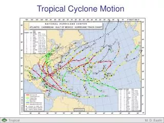
Track • Tropical cyclone motion dependent upon -Deep layer mean steering flow over much of troposphere (roughly 850 to 200 hPa) -Beta gyres. • The Beta Effect tends to induce a poleward and westward component to tropical cyclone motion, generally to the right of the mean flow in the tropics, roughly a 20 degree deflection on average. Typically adds about 2-5 ms-1 poleward and westward motion to TCs.
Beta Gyres Fradius = Force acting on a circular ring at distance r β = (f-fo)/y; units are in m-1s-1 ω = relative angular velocity (rad s-1) at distance r from the center R = outer vortex boundary Fradius = (mass)βω(R2/4) This will tend to pull the vortex northwards and westwards. Plus, if f + ζ = constant, ζ will decrease and ω will decrease, which will cause a reduction in tangential wind speeds as the storm moves poleward with time.
Track • Model output typically twice or four times per day • Overall, output from standard NWS models handle synoptic setup and beta gyres well enough to predict track quite accurately. NHC errors in track usually less than 300 mi out to 120 h. Considerable improvement over past few decades. • Use of ensemble forecasting improving track and other forecasts, such as predicted TC wind, rainfall, and/or tornadic threats.
Intensity • Dynamical models: use physical understanding and equations of atmosphere to make prediction • Statistical models: use past observations in order to predict future; typically use a long period of record in order to capture an adequate amount of scenarios; also need forecast products to be based on relevant predictors, ideally
Intensity • Intensification and weakening in a hurricane is a highly complex process, with several subtle factors involved (mentioned a few powerpoint presentations ago). • Our understanding is limited, which limits the accuracy of dynamical models. Less skill and slower improvement than track forecasting. • Statistical Hurricane Intensity Prediction Scheme (SHIPS): uses climatology and persistence (statistical) and GFS numerical simulation (dynamical) predictors. Choice and use of predictors is a characteristic of statistical forecasting.
Intensity Important SHIPS predictors include: • Difference between current intensity and potential intensity • VWS • Persistence • Upper tropospheric temperature Excluding persistence, values of predictors mentioned above are taken from GFS output.
Intensity • High resolution models, such as GFDL and HWRF, can resolve inner core processes of hurricanes and simulate intensity and processes involved with intensity changes in a realistic manner. • However, their accuracy is currently poorer than the SHIPS model, which combines both dynamical and statistical properties. Much to learn we still have regarding dynamical understanding of TC inner core processes.
Long Term Hurricane Forecasting Forecast seasonal North Atlantic activity using various predictors. Slowly varying components of Earth system can be fairly predictable for months in advance- examples: • ENSO phase • African West Sahel monsoon/rainfall • QBO used in past- not now • Caribbean SLP anomalies
Historical Perspective Over past 100+ years, considerable changes in observation systems and number of observations (general increase), largely due to advances in technology: • Ships • Surface weather stations, many now automated (ASOS) • 1944: aircraft reconnaissance • Rawinsondes • 1966: improved satellite observations • Buoys • Doppler radar • Microwave radiometer estimation of 10 m wind: QUIKSCAT and ASCAT • Microwave sounders
Historical Perspective Ships and surface weather stations were frequent ways to detect and observe TCs prior to aircraft reconnaissance era starting in the 1940’s. We can use the surface weather station record to gauge TC numbers in the past and try to estimate past activity. Some others use SST constructs to try to determine past activity. We’ll examine surface station records.
Historical Perspective • Density of shipping tracks and amount of populated coastline generally accounted for detection by Landsea • Landsea (2007): from 1966-2006, 59% of TCs strike land in entire Atlantic basin; apply ratio to storms beforehand: result in increase of 2.2 storms/year 1900-1965 • Landsea et al. (2004): 1851-1885: 0-6 TCs per year missed; 1886-1910: 0-4 per year in North Atlantic • Microwave satellite technology generally increases TC detection by 1 storm per year in past 10-15 yr
Historical Perspective • On average, about 1.7 hurricanes hit the U.S. per year Focus on hurricane hits to named storm and hurricane ratios during the satellite era (1966 onwards)
From work I have done, I wouldn’t be surprised if there has generally been a slight decrease in TCs over the 20th century. The inactive period from 1970-1994 is important. Too short a time series to tell how much about cycles and overall trends.
Historical Perspective Damages from hurricanes should be normalized to best compare damage between various eras. Account for changes in: population, inflation, wealth Normalization shows damage from major hurricanes throughout the 20th century, especially prior to 1970. The most costly hurricane occurred in 1926.
The Future? • Latest climate model consensus suggests that global warming will result in a general: -decrease in number of TCs -possible increase in maximum intensity of strongest storms by 5% or so Don’t put too much faith in these results just yet, I would suggest waiting for continued experimentation and a longer period of model consistency.
