Download
1 / 13
130 likes | 324 Views
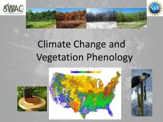
Phenology Walks and Trails as a Community and Scientific Resource. Multi-taxa, National-scale Plant and animal phenology observation program Citizen science Core protocols for research. Nature’s Notebook for scientists, naturalists, volunteers, land managers, park rangers, and YOU!.

E N D
Phenology Walks and Trails as a Community and Scientific Resource
Multi-taxa, National-scale Plant and animal phenology observation program Citizen science Core protocols for research Nature’s Notebook for scientists, naturalists, volunteers, land managers, park rangers, and YOU!
Phenology Trails What is a Phenology Walk? A phenology walk is an observation site, created online in Nature’s Notebook and on the ground, that includes a series of tagged plants and a list of animals to observe. Often phenology walks are created along an existing trail at a park, refuge, school, or other open space. Combine walks to create a virtual trail… Nature’s Notebook Plant Tag Example Photo credit: L. Romano
Phenology Trails What is a Phenology Trail? A phenology trail is a linked network of Nature’s Notebook phenology walks. Each walk has at least two plant and/or animal individuals tagged for data collection. Linked together, these sites provide participants with places to visit, enjoy nature, collect data, and learn about supporting organizations.
Phenology Trails • Why a trail? • Interesting way to link phenology monitoring activities in a region • Easy to model • Develops science and outreach connections between organizations with similar mission • Science, Phenology, and Climate Change Education opportunity at the local, regional, national, and global scale Facilitate, Network, Educate – Create Connections
Phenology Trails Develop a regional science/research/management question • Data collected is useful to answer the question • Trained participants collect observations at multiple sites • Organizations collaborate/share resources to collect observations • Participants help assess the data and answer the question Data is valuable to the broader USA National Phenology Network
Phenology Trails • Example questions: • How is the phenology of selected species responding to elevational gradients and the urban environment across the study sites? • When is the best time to harvest mesquite beans for dehydrating, (knowing that those remaining on the ground too long may become toxic)? • Which bird species are visiting the wildlife refuge prior to wetland restoration, during restoration, and after restoration? How do those species numbers compare to other regional sites? • What plants receive the most visits from pollinators in demonstration gardens across the sites? • How many host milkweed plants, across sites, are used by migrating monarch butterflies? And when do the monarchs arrive?
Phenology Trails Phenology English Habitats Plant & People Connections Local Ecology & Biodiversity
Phenology Trails • Tucson Phenology Trail • Biosphere 2 • Tucson Audubon Mason Center • UA Campus Arboretum • Sam Hughes Neighborhood • Pima Extension Offices (2) • Rincon Heights Neighborhood • SRER • Borton Elementary School • Tumamoc Hill • Arizona Sonora Desert Museum* • Tucson Botanical Garden* • Total of 75 Miles, start to finish • 3-10 species tagged at each *Coming online soon
Phenology Trails • Tucson Phenology Trail • species being monitored • Jojoba • Velvet mesquite • Yellow paloverde • Blue paloverde • Ocotillo • Creosote • Florida hopbush • Saguaro • Penstemon (parryi) • Texas Ranger • Desert Ironwood • Tagged at each site on the trail.
Phenology Trails NASA Satellite Aerial & On-the-ground Photography When do white oak trees leaf out in the spring and, subsequently, lose their leaves in the fall? Refuge Biologists Schoolyard habitats Nature Centers Volunteer Groups
Phenology Trails can: • Link community groups • Help with research and management questions • Engage volunteer groups Existing Phenology Walks & Trails: Tucson ✪ Phoenix ✪Denver ✪ Albuquerque Portland ✪ New York Photo credit: L. Barnett
You’re invited to connect with USA-NPN… Sign up for a phenology e-newsletter (quarterly) Join the Nature’s Notebook community and become an observer: Contribute to science while having fun! Discover new tools and resources for work or play LoriAnne Barnett lorianne@usanpn.org @loriannebarnett Thank you! LoriAnne Barnett lorianne@usanpn.org