Modelling of flow
290 likes | 545 Views
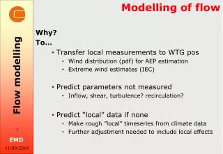
Modelling of flow. Why? To… Transfer local measurements to WTG pos Wind distribution ( pdf ) for AEP estimation Extreme wind estimates (IEC) Predict parameters not measured Inflow, shear, turbulence? recirculation? Predict “local” data if none

Modelling of flow
E N D
Presentation Transcript
Modelling of flow Why? To… Transfer local measurements to WTG pos Wind distribution (pdf) for AEP estimation Extremewindestimates (IEC) Predict parameters not measured Inflow, shear, turbulence? recirculation? Predict “local” data if none Make rough ”local” timeseries from climate data Furtheradjustmentneeded to includelocaleffects Flow modelling
Modelling of flow To understand the site! And find new sites! Why? Flow modelling
Flow occurs at many scales! Micro scale Meso scale Synoptic scale (Global scale) Flow modelling
Flow occurs at many scales! Flow modelling
Flow occurs at many scales! Example: Global and Synopticscales Flow modelling
Flow occurs at many scales! Föhn Example: some European ”Meso scale winds”: Flow modelling
Flow occurs at many scales! Example: ”Micro scale wind effects” Flow modelling
Different models for each scale Micro scale models: Typicalgridcell: 10s of m Typicaluse in siting/micro-siting Models like: WAsP, WEng, ”CFD” (LES, DES, DNS….) Mesoscale models: Typicalgridcell: several km Increaseduse in windenergy (hindcast & forecast) Needs input from global models! Possible input to microscale models Global/Synopticscale models (NWP) Typicalgridcell: 100-1000 km Research and metoffices, e.g. NCEP, DMI,…. Flow modelling
Micro scale models Two groups of micro scale models: Linearized models WAsP WEng MS Micro …. Non-linear models (referred to as “CFD”) WAsP-CFD Windsim Meteodyn … Flow modelling
Micro scale models Linearized versus “CFD” models Flow separation is the challenge! Only CFD can handle it (to some degree…) Flow modelling WAsP-CFD: Linear CFD
Micro scale models (WAsP) The WAsP model - General description Separated handling (superposition) of: Terrain speed up/down Roughness Atmospheric stability WAsP flow = Simple log-profile (flat, uniform roughness) +Terrain corr. (neutral) +Roughness corr. (neutral) +Stability corr. (neutral/unstable/stable) Flow modelling
Micro scale models (WAsP) The WAsP model - General description (Wind Atlas Analysis and Application Program = WAsP) A two step model: Step 1: remove local flow effects from measurements Produces a “regional” Wind Atlas Step 2: reapply local flow effects at WTG positions Flow modelling
Micro scale models (WAsP) The WAsP model - Terrain Grid: Mast/WTG centered cylindrical zooming grid Solves terrain as perturbation to a flat reference state Terrain corrections valid for neutral stability Flow modelling
Micro scale models (WAsP) ~1:10 only z01 The WAsP model - Roughness Flow modelling Transition z01/z02 ~1:100 only z02
Micro scale models (WAsP) The WAsP model - Stability A simple correction of the neutral profile (limitations!!) Setup via WAsP parameters Based on surface heat flux: For land (z0>0) and sea (z0=0) “Offset” = mean “RMS” = variation around mean Heat flux > 0: Unstable Heat flux < 0: Stable Heat flux = 0: Neutral Flow modelling
Micro scale models (WAsP) The WAsP model - A fix for flow separation? RIX = Ruggedness IndeX: Terrain fraction with expected flow separation (FS)? RIX = [area with FS] / [full area] Typically r=3-5km and >30-45% steepness used Suggested relationship btw. RIXWTG-RIXmast and UWAsP/Ucorr: Flow modelling Log(UWAsP/Ucorr) RIXWTG-RIXmast
Micro scale models (WAsP) RIX estimation in PARK & RIX correction in Loss&Uncertainty The WAsP model - A fix for flow separation? RIX = Ruggedness IndeX: ~ Percentage of terrain with expected flow separation (FS)? RIX = [area with FS] / [full area] Typically terrain within r=3-5km and >30-45% steepness used Simple relationship btw. RIXmast-RIXwtg and UWAsP/Ucorr Flow modelling
Micro scale models (CFD) Non-linear models (CFD) Solves the non-linear Navier-Stokes equations On a detailed grid covering the site area Iterative solution of the differential equations Very time consuming Often the result is grid-dependent () But this is not easily checked in current CFD softwares Indicated by the huge spread in DEWI’s CFD round robin test* Simplified handling of sub-grid scales (Turbulence) Parameterization needed to “close” the set of equations Hence referred to as “turbulence closure” Common model employed is: K-epsilon with various variations * F. Durante, V. Riedel, 2008, Round Robin Numerical simulation in Wind energy – Final Report, DEWI GmbH. Flow modelling
Meso scale models Meso scale models - not just flow models… • Numerical Weather Prediction (NWP) – hindcast/ forecast • Based on a physical atmosphere model w/ transport equations e.g.: • Momentum • Moisture • Heat • Forcings are imposed as input from synoptic models • Often several representative runs must be made • (not just an average run like for WAsP) • Out-put samples may be hourly (like Merra), but.. • A coarse grid (~ 50km) equivalates 4-5h temporal averaging • No “micro scale” effects are properly modelled! Flow modelling
Meso scale models Some well known Meso scale models: KAMM (Karlsruhe) MM5/WRF (mainly NCAR) … Flow modelling
Use of Meso scale models? Meso scale input to Micro scale models Meso input to WAsP: To generate a wind atlas (statistics) per grid cell in Meso model Two approaches: Make atlas directly from Meso scale model (Risø approach) a) Make Meso scale time series (virtual mast at site) b) Make wind atlas with WAsP using no terrain crude roughness (~meso) c) Use wind atlas in WAsP using detailed terrain/roughness mpdel Meso input to CFD: As boundary conditions for CFD model (“nesting”) Flow modelling
Atmospheric stability? Stability depends on dT/dZ: dT/dZ > adiabatic: Unstable ~ Heating from the ground Typical: day, summer, cumulus dT/dZ < adiabatic: Stable ~ Cooling from the ground Typical: night, winter, low wind dT/dZ = adiabatic: Neutral Adiabatic lapse rate ≈ 1°C/100m Typical: overcast, high wind Flow modelling
Atmospheric stability? Stability depends on dT/dZ: dT/dZ > adiabatic: Unstable ~ Heating from the ground Typical: day, summer, cumulus dT/dZ < adiabatic: Stable ~ Cooling from the ground Typical: night, winter, low wind dT/dZ = adiabatic: Neutral Adiabatic lapse rate ≈ 1°C/100m Typical: overcast, high wind Flow modelling
WindPRO and Flow models? Now (2.9): Direct link to WAsP (PARK/STATGEN/RESOURCE) Direct link to WEng (SITE COMPLIANCE) Direct link to WAsP-CFD (via EMD’s cluster) Mesoscale dataset (3 km) for Europe (subscription) Future: Siting parameters in WAsP-CFD Advanced forest model in WAsP-CFD Mesoscale dataset, the rest of the world? Flow modelling
WindPRO and Flow models WindPRO 2.9: High spatial resolution (0.03°x0.03°, ~3x3 km) 1-h temporal resolution Global boundary from ERA Interim (ECMWF) Flow modelling