Download
1 / 20
200 likes | 305 Views
Explore how Landsat data is used to map changes in ecosystem services in coastal Belize, focusing on fisheries and habitat links, habitat value changes, and policy suggestions. This study highlights the underestimation of seagrass and mangrove contributions to Belize's capture fisheries and suggests reducing terrestrial impact and increasing marine protection zones.

E N D
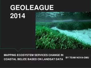
GEOLEAGUE 2014 MAPPING ECOSYSTEM SERVICES CHANGE IN COASTAL BELIZE BASED ON LANDSAT DATA BY TEAM NOVA-GMU
Meet the Team Semesters of experience
Overview Background Methods Results Discussion Summary --Ecosystem service --Belize fisheries and habitat links --Landsat collection and classification --Benefit transfer --Classified habitats --Habitat value changes --Habitat losses --Policy suggestions --Data limitations
Ecosystem Valuation • Ecosystem services support human populations • Value of services often not considered in economies
Belize Fisheries • Coastal zone revenue ~$1400 mil (US$) • Capture fisheries are ~3% of GDP; • Dominated by export of Spiny Lobster (Panulirusargus), Queen Conch (Strombusgigas) and pink shrimp (Penaeussp.) • Export revenue: $48.7 mil (2013 US$)
Belize Habitats • Seagrass and mangroves provide habitat for breeding, nursery, and feeding areas • Threats to mangroves • development • sedimentation changes • Threats to seagrass • salinity and pH changes • sedimentation • eutrophication
Methods: Imagery Level 1T images downloaded from USGS Earth Explorer Study area: ~90% of coastal population ~80% of seagrass ~45% of mangrove
Methods: Classification Coral Open Sea Sea Grass Urban Area Belize City Forest Agricultural • Training areas were created over each land cover type and grown to 30 pixel area regions using ERDAS Imagine Region Grow Tool • Minimum Distance Supervised Classification-64% accuracy • Accuracy Assessment Using Google Earth comparison • Raster to Polygon with Majority Filter and Boundary Clean
Results 1980 2013
Methods: Benefit transfer • Apply habitat specific per-area values from similar study sites • Transfer function relating value to habitat parameters preferable; lack of enough comparable sources • 9 mangrove, 3 seagrass transfer value studies • literature and database • applied median values to Belize habitat areas
Discussion: Habitat valuation • Underestimation of seagrass and mangrove contribution to Belize capture fisheries • 2006 fishery export income total: $48.7 mil (2013 US$) • 2013 benefit transfer estimation: $28.5 mil (2013 US$) • Subsistence and recreational fishing support from seagrass mangroves not considered
Discussion: Policy Suggestions • Reduce terrestrial impact on coastal zone • sediment barriers • riparian restoration • waste treatment • Increase marine protection zone extent
Discussion: Data limitations • Landsat Data • Resolution and bands, 1980 to 2013 • Occlusions, artifacts, cloud cover • Data sources and accessibility • Need for ground truthing, different RS sources
Summary • Capture fisheries consisting of conch, finfish, and lobster are a vital part of Belize’s economy • The value of the coastal ecosystems can be calculated in correlation with its area and the quantity of marine life caught for food • Marine environments can be classified using Landsat imagery, but it is important to have ancillary data and a more thorough classification using hyperspectral reflectance signatures • The 12% decline of the seagrass yields $3.4 million loss of habitat value • The 50% increase in urban areas and dramatic increase in population contributes to the pollution of the marine environment through the flow of waste products from impervious surfaces • To slow the decline of the habitats, it is recommended to reduce terrestrial impact and increase marine protection zone extent
Acknowledgements • Dr. Michael Krimmer • Greg Bacon • Dr. Kenneth Rasmussen • Mauro Gongora, Fisheries Officer, Belize Fisheries Department