Download
1 / 12
120 likes | 271 Views
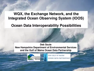
WQX, the Exchange Network, and the Integrated Ocean Observing System (IOOS) Ocean Data Interoperability Possibilities. Deb Soule New Hampshire Department of Environmental Services and the Gulf of Maine Ocean Data Partnership. Challenges of Sharing Ocean Data for the Gulf of Maine Region.

E N D
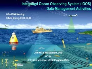
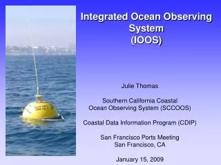
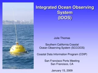
WQX, the Exchange Network, and the Integrated Ocean Observing System (IOOS) Ocean Data Interoperability Possibilities Deb Soule New Hampshire Department of Environmental Services and the Gulf of Maine Ocean Data Partnership
Challenges of Sharing Ocean Data for the Gulf of Maine Region • Bordered by 3 states and 2 countries • Covers 36,000 square miles and 7,500 miles of coastline • Researched, analyzed and managed by numerous non-profit, academic, state federal, and provincial entities • Data kept in many formats using many standards…or not • Data is not readily discoverable or available • Lots of jargon and acronyms - ocean vs. terrestrial data speak Base map courtesy of United States Geological Survey/Woods Hole Field Center
Thus the development of the Gulf of Maine Ocean Data Partnership • Purpose? To promote and coordinate the sharing, linking, electronic dissemination, and use of data on the Gulf of Maine region • Who is involved? Governmental agencies, intergovernmental organizations, and nongovernmental organizations, including academic, research, and other nonprofit entities – 20+ entities and growing • Goal is to implement an information system that is: • technically and institutionally capable of linking databases created and individually maintained by Partners and to archive data sets when appropriate; • region-wide in scale; • compatible with other regional, national, and international information systems; • accessible by individuals throughout the Gulf of Maine region and beyond; • develops the web-based, visualization, and other information technologies needed for the seamless exchange and facile use of distributed and aggregated data; and • acknowledges and maintains the integrity of all data sources.
Development of the Partnership (cont.) 4 Focus Areas: 1)Data Assurance and Authority - Data is of good quality and up to date - Partner has ownership or proper authority to serve data 2)Data Discoverability - Register data set with a data discovery portal GeoSpatial One-Stop (US) GeoConnections (Canada) NASA’s Global Change Master Directory (GCMD) (US) 3) Data Accessibility - Use a standard access method OpenDAP, DIGIR, OGC, Exchange Network, etc. 4) Data Interoperability - Sharing data seamlessly for integrated displays
Status of Partnership Progress • Data Authority and Discoverability well underway • - Provided metadata creation training to partners • - Partnership has portal on GCMD • - Ongoing review of metadata records • Short list of preferred Data Accessibility methods created • - To reduce crosswalk work • Now focusing on Data Interoperability • What will create biggest interoperability opportunity? • What data to use? For what purpose? • What standards to use? • Is there any money to help this effort? • What would be most compliant with the emerging IOOS?
What is the Integrated Ocean Observing System (IOOS)? • It “is a system of systems that routinely and continuously provides quality controlled data and information on current and future states of the oceans and Great Lakes from the global scale of ocean basins to local scales of coastal ecosystems. It is a multidisciplinary system designed to provide data in forms and at rates required by decision makers to address seven societal goals”. • Being driven by the National Oceanographic Partnership Program agencies: NOAA, NASA, Navy, Coast Guard, EPA etc. • Still in its infancy in terms of development • In the process of reviewing standards for use in the system • Similarities to Exchange Network goals and concepts? • “The Exchange Network is a secure Internet- and standards-based approach for exchanging environmental data and improving environmental decisions. The U.S. EPA, State environmental departments, and U.S. tribes and territories are partnering to build the Exchange Network to increase access to environmental data and make the exchange of data more efficient.”
In the absence of an operating IOOS… The Partnership wanted to develop a system with similar concepts in mind as IOOS Using a recommended access method in place by one of the partners Preferably which has funding opportunities Exchange Network
Exchange Network Grant • Received Exchange Network collaborative grant in October 2007 • Host of Partnership (the Gulf of Maine Ocean Observing System (GoMOOS)) to develop the host node • Four other partners to set up node clients – NHDES will use its node • Develop and implement a schema based on WQX • (We’ve already used parts of the draft WQX schema to develop a monitoring location pilot project.) • Develop web application with access to this data for all partners
Possible side effects of the project • Can the Exchange network interoperate/harmonize with systems that were designed to handle ocean data (biological, modeling, buoy measurements, physical/chemical, etc.) • - World in which Exchange Network operates typically is thought of ending at the beach • IOOS looking for recommendations for candidate standards – could the Exchange Network be a standard considered for use in IOOS? • Forms a bridge between the ocean and terrestrial folks • Get past the cultural impediments to data interoperability
Taking interoperability a step further • Partnership is designing an interoperability experiment between the Exchange Network, OGC, and OBIS • - Start developing a “system of systems” • OGC = Open Geospatial Consortium – “an international industry consortium of 344 companies, government agencies and universities participating in a consensus process to develop publicly available interface specifications.” - Doesn’t implement anything – umbrella of all things geospatial. • - Does Exchange Network follow OGC? • - EPA recently raised their level of membership in OGC - harmonize their geospatial approach with others • OBIS = Ocean Biogeographic Information System - Makes marine biogeographic data from all over the world freely available on the web • - Has a schema and uses DIGIR software to obtain data from data contributors
Interoperability Experiment (cont.) • Start answering broad questions about interoperability • – Where the rubber hits the road • – Actually try to fit the pieces together • – Get out of the data model stages • Work expected to being in 2008
Questions? Deb Soule New Hampshire Department of Environmental Services Email: Deb.Soule@des.nh.gov Gulf of Maine Ocean Data Partnership (GoMODP):http://www.gomodp.org/ GoMODP GCMD Portal: http://gcmd.gsfc.nasa.gov/KeywordSearch/Home.do?Portal=gomodp&MetadataType=0