Oceanography: Mapping the Ocean Floor
Oceanography: Mapping the Ocean Floor. Ocean Floor Topography. Why do you think there is less information about the sea floor than about landforms?. History of Ocean Exploration. In the early 1800’s, mariners recorded depths of shallow water features with a weighted line.

Oceanography: Mapping the Ocean Floor
E N D
Presentation Transcript
Oceanography: Mapping the Ocean Floor Ocean Floor Topography
Why do you think there is less information about the sea floor than about landforms?
History of Ocean Exploration • In the early 1800’s, mariners recorded depths of shallow water features with a weighted line. • In 1854, a depth-sounding device was attached to the line instead of the weight. This made determining when the line hit the bottom of the ocean floor easier. • During WWII, sonar (sound navigation ranging) was developed to measure distance by using a returning echo. • Today, advanced sonar is being established to make ocean floor mapping more accurate. GLORIA (Geologic Long-Range Inclined Asdic) is a side-scan sonar device that can be towed behind a vessel and can record the depth along the side of the vessel as well as below it.
New Technology • Ocean floor sensing technology has grown tremendously since ocean floor mapping started. • Satellites - a device designed to be launched into orbit around the Earth, another planet, the sun, etc. • Remote sensing - the science of gathering data on an object or area from a considerable distance to observe the Earth • Sonar - a method for detecting and locating objects submerged in water by determining the time for an echo to return and the direction from which it returns
Questions to answerDirections: Write the following questions leaving space to answer them from the video • 1- What is the depth of the deepest part of the ocean? How much deeper is it than the Grand Canyon? • 2- How do scientists travel down to the ocean floor? • 3- What is the top level of the ocean floor called? • 4- What is the second level of the ocean floor? • 5- What is the third level of the ocean floor?
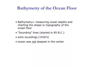
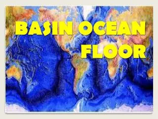
Ocean Floor Topography • Oceanography - is the study of the deep sea and shallow coastal oceans • Bathymetric maps are topographic maps of the bottom features of a lake, bay, or ocean. • Bathymetric maps are very similar to topographic maps, except that bathymetric maps show the depth below sea level and topographic maps show the elevation above sea level.
Contour Lines • Topographic maps and bathymetric maps use contour lines to show elevation or depth. • The contour interval is the difference between any two contour lines. • For example, a contour interval of 100 ft means that the land or sea bottom has risen or declined by 100 ft.
Underwater Landforms • Seamount – a mountain under the ocean formed from volcanic activity • Trench– a long, deep valley where old ocean floor sinks back toward the mantle • Abyssal plain – where the seafloor is shallow along the continent • Submarine canyon – where rivers empty into the sea, canyons are cut into the underwater plain • Mid-Ocean ridge – a series of mountain ranges on the ocean floor extending through all of the ocean in the world; cause by plate tectonics and seafloor spreading
Why is it important? • Ocean floor mapping explained the theory of plate tectonics and sea floor spreading • Scientists learned about magnetic striping and polar reversal • Helped to explain the occurrence of earthquakes in certain areas of the world • Learn about new creatures in the deep – possible medical information to be obtained • Curiosity about the world around us…
Ocean Salinity • Salinity is the total amount of dissolved salts in a sample of water. • In most parts of the ocean, the salinity is between 34 and 37 parts per thousand. • Salinity affects ocean water in different ways. • Ocean water does freeze until the temperature drops to about -1.90C whereas freshwater freezes at 00C • Saltwater has a higher density than fresh water
Ocean Temperature & Depth • Like temperatures on land, temperature at the surface of the ocean vary with location and the seasons. • Warm water, because it is less dense, forms at the ocean surface and does not sink, therefore cold water is found at lower depths. • As you descent through the ocean, the water temperature decreases. • Surface zone – Avg. temperature is 16.10C • Transition zone – Avg. temperature is about 40C • Deep zone – Avg. temperature is about 3.50C
Surface Currents • A current is a large stream of moving water that flows through the oceans and carries water from one place to another. Surface currents affect water to a depth of several hundred meters. They are driven mainly by winds.
Coriolis Effect Currents move in circular patterns due to the Coriolis effect. In the northern hemisphere, it causes the currents to curve clockwise; in the southern hemisphere currents move counterclockwise
The World’s Oceans The Gulf Stream is the largest and most powerful surface current in the North Atlantic Ocean caused by strong winds from the west. Climate is the pattern of temperature and precipitation typical over an areas over long periods of time. Surface currents warm or cool the air above it, affect the climate of land near the coasts.
El Nino & La Nina El Nino – a climate event that occurs every two to seven years in the Pacific Ocean with unusually high winds and warm ocean waters La Nina – a climate event that brings colder winds and cool ocean waters
Deep Currents – Global Ocean Conveyor • This current is very slow – it may take as long as 1,000 years to circulate between the oceans and back where they started. Deep currents are caused by differences in the density of ocean water. Deep currents move and mix water around the world by carrying cold water from the poles towards the equator.