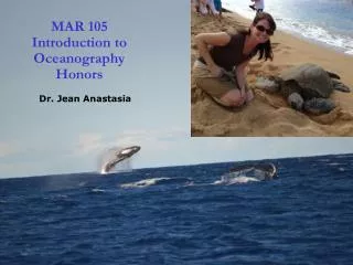
Introduction to Oceanography
Introduction to Oceanography. Oceanography The Science or Study of the Oceans Geological Oceanography Physical Oceanography Chemical Oceanography Biological Oceanography. Geological Oceanography Study of earth at edge of ocean Formation processes (seafloor) Sediments

Introduction to Oceanography
E N D
Presentation Transcript
Oceanography • The Science or Study of the Oceans • Geological Oceanography • Physical Oceanography • Chemical Oceanography • Biological Oceanography
Geological Oceanography • Study of earth at edge of ocean • Formation processes (seafloor) • Sediments • Rocks & minerals • Geothermal vents
Physical Oceanography • How & why oceans move • Weather • Heat transfer • Water cycles • Waves, tides, currents • Temperature
Chemical Oceanography • Composition & history of seawater • Seawater processes & interactions • Salinity • Dissolved gases • Nutrients
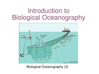
Biological Oceanography • Living organisms • Organisms relationships with each other and their environment
Marine Sediments (geological) • created by • Living Organisms (biological) • That are influenced by • Nutrients (chemical) • and • Currents & Temperature (physical)
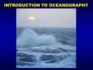
Why Study Oceanography? • Earth is the water planet • Oceans Modulate the Climate • Human Civilization (waves govern the coastal processes and habitat)
The Oceans cover ~71% of earth’s surface and have an average depth of ~3.8 km; carry most (80-97.5%) of the hydrospheric water supply;
Continental mountains (10.3%) ) % 2 9. 2 ( Ocean ridges (22.1%) D N Continental platforms (18.9%) A L Continental shelf and slope (11.4%) Ocean basin floors (29.8%) ) % 8 0. 7 ( N A E C O Continental rise (3.8%) Island arcs, trenches, guyots etc. (3.7%)
OCEANOGRAPHY-Study of the Oceans Contributions of the “ancients” • Phoenicians (from what is now Syria and Lebanon) navigated and traded around Mediterranean Sea, Indian Ocean, Red Sea, and Africa; 2000BC • Greeks-create Maps of Med. Sea-450BC, Eratosthenes(Mathematician) predicted the circumference of the earth: 42,000 KM real distance is 40,032 KM and developed the system of longitude and latitude. 3. Romans-studied and noted the phenomenon of erosion and researched and documented the water cycle
Pharos Lighthouse at Alexandria One of seven wonders of the ancient world Recently found by marine archeologists
The Polynesians: Explorers of the Pacific Ocean Polynesian Double-Hulled Canoe
Dual hulled boats carried 100 people Skilled navigation wave action bird flight stars atmospheric conditions Polynesian double hull canoe
Daily Activity – 9/15/2011 • In your notebook, write down three things you remember about the ancient history of oceanography.
Middle Ages • Fall of the Roman Empire -Europe lost most of its detailed understanding of geography • During this time, Arabic nations continued to explore and expand trade routes…. • The Vikings were ship-borne warriors and traders of the north (Norsemen) who went on expeditions to explore the Americas, Iceland, Greenland
Middle (Dark) Ages 400s – 1400s in Europe Extreme superstition Fear of intellectual inquiry Much information lost Map of Europe 600 AD
Vikings Age of Exploration 800-1066 AD Discovered North America 500 years before Columbus Leif Erickson
Age of Discovery • Columbus attempts to reach East Indies by sailing west because Eastern routes were blocked. He crossed the Atlantic and “found” the Americas… 2. Balboa settles the first European Colony in Panama. He crossed the Isthmus of Panama to the Pacific Ocean in 1513. He became the first European to lead an expedition known to have seen or reached the Pacific from the New World.
Age of Discovery • Magellan was credited with being the first around the world… though while on voyage, he was killed in the Philippines in 1521. However, the 18 members left of his Crew finished the voyage in 1522. The “sea” becomes a new place for empires to interact. It was the Era of trade with, and plunder of, the Aztecs and Incas for their gold and silver by the Spanish. The English and the Dutch pirates attack the Spanish fleets.
Voyages of Discovery • Early Chinese • Exploration of the Pacific and Indian Oceans • Europe • Prince Henry the Navigator • Naval observatory • Vasco da Gama • Christopher Columbus • Ferdinand Magellan • Sir Martin Frobisher • Francis Drake
MORE discoveries…. 1. Captain James Cook- 1700’s A British navigator who discovered the Hawaiian Islands. Is considered the best cartographer and reckless navigator of his time. Applied use of latitude and longitude. 2. Ben Franklincharted maps of the gulf stream in 1777. 3. Charles Darwin-1800’s sailed to the Galapagos Islands to study the Biology of the Sea and in the process developed his Theory of Natural Selection.
4. Edward Forbes -1800’s predicted different types of plant and animal life at different depths of the ocean. Introduced the idea of dredging. 5. Challenger Expedition- England’s Royal Society obtained the use of HMS Challenger to study sea floor characteristics, chemical composition of sea water and life at all levels! 6. FridtjofNansen- 1890’s Proved polar ice flowed. Entered ice by Alaska, exited by Greenland three years and over 1000 miles later. Determined that the North Pole is landless
The Importance of Charts and Navigational Information • Voyages of James Cook • Benjamin Franklin • Chart of Gulf Stream • National and commercial interests • U.S. Survey of the Coast set up in 1830 (now known as the U.S. Naval Oceanographic Office)
Franklin’s map and satellite photo of Gulf Stream • “You may delay but time will not.” • Benjamin Franklin
1847 Maury First “true” oceanographer 1847: U.S. Navy Lieutenant Matthew F. Maury produced first bathymetric, wind and current chart of the North Atlantic.
The Challenger Expedition • Comprehensive scientific expedition • Naval corvette refitted with laboratories, winches, and sounding scope • Circumnavigation • 361 sounding stations • Collected deep-sea water samples • Investigated deep-water motion • Temperature measurements at all depths • Thousands of biological and sea-bottom samples
Early Oceanographers Harsh conditions and slow work compared to today
Oceanography in the Twentieth Century • Support by wealthy individuals • Scripps Institution of Oceanography • Woods Hole Oceanographic Institution • Rapid advances during World War II • Office of Naval Research (ONR) and National Science Foundation (NSF) funding • International Geophysical Year (IGY) cooperation • Satellites • Deep Sea Drilling Program • National Oceanic and Atmospheric Administration (NOAA)
20th Century Oceanography 1. German expedition- 1920’s ship named Meteor was used to map depths in the Pacific Ocean. 2. US National Ocean Survey- Bathymetric readings to determine how deep each ocean is. Early techniques used pre-measured heavy rope or cable lowered over a ship's side. Today data is generated from an echosounder (sonar) mounted beneath or over the side of a boat, "pinging" a beam of sound downward at the seafloor. 3. National Oceanic and Atmospheric Administration (NOAA) establishes wise use of ocean resources, minerals, oil, fish, etc…
20th Century Oceanography 4. Oceanographic studies EXPAND!! Scripps Institution of Oceanography develop FLIP (Floating Instrument Platform) boat that turns vertically for research at different depths When FLIP is in its vertical position it is both extremely stable and quiet. It is used to study the way water circulates, how storm waves are formed, how heat is exchanged between the ocean and the atmosphere, and the sound made by underwater marine animals.
5. Submersibles-ALVINCreated by Woods Hole Oceanographic Institution and can carry up to 3 passengers to great depths (14,764 ft.), explore the ocean, the organisms there and record data. 6. Jacques Cousteau- SCUBA; Declared the importance of the oceans, he was a champion of the life that existed there and saw pollution—and exploitation by man--as the destroyer of the marine environment.
Glomar Challenger Deep Sea Drilling Project Ship(1968 to 1983) Howard Hughes’ ship
JOIDES Resolution (1985 to present)Ocean Drilling Program drill ship
Jacques Cousteau(1910-1997)invented SCUBA during World War II
Jacques Cousteau(1910-1997)Most famous oceanographer of the 20th century • If we go on the way we have, the fault is our greed... if we are not willing [to change], we will disappear from the face of the globe, to be replaced by the insect.~ Jacques Cousteau