Download
1 / 26
260 likes | 380 Views
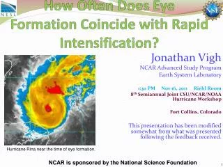
Eye Formation and Warm Rings. Jonathan L. Vigh Colorado State University 3:55 PM Wednesday August 26, 2009 Joint Informal NCAR-MMM/CSU/CIRA Hurricane Symposium NASA/TCSP Grant NNG06GA54G and NSF Grant ATM-0332197. Structure and Intensity Dataset Progress. Dataset Characteristics

E N D
Eye Formation andWarm Rings Jonathan L. Vigh Colorado State University 3:55 PM Wednesday August 26, 2009 Joint Informal NCAR-MMM/CSU/CIRA Hurricane Symposium NASA/TCSP Grant NNG06GA54G and NSF Grant ATM-0332197
Structure and Intensity Dataset Progress • Dataset Characteristics • Extensible, flexible, interoperable (netCDF!) • Designed to aggregate diverse information in time • A digital storm “wallet” for operational and research-grade data sources • Could “attach” 2D datasets (microwave, wind fields, etc.) • Will update in real-time • Current contents of dataset • Best Track (track, intensity, MSLP, wind radii, etc.) • Full suite of VDM including many common remarks (over 100 variables) • Future additions (immediate) • From subjective analysis of imagery: • Time of low level convective ring observed in microwave (2000 – current) • Time of cloud clearing for eye appearance in GOES-IR (1995 – current) • Extended Best Track dataset • SHIPS developmental dataset and operational diagnostics information • Ancillary structure data derived from HRD aircraft flight level dataset (secondary wind maxima, etc.) • Further additions (eventually) • F-deck information • Subjective Dvorak (eye definition) • Objective Dvorak (temp of eye, temp of surrounding cloud tops, eye scene) • Microwave (rain rate, wind radii) • Radar (eye shape, eye wall coverage, concentricity radial winds, cloud height max, rain rate, trend of size and presentation) • Dropsondes
Vortex Data Message Format URNT12 KNHC 061722 header, office, transmission day/time VORTEX DATA MESSAGE AL172008 stormid A. 06/17:07:10Z day/time of fix B. 15 deg 51 min N latitude of fix 081 deg 54 min W longitude of fix C. 850 mb 1398 m minimum height at standard level D. 49 kt estimate of maximum surface wind observed (visual or SFMR) E. 291 deg 8 nm bearing and range from center of maximum surface wind F. 031 deg 041 kt maximum flight level wind near center G. 293 deg 008 nm bearing and range from center of maximum flight level wind H. 997 mb minimum sea level pressure computed from dropsonde or extrapolated I. 16 C/ 1524 m maximum flight level temperature/altitude OUTSIDE eye J. 19 C/ 1521 m maximum flight level temperature/altitude INSIDE eye K. 16 C/ NA dew point temperature/sea surface temperature inside eye L. CLOSED eye character (closed wall, poorly defined, open SW) M. C18 eye shape/orientation/diameter (C18, CO8-14, E09/15/5) N. 12345/8 fix determined by/fix level O. 0.02 / 1 nm navigational accuracy/meteorological accuracy P. AF303 0317A PALOMA1 OB 08 aircraft number/wx mission identifier/stormname/ob/correction MAX FL WIND 41 KT NW QUAD 17:04:40 Z <- time of maximum wind noted with quadrant MAX OUTBOUND FL WIND 61 KT SE QUAD 17:11:40 Z <- if max outbound wind exceeds inbound MAX FL TEMP 20 C 129 / 07 NM FROM FL CNTR <- bearing and range if not within 5 nm of center
General Summary of Data 5498 vortex data messages (including non-unique corrections, duplicates) 4969 unique fixes 132 storms for which aircraft observed an eye (in all three basins) 112 storms in Atlantic basin # fixesflight leveleye Toutside TDP 1198 1500 ft 24.5 23.3 22.7 50 925 mb 22.8 21.1 20.2 1491 850 mb 20.8 17.5 17.0 2130 700 mb 16.6 10.8 10.9 7 500 mb 9.3 7.2 8.3
Eye Formation • 2368 cases out of 4969 total cases (47.7%) had an aircraft-observed eye • Criterion for eye formation cases: • Atlantic basin only (excludes 2 storms) • eye not already formed by first fix • reformations not included • <12 h between formation fix and previous fix • Eye formation observed by aircraft in: • 66 out of 112 storms (1.4% of all cases) • 48 storms formed an open eye • 18 storms formed a closed eye Open Eyes Closed Eyes
Storms with eyes Storms without eyes
Wind Trend Methodology • Reduce flight level winds to surface equivalents using Franklin et al. (2003) • Select upper bound points by excluding all wind maxima which are relatively weaker than surrounding points • Linearly interpolate the upper bound points to reference points for each 6-h period from 72-h before to 72-h after eye formation • Compute actual trends for each 6-h period
Warm Ring Criteria • Aircraft must report a supplementary maximum flight level temperature more than 5 n mi from the flight level center • The supplementary maximum temperature must be at least 2◦C greater than the maximum temperature reported within 5 n mi of the center • The radius of the supplementary maximum temperature report must not exceed the eye radius by more than 3 n mi (it is permitted to be up to 3 n mi within the eye wall).
Warm Ring Statistics 615 candidate warm ring cases out of 4969 unique fixes in the dataset: 12.4 % of the total. 139 met the qualification for warm rings without the radius check, or 2.8 % of the total. 110 were qualified warm rings with the radius check, 2.2 % of the total. Barotropic calculation of Schubert et al. (2007) suggests that when the dynamical eye size (eye radius / minimum Rossby radius of deformation) is greater than 1.8, the subsidence near the eye wall will be twice as great as at the center. 439 cases had dynamically-large eyes (>1.8) : 8.8 % of total. Out of these, 21 were qualified warm rings (0.4 % of total, or 19% of the warm rings) 513 cases had dynamically-small eyes (<0.6), with less than 10% variation of subsidence: 10.3 % of total. Out of these, 15 were qualified warm rings (0.3 % of the total, or 13.6% of warm rings)
Conclusions – Eye Formation The eye is observed to form by aircraft at an average intensity of 54 kt (surface equivalent) and MSLP of 992 hPa. • The weakest storms to form an eye had an intensity of ~30-40 kt. • The strongest storms to not form an eye while under aircraft surveillance had intensities of ~75-80 kts (BT) or 96-104 kt (FL). The intensification rate increases in the 24-h before eye formation, reaching a peak rate of +5.6 kt/6 h in the period just before the eye is observed. Intensification slows to +3.7 kt/6 h during the 12-h after the aircraft eye has been observed Schubert and Hack (1980) suggested that eye formation tends to stabilize the storm by removing diabatic heating from the high inertial stability of the core. These results suggest that this may be true in the short term.
Conclusions – Warm Rings • Incidence of warm rings does not appear to be strongly related to dynamical eye size. • Not for certain that these are “rings” instead of local asymmetric subsidence currents. • Mixing, hydrometeor evaporation likely complicate picture. • More detailed analysis from flight level dataset needed.
0) (0) There are 115 cases with concentric eyewalls that were detected by aircraft out of 4969 unique fixes in the dataset: 2.3 % of the total. (0) (0)) (0) There are 99 cases with a dew point depression greater than or equal to 15 degC out of 4969 unique fixes in the dataset: 2.0 % of the tota l. (0) There are 325 cases with a dew point depression less than or equal to 1 degC out of 4969 unique fixes in the dataset: 6.5 % of the total. (0) (0) There are 262 cases with a baroclinity greater than or equal to 10 degC out of 4969 unique fixes in the dataset: 5.3 % of the total. (0) (0) 16 storms exhibited a stadium effect. (0) There are 30 cases with pinhole eyes out of 2368 cases in which the storm had an eye: 1.3 % of the total. (0) There are 100 cases with very large eyes out of 2368 cases in which the storm had an eye: 4.2 % of the total. (0)