Download
1 / 24
240 likes | 402 Views
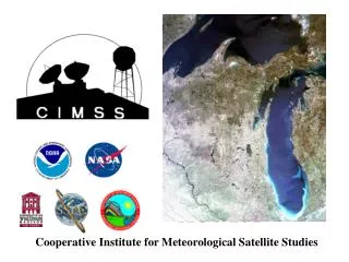
Cooperative Institute for Meteorological Satellite Studies. Outline. Overview of GIFTS NMP Requirements Overview of CIMSS/SSEC and high-spectral resolution observations Overview of GIFTPAP Algorithms GIFTPAP Milestones for FY03. GIFTS NMP Requirements. Baseline Validation

E N D
Outline • Overview of GIFTS NMP Requirements • Overview of CIMSS/SSEC and high-spectral resolution observations • Overview of GIFTPAP Algorithms • GIFTPAP Milestones for FY03
GIFTS NMP Requirements Baseline Validation The purpose of the EO-3 project is to accomplish the in-space validation of a measurement concept that will resolve both spatially and by altitude, temperature water vapor, and water-vapor and cloud-tracer winds in the atmosphere. Measurement Concept 1. Accurately measure vertical profiles of water vapor to infer tropospheric winds 2. Track water vapor features at discrete pressure levels using a time sequence of high spatial resolution moisture analyses obtained from geosynchronous soundings. 3. Generate high-quality water vapor-derived winds from moisture field measurements from the GIFTS instrument. 4. FTS will providing vertical resolution, LFPA will provide horizontal coverage and geosynchronous satellite observation platform (high temporal resolution) making possible revolutionary wind profiles and moisture transport measurements. THE VALIDATION OF THIS CAPABILITY IS EO-3’S PURPOSE. NOAA will execute an extensive validation plan as documented in the GIFTS Product Assessment Plan (PAP), utilizing data products produced by the GIFTS Instrument.
GIFTS NMP Requirements • Measurement Concept Validation Requirements • Temperature Profiles < 1.0 K for 1-km layers • Surface Temperature < 0.5 K • Water Vapor < 20% for 2-km layers • Wind Velocity < 4 m/s for 2-km layers • Relationship between <10 km • measurements of atmospheric properties and the point on the earth’s surface above which the measurements • were taken. • Notes: • 1. Temperature and water vapor accuracies are stated in terms of RMS errors (1σ) averaged over a single layer. • 2. Accuracy of wind velocity measurements is the magnitude of the difference vector between measured and true wind.
NOAA GIFTS Demonstration Plan stated goals are to * conduct real time study of forecasting impact of radiances / winds nowcasting impact of derived product images * gather case study data sets to enable validating GIFTS products testing of NWP assimilation approaches * archive golden year of level 1-b radiances Pacific winter storms severe storms in tornado alley hurricanes in the Atlantic * establish utilization approaches for HES day one
Algorithm development will address GOES products soundings winds cloud properties land surface products ocean products earth radiation budget ozone / trace gases / volcanic ash Derived product images will include 3 layers of moisture and total column atmospheric stability cloud temperature and phase land surface temperature diurnal excursions
Verner E. Suomi (1915-1995) with Robert J. Parent (left), SSEC Co-founder • 1959: 1st Meteorological Satellite Experiment • Earth Radiation Balance Observations on Explorer VII • 1966: 1st Earth Imaging from GEO • Spin-scan Camera on 1stAdvanced Technology Satellite (ATS 1) “Father of Satellite Meteorology”
UW - NOAA - NASA working together to use GEO for many years • 1966/67: 1st Earth Imaging from Geostationary Orbit • Suomi and Parent’s Spin-Scan Cloud Camera on ATS ATS-3 ATS-3 (color) ATS-1 (B/W)
UW - NOAA - NASA working together to use GEO for many years • 1974 - : 1st integratedprocessing system to display, navigate, loop images, and measure winds • Suomi’s “Man Computer Interactive Data Access System” (McIDAS) • 1978 - : National Archive of GOES data at UW SSEC • 1980: 1st Geostationary Sounder • Temperature and Water Vapor Profiles from VASinfrared observations on GOES-4(Geostationary Operational Environmental Satellite)
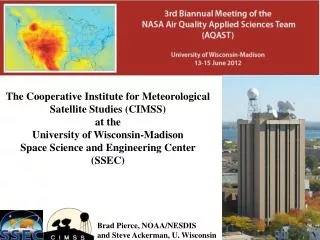
CIMSS Mission • To foster collaborative research among NOAA, NASA, and the University in those aspects of atmospheric and earth system science which exploit the use of satellite technology. • To serve as a center at which scientists and engineers working on problems of mutual interest can focus on satellite related research in atmospheric studies and earth system science. • To stimulate the training of scientists and engineers in the disciplines involved in the atmospheric and earth sciences.
Research Operations CIMSS understands transition from Research to Operations
UW has a long history with high-spectral resolution measurement systems
GOES in NWP, routine andexperimental: ModelGOES Data NCEP Global Sounder Radiance, Imager Winds, Imager Radiances Eta Model Sounder Radiance, Sounder PW, Imager Winds, Sounder Clouds FSL’s RUC Sounder TPW, Sounder Clouds CIMSS CRAS Sounder PW, Sounder Clouds Australia (LAPS) Imager Winds ECMWF Imager Winds, Imager Radiances GFDL (experimental) Imager Winds, GWINDEX rapid-scan winds NOGAPS Imager Winds, Sounder Winds NAAPS Biomass Fire Product CSU RAMS Biomass Fire Product (University of Sao Paulo/NASA-Ames) UW ALEXI Sounder Skin Temperature time-change Data Assimilation -- CIMSS has a role in every listed GOES product
The road to the next generation Geostationary Sounders (# of channels) HES(operational) (~1600) (~1600) GIFTS(experimental) CrIS (operational) IASI (operational) (~2400) AIRS (operational) (18) GOES Sounder(operational) Aircraft data (experimental), IMG (12) VAS(experimental) Ground-based (exp) To be ready for the HES system, we must learn from preceding instruments. HIRS (operational) IRIS (experimental) Pioneering work (theory) time
GIFTS PAPAlgorithm Development • Radiances • Atmospheric Soundings • Winds • Clouds • Surface • Composition • Radiation Budget • Data and Product Access and Visualization
Definitions of Algorithm Typesfor GIFTS • Validation – Features: satisfy NASA/Navy validation needs, case study application, become next generation operational algorithms • Demonstration – Features: satisfy NOAA demonstration needs, Real-time application,
FY03 Writing Activities Outline of NOAA Product Algorithm Description Draft of NOAA Product Algorithm Description Version 1 of key NOAA Product Algorithm Description Conference papers on key GIFTS algorithms Support NOAA Reviews Support CDR Materials Submit one or more papers on NOAA Product Algorithms Grant Annual Report/Continuation Proposal
UW’s Experience and Expertise will establish and execute “day one” algorithms for GIFTS (and approaches for HES)