Download
1 / 6
60 likes | 219 Views
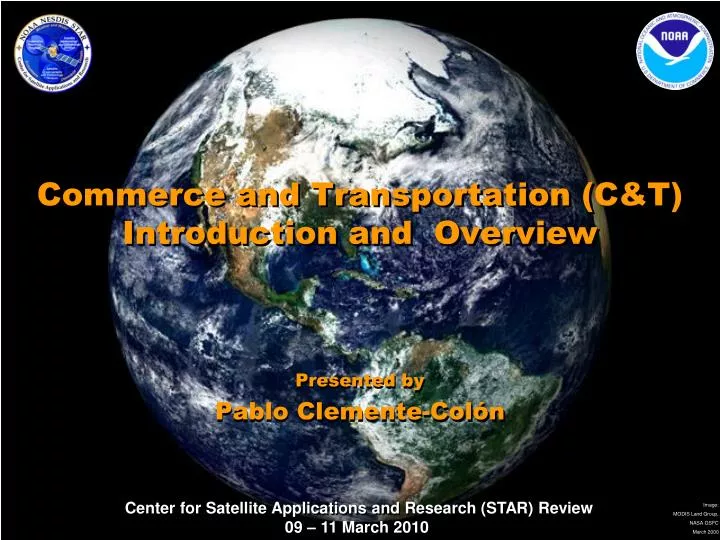
Commerce and Transportation (C&T) Introduction and Overview. Presented by Pablo Clemente-Colón. Commerce & Transportation Goal Research Areas.

E N D
Commerce and Transportation (C&T)Introduction and Overview Presented by Pablo Clemente-Colón
Commerce & Transportation Goal Research Areas Commerce and Transportation Goal (Enhance national economic performance through the development and use of an efficient, safe, secure, and environmentally sound U.S. transportation system). • Explore, develop and transition emerging technologies and techniques to enhance marine navigational safety and efficiency • Provide accurate, timely, and integrated weather information to meet air and surface transportation needs • Improve accuracy of positioning capabilities to realize national economic, safety, and environmental benefits • Develop the information and tools to make reliable decisions in preparedness, response, damage assessment, and restoration
Explore, Develop and Transition Emerging Technologies and Techniques to Enhance Marine Navigational Safety and Efficiency Continue research, development, and systems integration as required for remote sensing technologies including exploiting new and improved sensors and sensor systems to improve the safety and efficiency of navigational services provided by NOAA Test and evaluate oceanographic and marine meteorological sensors and systems to improve the quality, responsiveness, and value of individual sensors or integrated sensor systems to customer requirements Develop and evaluate state-of-the-art hydrographic and ocean mapping technologies and applications Continue to investigate new products and services including delivery mechanisms such as GIS Continue efforts in the technology of data visualization, particularly in the development of new and unconstrained paradigms in electronic navigational charting Develop technology and software whose use would result in increased efficiency, cost savings, and/or accuracy will be transitioned to operational use Satellite Altimetry and the NOAA / Navy / NGA / GEBCO Global Bathymetry Project (Walter H. F. Smith) Sea Ice Charting for Safe Navigation (Pablo Clemente-Colón) The Role of Satellite Ocean Surface Vector Wind (OSVW) Information in Mitigating Risk to Maritime Transportation (Paul S. Chang) Error Analysis of the Altimetric Bathymetry Model used by GEBCO and Google Earth (Karen Marks) National Ice Center (Pablo Clemente-Colon) Commerce & TransportationPriority Research Activities • Oral Presentation • Poster Presentation • Operational / Prediction 3
Provide Accurate, Timely, and Integrated Weather Information to Meet Air and Surface Transportation Needs Research and develop needs for real-time weather data collection for local effects such as fog, blowing and drifting snow, ice, high winds, thunderstorms, and other hazardous weather conditions can impact travel conditions with very short notice in order to provide accurate and timely information to meet air and surface transportation needs Research on advancing the sensing and prediction of atmospheric and space processes that contribute to global weather impacts on the aeronautics enterprise Implement emerging products and create innovative ways of incorporating them into the forecast process Transition research weather-observation prototypes into full operational use Downburst Potential Monitoring (Ken Pryor) A Cloud Object Based Volcanic Ash Detection Technique (Michael J. Pavolonis) Real-time Monitoring of Volcanic Ash from Mt Redoubt (using Principal Component Imagery) (Donald W. Hillger) Development of a visibility retrieval for the GOES-R Advanced Baseline Imager (Robert B. Pierce) Commerce & TransportationPriority Research Activities • Oral Presentation • Poster Presentation • Operational / Prediction 4
Develop the Information and Tools to Make Reliable Decisions in Preparedness, Response, Damage Assessment, and Restoration Develop preparedness and response actions that reduce the risks of spills and minimize the impact on commerce, communities, and the environment when spills do occur Research to improve our basic understanding of coastal and marine spills and, most importantly, advances our capacity for responding to spills in a manner that minimizes the impacts to biological, economic, social, and cultural resources Develop an integrated and effective research strategy to improve modeling, detection, and monitoring capabilities for submerged oil Research and improve risk assessment and response to oil-in-ice (on, under, and within ice) in the Arctic environment refining methods for modeling and monitoring dispersed oil/chemical plumes Hurricane Hazard Response with Synthetic Aperture Radar Imagery (William G. Pichel) GhostNet - At Sea Marine Debris Detection and Tracking (William G Pichel, X.iaofeng Li, and Christopher Jackson) Emerging Activity - Renewable Energy Wind and Solar Energy Estimation and Forecasting (Fuzhong Weng) GOES Solar Radiation Products in Support of Renewable Energy (Istvan Laszlo) Commerce & TransportationPriority Research Activities • Oral Presentation • Poster Presentation • Operational / Prediction 5
Commerce & TransportationPresentations Marine Transportation • Satellite Altimetry and the NOAA / Navy / NGA / GEBCO Global Bathymetry Project (Walter H. F. Smith) • Sea Ice Charting for Safe Navigation (Pablo Clemente-Colón) • The Role of Satellite Ocean Surface Vector Wind (OSVW) Information in Mitigating Risk to Maritime Transportation (Paul S. Chang) • Error Analysis of the Altimetric Bathymetry Model used by GEBCO and Google Earth (Karen Marks) • National Ice Center (Pablo Clemente-Colón) Air and Surface Transportation • Downburst Potential Monitoring (Ken Pryor) • A Cloud Object Based Volcanic Ash Detection Technique (Michael J. Pavolonis) • Real-time Monitoring of Volcanic Ash from Mt Redoubt (using Principal Component Imagery) (Donald W. Hillger) • Development of a visibility retrieval for the GOES-R Advanced Baseline Imager (Robert B. Pierce) Pollution Monitoring and Response • Hurricane Hazard Response with Synthetic Aperture Radar Imagery (William G. Pichel) • GhostNet - At Sea Marine Debris Detection and Tracking (William G Pichel, Xiaofeng Li, and Christopher Jackson) Renewable Energy • Wind and Solar Energy Estimation and Forecasting (Fuzhong Weng) • GOES Solar Radiation Products in Support of Renewable Energy (Istvan Laszlo) • Oral Presentation • Poster Presentation • Operational / Prediction