Download
1 / 11
140 likes | 373 Views
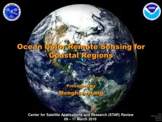
Ocean Color Remote Sensing for Coastal Regions. Presented by Menghua Wang. Requirement, Science, and Benefit. Requirement/Objective Ecosystems Protect, restore and manage the use of coastal and ocean resources through ecosystem-based management

E N D
Ocean Color Remote Sensing for Coastal Regions Presented by Menghua Wang
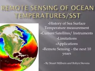
Requirement, Science, and Benefit Requirement/Objective • Ecosystems • Protect, restore and manage the use of coastal and ocean resources through ecosystem-based management • Healthy and productive coastal and marine ecosystems that benefit society • Advancing understanding of ecosystems to improve resource management • A well informed public that acts as a steward of coastal and marine ecosystems • Weather and Water • Serve society’s needs for weather and water information • Better, quicker, and more valuable weather and water information to support improved decisions • Increase lead time and accuracy for weather and water warnings and forecasts • Improve predictability of the onset, duration, and impact of hazardous and high-impact severe weather and water events Science • How to provide accurate water optical, biological, and biogeochemical property data in coastal and inland regions from satellite measurements? Benefit • Protect and monitor our ocean resource • Improve water resources forecasting capabilities • Protect and monitor water resources • Understand the effect of environmental factors on human health and well-being
Satellite Ocean Color Remote Sensing • Ocean Color Remote Sensing: Derive the ocean water-leaving radiance spectra by accurately removing the atmospheric and surface effects. • Ocean properties can then be derived from the ocean water-leaving radiance spectra. • At satellite altitude usually ~90% of sensor-measured signal over ocean comes from the atmosphere & surface • It is crucial to have accurate atmospheric correction and sensor calibration. • 0.5% error in atmospheric correction or calibration corresponds to possible of ~5% in the derived ocean water-leaving radiance. • We need ~0.1% sensor calibration accuracy.
SeaWiFS/MODIS Algorithm SeaWiFS Chlorophyll-a Concentration(October 1997-December 2003) • Routine Global Ocean Color Product Data from SeaWiFS/MODIS Using: • Gordon and Wang (1994) atmospheric correction algorithm. • Assuming: • Ocean is black at the near-infrared (NIR) wavelengths. • Aerosols are non- or weakly absorbing. • SeaWiFS/MODIS Experiences Show: • High quality ocean color products for global open oceans (Case-1 waters). • Significant efforts are needed for improvements of water color products in the coastal and inland water regions: • Turbid waters: Violation of the NIR black ocean assumption • Strongly-absorbing aerosols: Violation of non- or weakly absorbing aerosols
Atmospheric Correction: SWIR Bands(Wang & Shi, 2005; Wang, 2007) • At the shortwave IR (SWIR) wavelengths (>~1000 nm), ocean water has much strongly absorption and ocean contributions are significantly less. Thus, atmospheric correction can be carried out for coastal regions without using the bio-optical model. • Water absorption for 869 nm, 1240 nm, 1640 nm, and 2130 nm are 5 m-1, 88 m-1, 498 m-1, and 2200 m-1, respectively. • Examples using the MODIS Aqua 1240 and 2130 nm data to derive the ocean color products are provided. • We use the SWIR band (1240 nm) for the cloud masking. This is necessary for coastal region waters. • Require sufficient SNR characteristics for the SWIR bands and the SWIR atmospheric correction has slight larger noises at the short visible bands (compared with those from the NIR algorithm).
Results from SWIR Algorithm(U.S. East Coast) Chlorophyll-a April 2002-2007 In Situ In Situ MODIS (NIR) MODIS (NIR-SWIR) Chlorophyll-a Comparison Results in Chesapeake Bay
Chlorophyll-a0.01-10 (mg/m3)(Log scale) New Ocean Color Processing SWIR-based Global Ocean Color Data Processing at NOAA/STAR July, 2005 Standard Data Processing Old New 11 peer-reviewed papers about algorithms & validations since 2005 July, 2005 NIR-SWIR Data Processing
Diffuse Attenuation Coefficient forTurbid Conditions Development of New Water Diffuse Attenuation Coefficient Kd(490) Algorithm for the Chesapeake Bay and Turbid Coastal Waters Using the MODIS Data July, 2005 Standard Data Processing Old Old Wang, M., S. Son, and L. W. Harding Jr., “Retrieval of diffuse attenuation coefficient in the Chesapeake Bay and turbid ocean regions for satellite ocean color applications,” J. Geophys. Res., 114, C10011, doi:10.1029/2009JC005286, 2009. New New Validation Results July, 2005
Current Research and Development Activities • Transition of Research to Operational for the SWIR-Based Algorithms: • Working with the NOAA data operational partners, we have been working on implementing the SWIR-based ocean color data processing system into the NOAA operational data processing system. • Near real time ocean color products will be produced using the SWIR-based algorithms for the U.S. coastal regions in the NOAA CoastWatch Program. • Improved ocean color data, e.g., new Kd(490) product for turbid waters, will be generated. • NPOESS (NPP)-VIIRS Ocean Color Cal/Val: • On-orbit Vicarious Calibration for the VIIRS ocean color products. • NOAA VIIRS ocean color data processing. • VIIRS ocean color product validation. • Algorithm Development and Ocean Color Data Applications: • Algorithms development (e.g., for dealing with the absorbing aerosols in coastal region) and refinement for ocean coastal and inland waters. • Various ocean color data applications for ocean coastal and inland waters. • Future Ocean Color Satellite Missions: • NASA Aerosol, Cloud, and Ecosystem (ACE) Mission. • NASA Geostationary Coastal and Air Pollution Events (GEO-CAPE) Mission.
Challenges and Path Forward • Science challenges • Accurate remote sensing of the water properties is still challenges for: • (a) complex coastal and inland waters and • (b) strongly absorbing aerosols. • Next steps • Continue efforts for improving the remote sensing data products for coastal and inland waters. • Transition Path • We have been working on transition of research to operational for the SWIR-based algorithms. • The SWIR-based data processing will be operational this year.