Download
1 / 107
1.08k likes | 1.23k Views
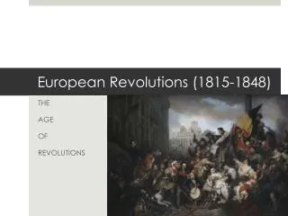
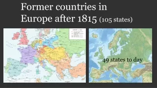
History about 105 countrys before year 1815 (Europe)<br>To day only 49 countrys left.

E N D
Former countries in Europe after 1815 (105 states) 49 states to day
By Alexander Altenhof - Own work. Source of Information:Historical atlases– Map "1815 - L'Europe apès le Congrès de Vienne" (Author unknown)(Link)–Ramsay Muir, George Philip (ed.): Philip's New School Atlas of Universal History, George Philip & Son, Ltd., London 1928– Dr. Walter Leisering (ed.): Putzger Historischer Weltatlas, Cornelsen Verlag, Berlin 1992, ISBN 3-464-00176-8– Bayerischer Schulbuch-Verlag (ed.): Großer Historischer Weltatlas, Dritter Teil, Neuzeit, Bayerischer Schulbuch-Verlag, München 1981, ISBN 3-7627- 6021-7.– Prof. Dr. Hans-Erich Stier, Prof. Dr. Ernst Kirsten a. o. (ed.): Großer Atlas zur Weltgeschichte, Orbis Verlag, München 1990, ISBN 3-7627- 6021-7Other publications– Reinhard Stauber: Der Wiener Kongress, Böhlau Verlag, Wien/Köln/Weimar 2014, ISBN 978-3-8252-4095-0–Thierry Lentz: 1815. Der Wiener Kongress und die Neugründung Europas, Siedler Verlag, München 2014, ISBN 978-3- 8275-0027-4, CC BY-SA 4.0, https://commons.wikimedia.org /w/index.php?curid=50255845
Allenstein Regierungsbezirk Allenstein was a Regierungsbezirk, or government region, of the Prussian province of East Prussia from 1905 until 1945. The regional capital was Allenstein (present-day Olsztyn). The territory today is part of the Polish Warmian- Masurian Voivodeship. The government region was created on 1 November 1905 as the third East Prussian Regierungsbezirk out of the southern districts of the two original administrative regions Gumbinnen and Königsberg, which had been established in 1815. It comprised the south of the former Duchy of Prussia; the lands of the Allenstein and Rößel districts had belonged to the Prince-Bishopric of Warmia, annexed by Prussia in 1772. In 1920 East Prussian plebiscite 1920 all the Allenstein Region plus the District of Oletzko (de) was part of the Allenstein Plebiscite precinct, with the electorate voting for remaining with Germany by more than 97%. In 1945 following World War II, Regierungsbezirk Allenstein was dissolved when East Prussia was partitioned between the Republic of Poland and the Soviet Union (Kaliningrad Oblast) according to the resolutions at the Potsdam Conference. East Prussian Regierungsbezirk Allenstein (red), established in 1905 Almost a country 1920
https://commons.wikimedia.org/wiki/File:Duchy_of_Anhalt_1863-1918_en.svghttps://commons.wikimedia.org/wiki/File:Duchy_of_Anhalt_1863-1918_en.svg Duchy of Anhalt Herzogtum Anhalt 1806–1918 By Shadowxfox - Own work based on: File:Deutsches Reich (Karte) Anhalt.svg, CC BY-SA 3.0, https://commons.wikimedia.org/w/index.php?curid=35265347
Republic of Armenia Հայաստանի Հանրապետութիւն 1918–1920 By Yerevanci - Own work, CC BY-SA 3.0, https://commons.wikimedia.org/w/index.php?curid=27929331
Austrian Empire 1804–1867 By Spiridon Ion Cepleanu - Own work, CC BY-SA 3.0, https://commons.wikimedia.org/w/index.php?curid=18152140 By TRAJAN 117This vector image was created with Inkscape. - Own workThis vector image includes elements that have been taken or adapted from this: Blank map of Europe 1815.svg (by Alphathon)., CC BY-SA 3.0, https://commons.wikimedia.org/w/index.php?curid=27673116 Government Emperor • • • Absolute monarchy 1804–1835 1835–1848 1848–1867 Francis I Ferdinand I Franz Joseph I
By Andrein - Transferred from en.wikipedia, Public Domain, https://commons.wikimedia.org/w/index.php?curid=5867649 https://commons.wikimedia.org/wiki/File:Dissolution_of_Austria-Hungary.png Kingdoms and countries of Austria- Hungary: Cisleithania (Empire of Austria[6]): 1. Bohemia, 2. Bukovina, 3. Carinthia, 4. Carniola, 5. Dalmatia, 6. Galicia, 7. Küstenland, 8. Lower Austria, 9. Moravia, 10. Salzburg, 11. Silesia, 12. Styria, 13. Tyrol, 14. Upper Austria, 15. Vorarlberg; Transleithania (Kingdom of Hungary[6]): 16. Hungary proper 17. Croatia-Slavonia; 18. Bosnia and Herzegovina (Austro-Hungarian condominium) By TRAJAN 117This vector image was created with Inkscape. - Own workThis vector image includes elements that have been taken or adapted from this: German Empire 1914.svg (by Alphathon)., CC BY-SA 3.0, https://commons.wikimedia.org/w/index.php?curid=18627049 Austria-Hungary↓ 1867–1918
Avar Khanate Khanate Early 13th century–1864
Azerbaijan Democratic Republic یتیروهموج قلخ ناجیابرذآ Azərbaycan Demokratik Respublikası 1918–1920 By Emin Bashirov - Own work, CC BY-SA 3.0, https://commons.wikimedia.org/w/index.php?curid=6323251 By Melikov Memmed - Own work, CC0, https://commons.wikimedia.org/w/index.php?curi d=14951900
Grand Duchy of Baden Großherzogtum Baden State of the Confederation of the Rhine (1806– 1813) State of the German Confederation (1815–1866) Federal State of the German Empire (1871–1918) 1806–1918 By Elevatorrailfan - This vector image includes elements that have been taken or adapted from this: Blank map of Europe 1815.svg., CC BY-SA 4.0, https://commons.wikimedia.org/w/index.php?curid=42274670 By Unknown - Karten-und Luftbildstelle der DB Mainz, Public Domain, https://commons.wikimedia.org/w/index.php?curid=5922808
Kingdom of Bavaria Königreich Bayern Electorate of the Holy Roman Empire (1805–1806) State of the Confederation of the Rhine (1806–13) State of the German Confederation (1815–66) Federal State of the German Empire (1871–1918) 1805–1918 https://commons.wikimedia.org/wiki/File:German_Empire_-_Bavaria_(1871).svg Kingdom of Bavaria
Year 1918 – 1920 British goverment By NordNordWest - Own work, usingUnited States National Imagery and Mapping Agency dataWorld Data Base II data, CC BY-SA 3.0, https://commons.wikimedia.org/w/index.php?curid=7773875 Batumi Batumi (Georgian: ბათუმი [bɑtʰumi]) is the second-largest city of Georgia, located on the coast of the Black Sea in the country's southwest.[2] Situated in a subtropical zone near the foot of the Lesser Caucasus Mountains, Batumi is a popular tourist destination known for its varying weather–it is a bustling seaside resort during warm seasons, but it can get entirely covered in snow during winter. Much of Batumi's economy revolves around tourism and gambling, but the city is also an important sea port and includes industries like shipbuilding, food processing and light manufacturing. Since 2010, Batumi has been transformed by the construction of modern high-rise buildings, as well as the restoration of classical 19th-century edifices lining its historic Old Town
Belarusian People's Republic Partially recognized Government in exile since 1919 Russian rule (1795–1918) Belarusian People's Republic (from 1918) Byelorussian Soviet Republic (1919–91) West Belarus (1919–39) Modern Belarus (from 1991)
Free Hanseatic City of Bremen At the unwinding of the Holy Roman Empire in 1806 the Free Imperial City of Bremen (as of 1646, after earlier privileges of autonomy of 1186) was not mediatised but became a sovereign state officially titled Free Hanseatic City of Bremen. Its currency was the Bremen thaler (until 1873). In 1811 the First French Empire annexed the city-state. Upon the first, albeit only preliminary, defeat of Napoléon Bonaparte, Bremen resumed its pre-1811 status as city-state in 1813. The Vienna Congress of 1815 confirmed Bremen's—as well as Frankfurt's, Hamburg's, and Lübeck's—independence after pressuring by Bremen's emissary, and later burgomaster, Johann Smidt. Bremen became one of 39 sovereign states of the German Confederation. In 1827 the state of Bremen bought the tract of land from the Kingdom of Hanover, where future Bremerhaven would be established. Bremen became part of the North German Confederation in 1867 and became an autonomous component state of the new-founded German Empire in 1871 By Ulamm(talk) 23:44, 29 December 2013 (UTC) - Own work, CC BY-SA 3.0, https://commons.wikimedia.org/w/index.php?curid=30394605
By Shadowxfox - Own work based on: File:Deutsches Reich (Karte) Braunschweig.svg, CC BY-SA 3.0, https://commons.wikimedia.org/w/index.php?curid=35265353 Duchy of Brunswick Herzogtum Braunschweig (German) Part of the German Confederation, the North German Confederation, and the German Empire 1815–1918
Carpatho-Ukraine Unrecognized state 1939 Carpatho-Ukraine (Ukrainian: Карпа́тська Украї́на, Karpats’ka Ukrayina, pronounced [kɐrˈpɑtsʲkɐ ukrɐˈjinɐ]) was an autonomous region within Czechoslovakia from late 1938 to March 15, 1939. It was declared an independent republic by Avgustyn Voloshyn on March 15, 1939. Voloshyn named himself the president and asked Adolf Hitler to support him. Hitler did not reply and the historical part of Hungary was annexed by Hungary between March 15 and March 16, 1939, remaining under Hungarian control until the end of World War II, when it was ceded to the Soviet Union. The territory is now administered as Zakarpattia Oblast in Ukraine.
Carnaro and Fiume year 1918 – 1920 The Italian Regency of Carnaro (Italian: Reggenza Italiana del Carnaro) was a self-proclaimed state in the city of Fiume (now Rijeka, Croatia) led by Gabriele d'Annunzio between 1919 and 1920. It is also known by its lyrical name in Italian: Fiume Endeavour (Impresa di Fiume). By No machine-readable author provided. Decius assumed (based on copyright claims). - No machine-readable source provided. Own work assumed (based on copyright claims)., CC BY 2.5, https://commons.wikimedia.org/w/index.php?curid=994390 During World War I (1914–1918), Italy made a pact with the Allies, the Treaty of London (1915), in which it was promised all of the Austrian Littoral, but not the city of Fiume. After the war, at the Paris Peace Conference, 1919, this delineation of territory was confirmed, with Fiume remaining outside of Italian borders, instead joined with adjacent Croatian territories into the Kingdom of Serbs, Croats and Slovenes. Gabriele d'Annunzio was angered by what he considered to be handing over of the city of Fiume. On September 12, 1919, he led around 2,600 troops from the Royal Italian Army (the Granatieri di Sardegna), Italian nationalists and irredentists, into a seizure of the city, forcing the withdrawal of the inter-Allied (American, British and French) occupying forces. Their march from Ronchi dei Legionari to Fiume became known as the Impresa di Fiume ("Fiume Endeavour"). Gabriele d'Annunzio (in the middle with the stick) with some legionaries (components of the Arditi's department of the Italian Royal Army) in Fiume in 1919. To the right of d'Annunzio, facing him, Lt. Arturo Avolio (commander of the Ardit's department of Bologna Brigade). On the same day, d'Annunzio announced that he had annexed the territory to the Kingdom of Italy. He was enthusiastically welcomed by the Italian population of Fiume. This move was opposed by the Italian government and d'Annunzio tried to resist pressure from Italy. The plotters sought to have Italy annex Fiume, but were denied. Instead, Italy initiated a blockade of Fiume while demanding that the plotters surrender. During his time in Fiume in September 1919, Filippo Tommaso Marinetti called the leaders of the Exploit "advance- guard deserters" (disertori in avanti).
Channel Islands year 1940 - 1945 Year 1940, 92 000 people living in the islands. From aprox 1200 + , United Kingdom. Germany 1940 – 1945. Sark liberated as late as 10 may 1945. List of islands The permanently inhabited islands of the Channel Islands and their population and area are: Jersey 100,080 (118 km2) Guernsey 63,026 (65 km2) Alderney 2,000 (8 km2) Sark 600 (5 km2) Herm 60 (2 km2) Jethou 3 (0.2 km2) Brecqhou (Brechou) (0.3 km2) By Aotearoa - Own work, CC BY-SA 3.0, https://commons.wikimedia.org/w/index.php?curid=3885255 The islands were the only British territory to be occupied by the German Army during World War II.
Cospaia Republic Repubblica di Cospaia Microstate 1440–1826 The Republic of Cospaia was a small state in Italy, located in northern Umbria, independent from 1440 to 1826. It was located in what is now the hamlet (frazione) of Cospaia in the comune of San Giustino in the Province of Perugia
Couto Misto Microstate 10th century–1868 Couto Misto (Portuguese: Couto Misto [ˈko(w)tu ˈmiʃtu], Galician: Couto Mixto, Spanish: Coto Mixto) was an independent microstate on the border between Spain and Portugal. It was composed of the villages of Santiago de Rubiás, Rubiás (now in the Spanish municipality of Calvos de Randín), and Meaus (now in the Spanish municipality of Baltar), all in the Salas Valley, Ourense, Galicia. The territory of the Couto Misto also included a small uninhabited strip now part of the Portuguese municipality of Montalegre.
The Cretan State (Greek: Κρητική Πολιτεία, Kritiki Politia; Ottoman Turkish: ىتلود دیرك ,Girit Devleti), was established in 1898, following the intervention by the Great Powers (Britain, France, Italy, Austria-Hungary, and Russia) on the island of Crete. In 1897, an insurrection in Crete led the Ottoman Empire to declare war on Greece, which led Great Britain, France, Italy and Russia to intervene on the grounds that the Ottoman Empire could no longer maintain control. It was the prelude of the island's final annexation to the Kingdom of Greece, which occurred de facto in 1908 and de jure in 1913. History • • • September 1908 • • Proclamation Theriso revolt Unilateral union with Greece 9 December 1898 10 March 1905 24 Treaty of London 30 May 1913 Union with Greece Cretan State 1 December 1913
By Crossswords - https://upload.wikimedia.org/wikipedia/commons/archive/3/33/20150102092908% 21Crimea_crisis_map.PNG, CC BY-SA 3.0, https://commons.wikimedia.org/w/index.php?curid=37635280 Crimea was annexed by the Russian Federation in early 2014 and the peninsula, Ukrainian territory since 1954, is now administered as two Russian federal subjects—the Republic of Crimea and the federal city of Sevastopol. Until 2016 these new subjects were grouped in the Crimean Federal District. The annexation was accompanied by a military intervention by Russia in Crimea that took place in the aftermath of the 2014 Ukrainian revolution and was part of wider unrest across southern and eastern Ukraine.
The Independent State of Croatia (Croatian: Nezavisna Država Hrvatska, NDH; German: Unabhängiger Staat Kroatien; Italian: Stato Indipendente di Croazia) was a World War II fascist puppet state of Germany and Italy. It was established in parts of occupied Yugoslavia on 10 April 1941, after the invasion by the Axis powers. Its territory consisted of most of modern-day Croatia and Bosnia and Herzegovina, as well as some parts of modern-day Serbia and Slovenia, but also excluded many Croat-populated areas in Dalmatia (until late 1943), Istria, and Međimurje regions (which today are part of Croatia). In 1942, Germany suggested Italy take military control of all of Croatia out of a desire to redirect German troops from Croatia to the Eastern Front. Italy however rejected the offer as it did not believe that it could handle the unstable situation in the Balkans alone.[22] After the ousting of Mussolini and the Kingdom of Italy's armistice with the Allies, the NDH on 10 September 1943 declared that the Treaties of Rome were null and void and annexed the portion of Dalmatia that had been ceded to Italy. The NDH attempted to annex Zara, which had been a recognized territory of Italy since 1919 but long an object of Croatian irredentism, but Germany did not allow it By DIREKTOR - Own work, CC BY-SA 4.0, https://commons.wikimedia.org/w/index.php?curid=37973302 Independent State of Croatia Nezavisna Država Hrvatska Puppet state of Germany (1941–45) Protectorate of Italy (1941–43) 1941–1945
Czechoslovakia, or Czecho-Slovakia; Czech and Slovak: Československo, Česko-Slovensko, was a sovereign state in Central Europe that existed from October 1918, when it declared its independence from the Austro-Hungarian Empire, until its peaceful dissolution into the Czech Republic and Slovakia on 1 January 1993. From 1939 to 1945, following its forced division and partial incorporation into Nazi Germany, the state did not de facto exist but its government-in- exile continued to operate. From 1948 to 1990, Czechoslovakia was part of the Soviet bloc with a command economy. Its economic status was formalized in membership of Comecon from 1949 and its defense status in the Warsaw Pact of May 1955. A period of political liberalization in 1968, known as the Prague Spring, was forcibly ended when the Soviet Union, assisted by several other Warsaw Pact countries, invaded. In 1989, as Marxist–Leninist governments and communism were ending all over Europe, Czechoslovaks peacefully deposed their government in the Velvet Revolution; state price controls were removed after a period of preparation. In 1993, Czechoslovakia split into the two sovereign states of the Czech Republic and Slovakia. By Blank_map_of_Europe.svg: maix¿?derivative work: Alphathon /'æɫfə.θɒn/ (talk) - Blank_map_of_Europe.svg, CC BY-SA 3.0, https://commons.wikimedia.org/w/index.php?curid=17172982 Czechoslovakia Československo Česko-Slovensko 1918–1992 1939–1945: Government-in-exile
The Free City of Danzig (German: Freie Stadt Danzig; Polish: Wolne Miasto Gdańsk) was a semi-autonomous city-state that existed between 1920 and 1939, consisting of the Baltic Sea port of Danzig (now Gdańsk, Poland) and nearly 200 towns and villages in the surrounding areas. It was created on 15 November 1920 in accordance with the terms of Article 100 (Section XI of Part III) of the 1919 Treaty of Versailles after the end of World War I. The Free City included the city of Danzig and other nearby towns, villages, and settlements that had been primarily inhabited by Germans. As the Treaty stated, the region was to remain separated from post-World War I Germany (the Weimar Republic) and from the newly independent nation of the Second Polish Republic ("interwar Poland"), but it was not an independent state. The Free City was under League of Nations protection and put into a binding customs union with Poland. By Gdansk_Bay_Borderlines_1939_English.png: Masturbiusderivative work: Justass (talk) - Gdansk_Bay_Borderlines_1939_English.png, CC BY-SA 3.0, https://commons.wikimedia.org/w/index.php?curid=8516865 Free City of Danzig Freie Stadt Danzig (German) Wolne Miasto Gdańsk (Polish) Free City under League of Nations protection 1920–1939 Historical era • • • Interwar period 15 November 1920 1 September 1939 2 September 1939 Established Invasion of Poland Annexed by Germany
East Karelia year 1922 East Karelia (Finnish: Itä-Karjala, Karelian: Idä-Karjala), also rendered as Eastern Karelia or Russian Karelia, is a name for the part of Karelia that since the Treaty of Stolbova in 1617 has remained Eastern Orthodox under Russian supremacy. It is separated from the western part of Karelia, called Finnish Karelia or historically Swedish Karelia (before 1808). Most of East Karelia is now part of the Republic of Karelia within the Russian Federation. It consists mainly of old historical regions of Viena and Aunus. 19th century ethnic nationalist Fennomans saw East Karelia as the ancient home of Finnic culture, "un-contaminated" by both Scandinavians and Slavs. In the sparsely populated East Karelian backwoods, mainly in White Karelia, Elias Lönnrot collected the folk tales that ultimately would become Finland's national epic, the Kalevala. The idea of annexing East Karelia to Finland ("Greater Finland") was widely supported in newly independent Finland. It was especially popular during the Continuation War when it seemed possible through German assistance. Most of East Karelia was occupied by Finnish forces 1941– 1944. The war was accompanied by hardship for the local ethnic Russian civilians, including forced labour and internment in prison camps as enemy aliens. After the Continuation War, calls for annexation of East Karelia have virtually disappeared. After Karelia was divided between Finland and Russia in 1918, the Finnic peoples that made up most of the population of East Karelia were promised far-reaching cultural rights. However, these rights were never realised and under Stalin ethnic Finns were persecuted and an intensive Russification programme began. Since the fall of communism, there has been a revival in Finnic culture in East Karelia. East Karelia and West Karelia with borders of 1939 and 1940/1947. They are also known as Russian Karelia and Finnish Karelia respectively.
The Republic of Guria or the Gurian Peasant Republic was an insurrection that took place in the western Georgian province Guria, against Imperial Russia, prior to and during the Russian Revolution of 1905. After the beginning of the 1905 Revolution, however, the revolt began spreading throughout Georgia and the Gurian revolution proceeded even in a more radical way. The peasants sent away all the authorities, and, nominating their own judges, they organized independent village communities and armed red detachments also known as forest brothers, embodying a whole territory. The Gurian peasant women at village meetings adopted resolutions demanding political equality with men. The revolutionaries largely used terrorism against the Tsarist officers and loyal landlords. By February the whole of Guria was in the power of the revolutionaries, perhaps the world’s first Marxist national-liberation movement. On January 10, 1906 Colonel Krilov’s strong reinforcements of all arms attacked the province and ruthlessly crushed the insurrection putting an end to the “Gurian Republic”. Republic of Guria გურიის რესპუბლიკა 1905–1906
East Germany, officially the German Democratic Republic (GDR; German: Deutsche Demokratische Republik pronounced [ˈdɔʏtʃə demoˈkʀaːtɪʃə ʀepuˈbliːk], DDR), was a communist state in central- western Europe, during the Cold War period. It described itself as a socialist "workers' and peasants' state." From 1949 to 1990, it administered the portion of Germany that had been occupied by Soviet forces at the end of World War II—the Soviet Occupation Zone of the Potsdam Agreement, bounded on the east by the Oder– Neisse line. The Soviet zone surrounded West Berlin, but did not include it; as a result, West Berlin remained outside the jurisdiction of the GDR. The East German population declined by three million people throughout its forty-one year history, from 19 million in 1948 to 16 million in 1990; of the 1948 population, some 4 million were deported from the lands east of the Oder-Neisse line. This was a stark contrast from Poland, which increased during that time; from 24 million in 1950 (a little more than East Germany) to 38 million (more than twice of East Germany's population). This was primarily a result of emigration—about one quarter of East Germans left the country before the Berlin Wall was completed in 1961,[55] and after that time, East Germany had very low birth rates,[56] except for a recovery in the 1980s when the birth rate in East Germany was considerably higher than in West Germany German Democratic Republic Deutsche Demokratische Republik (German) Member of the Warsaw Pact (1955–1989) 1949–1990
Finnish Democratic Republic Suomen kansanvaltainen tasavalta Demokratiska Republiken Finland Puppet state of the Soviet Union 1939–1940 The Finnish Democratic Republic (Finnish: Suomen kansanvaltainen tasavalta, also Finnish: Suomen kansantasavalta, Swedish: Demokratiska Republiken Finland, Russian: Финляндская Демократическая Республика) was a short-lived puppet government created and recognised only by the Soviet Union. Headed by Finnish- born politician Otto Ville Kuusinen, the Finnish Democratic Republic was Joseph Stalin's planned means to conquer Finland.It nominally operated in the parts of Finnish Karelia that were occupied by the Soviet Union during the Winter War. The Soviet Union argued that it was the only rightful government for all of Finland that was capable of ending the Winter War and restoring peace; however, before the end of the war, the Soviets gave up this interpretation to make peace with the preexisting government of Finland, which was still recognized by the rest of the world. By Jniemenmaa- Own work, CC BY-SA 3.0, https://commons.wikimedia.org/w/index.php?curid=6017493
Frankfurt was a major city of the Holy Roman Empire, being the seat of imperial elections since 885 and the city for imperial coronations from 1562 (previously in Free Imperial City of Aachen) until 1792. Frankfurt was declared an Imperial Free City (Reichsstadt) in 1372, making the city an entity of Imperial immediacy, meaning immediately subordinate to the Holy Roman Emperor and not to a regional ruler or a local nobleman. Due to its imperial significance, Frankfurt survived mediatisation in 1803. Following the collapse of the Holy Roman Empire in 1806, Frankfurt fell to the rule of Napoleon I, who granted the city to Karl Theodor Anton Maria von Dalberg; the city became known as the Principality of Frankfurt. The Catholic clergy Dalberg emancipated the Catholics living with the city boundary. In 1810 Dalberg merged Frankfurt with the Principality of Aschaffenburg, the County of Wetzlar, Fulda, and Hanau to form the Grand Duchy of Frankfurt. After the defeat of Napoleon and the collapse of the Confederation of the Rhine, Frankfurt was returned to its pre-Napoleonic constitution via the Congress of Vienna of 1815 and became a sovereign city-state and a member of the German Confederation. Free City of Frankfurt Freie Stadt Frankfurt State of the Holy Roman Empire State of the German Confederation 1372–1806 1806–1815: Grand Duchy 1816–1866
The Democratic Republic of Georgia (DRG; Georgian: საქართველოს დემოკრატიული რესპუბლიკა sak’art’velos demokratiuli respublika) existed from May 1918 to February 1921 and was the first modern establishment of a Republic of Georgia. The DRG was created after the collapse of the Russian Empire that began with the Russian Revolution of 1917. Its established borders were with the Kuban People's Republic and the Mountainous Republic of the Northern Caucasus in the north, the Ottoman Empire and the First Republic of Armenia in the south, and the Azerbaijan Democratic Republic in the southeast. It had a total land area of roughly 107,600 km2 (by comparison, the total area of today's Georgia is 69,700 km2), and a population of 2.5 million. The republic's capital was Tbilisi, and its state language was Georgian. Proclaimed on May 26, 1918, on the break-up of the Transcaucasian Federation, it was led by the Georgian Social Democratic Party (also known as the Georgian Menshevik Party). Facing permanent internal and external problems, the young state was unable to withstand invasion by the Russian SFSR Red Armies, and collapsed between February and March 1921 to become a Soviet republic. By Goran tek-en - Own workThis file was derived from:Carte de la Georgie, 1920.jpgKingdom of Georgia after dissolution as a unified state, 1490 AD.svg, CC BY-SA 3.0, https://commons.wikimedia.org/w/index.php?curid=30984750 Democratic Republic of Georgia საქართველოს დემოკრატიული რესპუბლიკა (Georgian) 1918–1921
The Kingdom of Greece (Greek: Βασίλειον τῆς Ἑλλάδος, [vaˈsiliɔn ˈtis ɛˈlaðɔs]) was a state established in 1832 at the Convention of London by the Great Powers (the United Kingdom, Kingdom of France and the Russian Empire). It was internationally recognised by the Treaty of Constantinople, where it also secured full independence from the Ottoman Empire. This event also marked the birth of the first fully independent Greek state since the fall of the Byzantine Empire to the Ottomans in the mid-15th century. The Kingdom succeeded from the Greek provisional governments after the Greek War of Independence, and lasted until 1924. In 1924 the monarchy was abolished, and the Second Hellenic Republic was established, after Greece's defeat by Turkey in the Asia Minor Campaign. It lasted until 1935, when it was overthrown by a military coup d'état which restored the monarchy. The restored Kingdom of Greece lasted from 1935 to 1973. The Kingdom was again dissolved in the aftermath of the seven-year military dictatorship (1967–1974), and the Third Republic, the current Greek state, came to be, after a popular referendum. By TRAJAN 117This vector image was created with Inkscape. - Own workThis vector image includes elements that have been taken or adapted from this: Blank map of Europe 1956-1990.svg (by Alphathon)., CC BY-SA 3.0, https://commons.wikimedia.org/w/index.php?curid=19225662 Historical eraModern • • • • • • • • London Protocol Constitution granted Second Republic Monarchy restored Axis occupation Admitted to the United Nations Military Junta Abolishment by Papadopoulos 30 August 1832 3 September 1843 25 March 1924 3 November 1935 April 1941–October 1944 Kingdom of Greece Βασίλειον τῆς Ἑλλάδος 1832–1924 1935–1973 25 October 1945 21 April 1967 1 July 1973
Free and Hanseatic City of Hamburg The city was member in the medieval Hanseatic trading league and a free imperial city of the Holy Roman Empire. From 1815 until 1866 Hamburg was an independent and sovereign state of the German Confederation, then the North German Confederation (1866–71), the German Empire (1871–1918) and during the period of the Weimar Republic (1918–33). In Nazi Germany Hamburg was a city-state and a Gau from 1934 until 1945. After the Second World War Hamburg was in the British Zone of Occupation and became a state in the western part of Germany in the Federal Republic of Germany (Since 1949). Hamburg ca. 1600
Kingdom of Hanover 1814–1866 History • • • • • Congress of Vienna Revolution of 1848 Austro-Prussian War Peace of Prague Annexed by Prussia 12 October 1814 13 March 1848 14 June 1866 23 August 1866 20 September 1866 By kgberger - own drawing/Source of Information: Putzger – Historischer Weltatlas, 89. Auflage, 1965, CC BY 2.5, https://commons.wikimedia.org/w/index.php?curid=1483888
Heligoland Named after Heligoland, it was the location of World War I naval battles in 1914 and 1917. In 1939 it also had a World War II aerial battle named after it. In the Heligoland Basin (Helgoländer Becken), a basin lying directly southwest of Heligoland, the bight is up to 56 metres deep. One of the busiest shipping lanes in the world, from Hamburg and the mouth of the Elbe to the Straits of Dover and the English Channel, runs through the Heligoland Bight. The area also includes nature reserves such as the Heligoland Felssockel and the protected Wadden Sea, in which the Wadden Sea National Parks of Schleswig- Holstein (East), Hamburg (southeast) and Lower Saxony (south) are located. Year 1821 ( 2 200 people) when the Englishmen left the island. Year 1952 the islands was incorporated in Germany. By Hohum- Own work, CC BY-SA 3.0, https://commons.wikimedia.org/w/index.php?curid=11273470 https://commons.wikimedia.org/wiki/File:Helgoland_Vogelperspektive_sx.jpg
Grand Duchy of Hesse and by Rhine Großherzogtum Hessen und bei Rhein State of the Confederation of the Rhine (1806–1813) State of the German Confederation (1815–1866) State of the North German Confederation (1867–1871) Federal State of the German Empire (1871–1918) 1806–1918 1806–1918 The Grand Duchy of Hesse and by Rhine (German: Großherzogtum Hessen und bei Rhein), or the Grand Duchy of Hesse (German: Großherzogtum Hessen) between 1806 and 1816, was an independent country and member state of the Confederation of the Rhine as of 1806, when the Landgraviate of Hesse-Darmstadt was elevated to a Grand Duchy which it remained until 1918, when the monarchy was overthrown. Hesse lost its independence when it joined the German Empire in 1871. Before 1866, its northern neighbour was its former sister Landgraviate, since 1803 an Electorate, of Hesse-Kassel – for this reason, this state was sometimes colloquially known as Hesse-Darmstadt.
Landgraviate of Hesse-Homburg Landgrafschaft Hessen-Homburg 1622–1866 Hesse-Homburg was formed into a separate landgraviate in 1622 by the landgrave of Hesse-Darmstadt; it was to be ruled by his son, although it did not become independent of Hesse- Darmstadt until 1668. It was briefly divided into Hesse-Homburg and Hesse- Homburg-Bingenheim; but these parts were reunited in 1681. In 1806, Hesse-Homburg was incorporated with Hesse- Darmstadt; but in 1815, by the Congress of Vienna, the latter state was compelled to recognize the independence of Hesse- Homburg, which was increased by the addition of Meisenheim. The landgraviate of Hesse-Homburg consisted of two parts, the district of Homburg on the right side of the Rhine, and the district of Meisenheim, added in 1815, on the left side of the same river. In 1866, Hesse-Homburg was inherited by the grand-duke of Hesse-Darmstadt, while Meisenheim fell to Prussia. Later that same year, these territories were taken from Hesse- Darmstadt again, and the former landgraviate was combined with the Electorate of Hesse-Kassel, duchy of Nassau, and the free city of Frankfurt to form the Prussian province of Hesse- Nassau. Today, it forms a part of the German state of Hesse. By Ziegelbrenner - own drawing/Source of Information: Putzger – Historischer Weltatlas, 89. Auflage, 1965 & de: Jean Joseph Tranchot / de: Karl von Müffling, CC BY-SA 3.0, https://commons.wikimedia.org/w/index.php?curid=959591
Electorate of Hesse Kurfürstentum Hessen State of the Holy Roman Empire State of the German Confederation 1803–1807 1814–1866 The Electorate of Hesse (also known as Hesse-Kassel) was a state elevated by Napoleon in 1803 from the Landgraviate of Hesse-Kassel. When the Holy Roman Empire was abolished in 1806, the Prince-Elector of Hesse chose to remain an Elector, even though there was no longer an Emperor to elect. In 1807, with the Treaties of Tilsit the area was annexed to the Kingdom of Westphalia, but in 1814 the Congress of Vienna restored the electorate. The state—last of its kind—consisted of several detached territories to the north of Frankfurt which survived until 1866 with the name of an electorate within the German Confederation. It comprised a total land area of 3,699 square miles (9,580 km2), and its population in 1864 was 745,063. By ziegelbrenner - own drawing/Source of Information: Putzger – Historischer Weltatlas, 89. Auflage, 1965; Westermanns Großer Atlas zuur Weltgeschichte, 1969; Haacksgeographischer Atlas. VEB Hermann Haack Geographisch-KartographischeAnstalt, Gotha/Leipzig, 1. Auflage, 1979., CC BY 2.5, https://commons.wikimedia.org/w/index.php?curid=1511111 6
Hohenzollern-Hechingen State of the Holy Roman Empire (until 1806) 1576–1850 Hohenzollern-Hechingen was a small principality in southwestern Germany. Its rulers belonged to the Swabian branch of the Hohenzollern dynasty. The County of Hohenzollern-Hechingen was created in 1576, upon the partition of the County of Hohenzollern, a fief of the Holy Roman Empire. When the last count of Hohenzollern, Charles I of Hohenzollern (1512–1579) died, the territory was to be divided up between his three sons: Eitel Frederick IV of Hohenzollern-Hechingen (1545–1605) Charles II of Hohenzollern-Sigmaringen (1547–1606) Christopher of Hohenzollern-Haigerloch (1552–1592) Unlike the Hohenzollerns of Brandenburg and Prussia, the Hohenzollerns of southwest Germany remained Roman Catholic. The County was raised to a principality in 1623. The principality joined the Confederation of the Rhine in 1806 and was a member state of the German Confederation between 1815 and 1850. The democratic Revolution of 1848 was relatively successful in Hohenzollern, and on 16 May 1848, the Prince was forced to accept the establishment of a constitution. However, the conflict between monarch and democrats continued, and on 6 August, Hohenzollern was occupied by Prussian forces. On 7 December 1849, Prince Friedrich Wilhelm Konstantin sold the country to his relative, King Frederick William IV of Prussia. On 12 March 1850, Hohenzollern-Hechingen officially became part of Prussia, and formed together with Hohenzollern-Sigmaringen the Province of Hohenzollern. By Känsterle from nl, CC BY-SA 3.0, https://commons.wikimedia.org/w/index.php?curid=9667587
Italian Social Republic Repubblica Sociale Italiana Puppet state of Germany 1943–1945 On 24 July 1943, after the Allied landings in Sicily on a motion by Dino Grandi the Grand Fascist Council voted a motion of no confidence in Mussolini. Mussolini's position had been undermined by a series of military defeats from the start of Italy's entry into the war in June 1940, including the bombing of Rome, the loss of the African colonies and the Allied invasions of Sicily and the southern Italian Peninsula. The new Italian government had moved Mussolini from place to place while he was in captivity in an attempt to foil any attempts at rescue. Despite this, the Germans eventually pinpointed Mussolini at the Campo Imperatore Hotel at Gran Sasso. On 12 September, Mussolini was liberated by the Germans in Operation Eiche in the mountains of Abruzzo, while the Italian carabinieri were allegedly placed under orders to not fire their weapons at the raiders, rendering them defenseless. After being liberated, Mussolini was flown to Bavaria. Gathering what support he still had among the Italian population, his liberation made it possible for a new German-dependent Fascist Italian state to be created. By XrysD - Own work, CC BY-SA 4.0, https://commons.wikimedia.org/w/index.php?curid=63249495
Irish Republic Poblacht na hÉireann (Saorstát Éireann) Revolutionary state 1919–1922 Disputed with the United Kingdom Historical era • • • 1922 • 1922 Interwar period Proclamation of the Irish Republic 24 April 1916 Independence declared Anglo-Irish Treaty adopted 21 January 1919 7 January Irish Free State established 6 December By Rob984 - Derived from:File:Blank map of Europe (polar stereographic projection) cropped.svg, CC BY-SA 4.0, https://commons.wikimedia.org/w/index.php?curid=41107766 The Irish Republic (Irish: Poblacht na hÉireann or Saorstát Éireann) was a revolutionary state that declared its independence from the United Kingdom of Great Britain and Ireland in January 1919. The Republic claimed jurisdiction over the whole island of Ireland, but by 1920 its functional control was limited to only 21 of Ireland's 32 counties, and British state forces maintained presence across much of the north-east, as well as Cork, Dublin and other major towns.
Free, Independent, and Strictly Neutral City of Cracow with its Territory Wolne, Niepodległe i Ściśle Neutralne Miasto Kraków z Okręgiem Protectorate of Austria, Prussia and Russia 1815–1846 History • Established 3 May 1815 • November Uprising • Kraków Uprising 16 November 1846 29 November 1830 The Free, Independent, and Strictly Neutral City of Cracow with its Territory (Polish: Wolne, Niepodległe i Ściśle Neutralne Miasto Kraków z Okręgiem), more commonly known as either the Free City of Cracow or Republic of Cracow (Polish: Rzeczpospolita Krakowska, German: Republik Krakau), was a city republic created by the Congress of Vienna in 1815, which included the city of Kraków and its surrounding areas. It was controlled by its three neighbours (Russia, Prussia, and Austria). It was a center of agitation for an independent Poland. In 1846, in the aftermath of the unsuccessful Kraków Uprising, it was annexed by the Austrian Empire. It was a remnant of the Duchy of Warsaw, which was partitioned between the three states in 1815. It was an overwhelmingly Polish-speaking city-state; of its population 85% were Catholics, 14% were Jews while other religions comprised less than 1%. The city of Kraków itself had a Jewish population reaching nearly 40%, while the rest were almost exclusively Polish-speaking Catholics. By Blank_map_of_Europe.svg: maix¿?derivative work: Alphathon /'æɫfə.θɒn/ (talk) - This file was derived from Blank map of Europe.svg:, CC BY-SA 3.0, https://commons.wikimedia.org/w/index.php?curid=27668323
Kuban People's Republic 1918–1920 The Kuban People's Republic (Russian: Кубанская Народная Республика Kubanskaya Narodnaya Respublika; Ukrainian: Кубанська Народна Республiка Kubans'ka Narodna Respublika) was an anti-Bolshevik state during the Russian Civil War, comprising the territory of the modern-day Kuban region in Russia. The republic was proclaimed by the Kuban Rada on 28 January 1918, and declared its independence on 16 February. It would include all territory of the former Kuban Oblast of the Russian Empire. During its brief independence, it sought union with the Ukrainian People's Republic until the latter was occupied by Soviet forces. The Kuban People's Republic was crushed 7 November 1919, having existed for 21 months.
Principality of Lichtenberg Fürstentum Lichtenberg 1815–1834 History Congress of Vienna sold to Prussia • • 1815 1834 The Principality of Lichtenberg (German: Fürstentum Lichtenberg) on the Nahe River was an exclave of the Duchy of Saxe- Coburg-Saalfeld from 1816 to 1826 and the Duchy of Saxe-Coburg and Gotha from 1826 to 1834, when it was sold to the Kingdom of Prussia. Today the area lies in two States of Germany – Saarland in the District of St. Wendel and Rhineland- Palatinate in the District of Birkenfeld. By The original uploader was Störfix at German Wikipedia(Original text: de:Benutzer:Störfix) - Transferred from de.wikipedia to Commons.(Original text: selbst gezeichnet), CC BY-SA 2.0 de, https://commons.wikimedia.org/w/index.php?curid=1855620
Principality of Lippe Fürstentum Lippe State of the Holy Roman Empire (1123–1806) State of the Confederation of the Rhine (1806–1813) State of the German Confederation (1815–1866) State of the North German Confederation (1867–1871) Federal State of the German Empire (1871–1918) 1123–1918 Lippe (later Lippe-Detmold and then again Lippe) was a historical state in Germany, ruled by the House of Lippe. It was located between the Weser River and the southeast part of the Teutoburg forest.
Free and Hanseatic City of Lübeck Freie und Hansestadt Lübeck Free imperial city of the Holy Roman Empire Member of the German Confederation Member of the North German Confederation State of the German Empire State of the Weimar Republic 1226–1811 1815–1937 History • Gained Imp. immediacy from Emp. Frederick II • Annexed by French Empire • Regained sovereignty under Congress of Vienna 1815 • Abolished by the Greater Hamburg Act 1226 1811 1 April 1937 The Free and Hanseatic City of Lübeck was a city-state from 1226 to 1937, in what is now the German states of Schleswig-Holstein and Mecklenburg-Vorpommern.
Duchy of Lucca Ducato di Lucca 1815–1847 History • • Congress of Vienna Annexed by Tuscany 9 June 1815 17 December 1847 The Duchy of Lucca was a small Italian state existing from 1815 to 1847. It was centered on the city of Lucca. By the Congress of Vienna of 1815 the Duchy was to revert to Tuscany on the end of its Bourbon line of rulers, which happened in 1847. Tuscany was annexed by the Kingdom of Sardinia (Piedmont) in 1860. By Gabagool- Own work, CC BY 3.0, https://commons.wikimedia.org/w/index.php?curid=7162695 The Duchy was formed in 1815 by the Congress of Vienna,[1] out of the former Republic of Lucca and the Principality of Lucca and Piombino, which had been ruled by Elisa Bonaparte.[2] It was created to compensate the House of Bourbon-Parma for the loss of the Duchy of Parma, which had been given to Marie Louise of Austria.
Duchy of Massa and Carrara Ducato di Massa e Carrara 1473–1829 The Duchy of Massa and Carrara was the duchy that controlled the towns of Massa di Carrara and Carrara; the area is now part of unified Italy, but retains its local identity as the province of Massa-Carrara. Historical era • • • Italian Renaissance Established French rule Disestablished 22 February 1473 1796-1814 14 November 1829
Grand Duchy of Mecklenburg-Schwerin Großherzogtum Mecklenburg-Schwerin State of the German Confederation (1815–48, 1850–66) State of the North German Confederation (1867–71) Federal State of the German Empire (1871–1918) 1815–1918 The Grand Duchy of Mecklenburg-Schwerin was a territory in Northern Germany held by the House of Mecklenburg residing at Schwerin. It was a sovereign member state of the German Confederation and became a federated state of the North German Confederation and finally of the German Empire in 1871. In the early years of the French Revolutionary Wars Duke Frederick Francis I of Mecklenburg-Schwerin had remained neutral, and in 1803 he regained Wismar, which was pawned to him from Sweden. After Napoleon's victory at the Battle of Austerlitz and the final dissolution of the Holy Roman Empire in 1806, he joined the Confederation of the Rhine by a treaty of 22 March 1808. Napoleon, in preparation for the French invasion of Russia in 1812, disregarded this alliance; he offered the duchy to the Swedish heir apparent Jean Bernadotte for his support. By Shadowxfox - Own work based on: File:Deutsches Reich (Karte) Mecklenburg-Schwerin.svg, CC BY-SA 3.0, https://commons.wikimedia.org/w/index.php?curid=35265362 History • • Congress of Vienna German Revolution 14 June 1815 14 November 1918
Grand Duchy of Mecklenburg-Strelitz Großherzogtum Mecklenburg-Strelitz State of the German Confederation, the North German Confederation, and the German Empire 1815–1918 The Grand Duchy of Mecklenburg-Strelitz was a territory in Northern Germany, held by the younger line of the House of Mecklenburg residing in Neustrelitz. Like the neighbouring Grand Duchy of Mecklenburg-Schwerin, it was a sovereign member state of the German Confederation and became a federated state of the North German Confederation and finally of the German Empire upon the unification of 1871. After World War I and the German Revolution of 1918–19 it was succeeded by the Free State of Mecklenburg-Strelitz. By de:Benutzer:Störfix - selbst gezeichnet, de:Benutzer:Störfix, Public Domain, https://commons.wikimedia.org/w/index.php?curid=699237 The Duchy of Mecklenburg-Strelitz, established according to the dynastic Treaty of Hamburg in 1701, adopted the corporative constitution of the sister Duchy of Mecklenburg-Schwerin by an act of September 1755. During the Napoleonic Wars it was spared the infliction of a French occupation through the good offices of King Maximilian I Joseph of Bavaria and his minister Maximilian von Montgelas; Duke Charles II of Mecklenburg-Strelitz declared neutrality in 1806 and joined the Confederation of the Rhine in 1808, however, he withdrew in 1813 on the eve of the German campaign in favor of an alliance against Napoleon. He joined the German Confederation established after the 1815 Congress of Vienna to succeed the dissolved Holy Roman Empire; he and his cousin Frederick Francis I of Mecklenburg-Schwerin both assumed the title of grand duke (Großherzog von