Download
1 / 11
110 likes | 114 Views
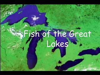
Evaluation of Dynamic Heights on the Great Lakes. Daniel Roman and Xiaopeng Li. HC vs. NAVD 88 Datum Defect. GL WLS Stations. Method. Geometric coordinates of water surface. Inverted rod. CORS Antenna. WLS Housing. ETG. Receiver. ETG Table (datum). Great Lake. leveling. BM.

E N D
Evaluation of Dynamic Heights on the Great Lakes Daniel Roman and Xiaopeng Li
HC vs. NAVD 88 Datum Defect Joint Assembly of IAG-IASPEI in Kobe, Japan JUly 30 - August 4, 2017
GL WLS Stations Joint Assembly of IAG-IASPEI in Kobe, Japan JUly 30 - August 4, 2017
Method Geometric coordinates of water surface Inverted rod CORS Antenna WLS Housing ETG Receiver ETG Table (datum) Great Lake leveling BM IGLD 85 Datum surface Joint Assembly of IAG-IASPEI in Kobe, Japan JUly 30 - August 4, 2017
Method Joint Assembly of IAG-IASPEI in Kobe, Japan JUly 30 - August 4, 2017
Geometric Coordinates of WS (CORS) Joint Assembly of IAG-IASPEI in Kobe, Japan JUly 30 - August 4, 2017
Geopotential Model-Derived Heights (CORS) Joint Assembly of IAG-IASPEI in Kobe, Japan JUly 30 - August 4, 2017
Geometric Coordinates of WS (Campaign GPS-Canadian solution) * Latitude/longitude are from hand held GPS at WLS station – height transferred from BM Joint Assembly of IAG-IASPEI in Kobe, Japan JUly 30 - August 4, 2017
Geopotential Model-Derived Heights (Campaign GPS-Canadian solution) Joint Assembly of IAG-IASPEI in Kobe, Japan JUly 30 - August 4, 2017
Summary • Dynamic Heights can be derived from a geopotential model and GNSS • A one arc-minute model would be ideal • Oherwise, approximations are required • CORS better than campaign GPS • Further evaluation awaits final adjustment of GPS campaign data • Water topography issues still remain Joint Assembly of IAG-IASPEI in Kobe, Japan JUly 30 - August 4, 2017
Questions? Daniel R. Roman Chief Geodesist National Geodetic Survey Joint Assembly of IAG-IASPEI in Kobe, Japan JUly 30 - August 4, 2017