Download
1 / 13
130 likes | 262 Views
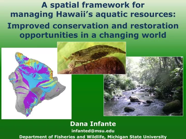
A spatial framework for managing Hawaii’s aquatic resources:. Improved conservation and restoration opportunities in a changing world. Dana Infante infanted@msu.edu Department of Fisheries and Wildlife, Michigan State University. www.fishhabitat.org.

E N D
A spatial framework formanaging Hawaii’s aquatic resources: Improved conservation and restoration opportunities in a changing world Dana Infante infanted@msu.edu Department of Fisheries and Wildlife, Michigan State University
www.fishhabitat.org Protect, restore and enhance nation’s aquatic communities through partnerships Objectives • Conduct an objective condition analysis of fish habitats • Identify priority habitats for conservation, enhancement, or restoration
2010 Hawaiian River Condition Assessment: Built from a landscape approach Landscape factors Habitat Condition index Good Biology Poor Landscape-scale disturbances • Agriculture, urban land use Roads • Former plantations Dams • Ditch intersections, length Quarries • Injection wells TRI Sites • NPDES sites
Spatial framework and database • National HydrographyDataset (1:24,000 NHD) • Local and network catchments delineated using ArcHydro • Confluence to confluence reaches • Breaks implemented based on elevation • Assessment data and other variables have been attributed to each spatial unit Network catchment Local catchment Reach Reach Reach
Flexibility and benefits of a spatial framework Moku Network catchments Island Ahupua’a Island Local catchments and reaches, NHD
Current applications • NFHAP coastal condition assessment for Hawaii • “Assessment of coral and fish disease in three priority watersheds and their relationship to land-based pollution loads,” R. Oram, G. Aeby, T. Work • Plans to compare results with Hawaii Watershed Atlas
Plans to refine the assessment • Integrate additional landscape-scale disturbance data • Golf courses • Refined fragmentation statistics • Downstream disturbances measures • “Calibrate” scores using biological data Target reach
Next step • “Managing the Nations Fish Habitat at Multiple Spatial Scales in a Rapidly Changing Climate” • USGS-funded project to determine vulnerability of fish habitat to projected changes in climate and land use • Project builds on elements of current condition assessment • Goal: Conduct a similar type of assessment in Hawaii, using current conditions scores as a base • Consider freshwater, marine and terrestrial systems • “Integrated” vulnerability assessment • Currently working with PICCC, USGS to coordinate a planning meeting
Thank you! • Gordon Smith • Dan Polhemus • Bob Nishimoto • Glenn Higashi • Jim Parham • Malie Beach Smith • Gary Whelan • Doug Beard • Andrea Ostroff • NFHAP Science and Data Committee
Gary Whelan (MDNRE), Doug Beard (USGS), Andrea Ostroff (USGS) • NFHAP Science and Data Committee “More people working for more fish”
Disturbance variables: Urban and point source
Disturbance variables: Former plantation, fragmentation, ditches, agriculture, 303D listings
Benefits of a spatial framework • Summarizes amounts, types, and locations of natural and anthropogenic system influences • Integrates data and results of other studies across different scales • Allows decision makers to easily compare regions, identifying priority areas for protection, enhancement, or restoration • Establishes a consistent reporting framework Reach • A Hierarchical Spatial Framework and Database for the National River Fish Habitat Condition Assessment, In Review. L. Wang, D. Infante, P. Esselman, A. Cooper, D. Wu,W. Taylor, D. Beard, G. Whelan, and A. Ostroff