Download
1 / 17
170 likes | 280 Views
CAPS Realtime 4-km Multi-Model Convection-Allowing Ensemble and 1-km Convection-Resolving Forecasts for the NOAA Hazardous Weather Testbed (HWT) 2009 Spring Experiment. Ming Xue, Fanyou Kong, Kevin W. Thomas, Jidong Gao, Yunheng Wang, Keith Brewster, Kelvin K. Droegemeier, Xuguang Wang

E N D
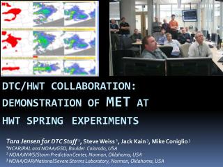
CAPS Realtime 4-km Multi-Model Convection-Allowing Ensemble and 1-km Convection-Resolving Forecasts for the NOAA Hazardous Weather Testbed (HWT) 2009 Spring Experiment Ming Xue, Fanyou Kong, Kevin W. Thomas, Jidong Gao, Yunheng Wang, Keith Brewster, Kelvin K. Droegemeier, Xuguang Wang Center for Analysis and Prediction of Storms (CAPS), University of Oklahoma John Kain2, Steve Weiss3, David Bright3, Mike Coniglio2 and Jun Du4 2National Severe Storms Laboratory 3Storm Prediction Center 4Environmental Modeling Center/NCEP Contact: mxue@ou.edu
HWT Spring Experiment Daily Discussions (pictures from spring 2007)
Scientific Issues to Address • The values and cost-benefits of convection-resolving versus convection-parameterizing short-range ensembles versus even-higher-resolution deterministic forecast; • Suitable perturbation methods for storm-scale ensemble, e.g., IC, physics, and model perturbations; • Proper handling and use of boundary perturbations; • The value and impact of assimilating high-resolution data including those from radars; • The most effective ensemble processing and most useful products at the convective scales; • The impact of such unique products on forecasting and warning.
Forecast Configurations of Three Years Spring 2007: 10-member WRF-ARW, 4 km, 33 h, 21Z start time, NAM+SREF ICs. 5 members physics perturbations only, 5 with Phy+IC+LBC perturbations. Single 2 km grid. 2/3 CONUS (2007 NWP conf.) Spring 2008: larger domain, 00Z start, Phy+IC+LBC pert for all. Radar Vr and Z data assimilation for 4 and 2 km grids! (2008 SLS Conf.) Spring 2009: 20 members, CONUS-scale, 4 km, 3 models (ARW, NMM, ARPS), mixed physics/IC/LBCs, radar DA, once a day, 30-hour forecasts from 0Z. + Single 1 km deterministic. About 1.5 months each spring season from mid-April through early June
Configuration of Ensemble Members PBL ARW NMM ARPS
ARPS 3DVAR Analysis Grid 1 km grid: 3603 x 2691 x 51 WRF ARW (4 and 1 km) and ARPS forecast grid and common post-processing grid WRF NMM forecast grid
Forecast Configurations – more details • ARPS 3DVAR+Cloud Analysis provide control IC • IC perturbations and LBCs from SREF for perturbed members • NAM forecasts for control LBCs • Level-2 radial velocity and reflectivitydata from over 120 WSR-88D radars analyzed. • Physics options: mixed for the ensemble. • 3D output every hour, selected 2D output every 5 minutes. • Hourly graphics posted on the web, and extracted 2D fields sent to HWT N-AWIPS • 1 km forecasts using ~10,000 cores on a Cray XT5 at National Institute for Computational Science (NICS) at University of Tennessee • 4 km ensembles using ~2000 cores on a Cray XT3 at Pittsburgh Supercomputing Center (PSC). • 4 million CPU-hours used. Over 100 TB of data archived. • Forecasts completed in 5-9 hours over night.
18-hour ensemble forecast products Spread Spaghetti of 35 dBZ reflectivity Probability matched reflectivity Probability of reflectivity >35 dBZ Observed reflectivity 1800 UTC, May 8, 2009
FY WM TM TM WY TY FM TM WM TY Postage stamp view of 18-h forecast from 20 4-km ensemble members and 1 km ARW, valid at 1800 UTC, May 8, 2009 (Thompson scheme captured the MCV the best)
Postage stamp view of 18-h forecast from 20 4-km ensemble members and 1 km ARW, valid at 1800 UTC, May 8, 2009 FY WY FM FM WM TY FY WM LT LT
ETS for 3-hourly precip ≥ 0.5 in 2009 (26-day) 2008 (32-day) Probability-matched score generally better than any ensemble member 2 km score no-better than the best 4-km ensemble member – may be due to physics 1-km score better than any 4-km member and than the 4 km PM score.
0 – 6h forecasts! ETS for hourly precip ≥ 0.1 in 2008 (36-day) 2009 (24-day)
BIAS for 1 h precip of 2009 (24-day average) ≥0.1 inch/h
Reliability diagram for precipitation probability forecast 12 h forecast of 1 h accumulated precip. ≥ 0.1in
Preliminary Conclusions/Discussion All aspects of uncertainty should be taken into account for convective scale ensemble (a multi-scale problem) – optimal design remains a research question; Multi-model seems to be beneficial but for 0-12 hour precipitation forecast, radar data impact much larger than impact of model/physics uncertainties. Special challenges with post-processing for precipitation-type forecasting fields; Systematic precipitation bias can significantly affect ensemble reliability; Convection-allowing ensemble clearly outperforms convection-parameterized ensembles (Clark et al. 2009, not shown); Radar data assimilation removes spin up problem, improves QPF, and the impacts last longer for organized convection with weak large-scale forcing; impacts are expected to be larger with more advanced DA methods; Probability-matched ensemble precipitation forecast better than any 4 km-member 1-km forecasts generally better than 4-km forecasts, better than 4-km PM ensemble forecast for heavy precipitation; 4-km QPF significantly better than 12-km ETA QPF.
Future work One-of-a-kind data set awaiting for detailed post-analysis/evaluation; insufficient of specific support so far ($125K/year NOAA CSTAR support for the entire effort). Fruitful collaboration/leverage using the data sets; Optimal design and evaluation: e.g., Adding convective-scaleperturbations, perturbing land-surface model ICs, using other perturbation methods (e.g., EnKF, ETKF); Possibly adding COAMPS (strong interest from NRL); Post-analysis: e.g., calibration, bias removal, detailed performance evaluation, cost-benefit/trade off assessment, effective products for end users; Integration with national efforts.
List of referred publications using the data • Schwartz, C., J. Kain, S. Weiss, M. Xue, D. Bright, F. Kong, K. Thomas, J. Levit, and M. Coniglio, 2009: Next-day convection-allowing WRF model guidance: A second look at 2 vs. 4 km grid spacing. Mon. Wea. Rev., Accepted. • Schwartz, C. S., J. S. Kain, S. J. Weiss, M. Xue, D. R. Bright, F. Kong, K. W.Thomas, J. J. Levit, M. C. Coniglio, and M. S. Wandishin, 2009: Toward improved convection-allowing ensembles: model physics sensitivities and optimizing probabilistic guidance with small ensemble membership. Wea. Forcasting, Conditionally accepted. • Clark, A. J., W. A. Gallus, Jr., M. Xue, and F. Kong, 2009: A comparison of precipitation forecast skill between small near-convection-permitting and large convection-parameterizing ensembles. Wea. and Forecasting, Accepted. • Clark, A. J., W. A. Gallus, Jr., M. Xue, and F. Kong, 2009: Growth of spread in convection-allowing and convection-parameterizing ensembles, Being submitted. • Coniglio, M. C., K. L. Elmore, J. S. Kain, S. Weiss, and M. Xue, 2009: Evaluation of WRF model output for severe-weather forecasting from the 2008 NOAA Hazardous Weather Testbed Spring Experiment. Wea. Forcasting, Conditionally accepted. • More coming.