Download
1 / 9
90 likes | 103 Views
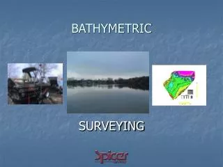
Total Hydrographic are your certified Hydrographic Surveyors and Marine Mapping/GIS professionals. Bathymetry is the study and mapping of the sea floor. Bathymetric surveys allow for us to measure the depth of a body of water as well as map its underwater features.<br>

E N D
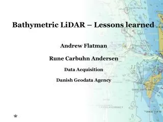
How We Conduct Bathymetric Surveys? Total Hydrographic are your certified Hydrographic Surveyors and Marine Mapping/GIS professionals.
Bathymetry is the study and mapping of the sea floor. Bathymetric surveys allow for us to measure the depth of a body of water as well as map its underwater features. Bathymetic data is used in a range of applications, some include: • Hazard Detection • Safety of Navigation and Nautical Charting • Determiniation of Maritime Boundaries • Environmental Management, including developing baseline data • Research for Coastal and Marine Processes • Installation of Maritime infrastructure
At Total Hydrographic we gather bathymetric data in a variety of different methods and equipment. Our Multibeam Echosounder (MBES) is a full bathymetric seafloor coverage system. The MBES system emits 512 beams in a fan shape beneath the boat allowing the system to capture up to 200,000 soundings per second and ensure maximum coverage of the seafloor. Our Single Beam Echosounder (SBES) on the other hand, captures data using a single beam directly below where the system is mounted. Single Beam surveys are at a pre-defined line spacing; for example 2m, 5m, 20m. The size of these intervals determines the final resolution of the survey.
Multibeam survey and Single Beam surveys are each best suited to their own individual set of circumstances, locations and client needs. Total Hydrographic can help by recommending a particular solution specific to your own requirements and priorities as both MBES and SBES have their individual strengths and capabilities. Hazard Detection and Debris Clearance
Hazard Detection and Debris Clearance is a necessary support service for any organisation that manages a body of water. It is crucial to identify new or existing obstructions from natural or anthropogenic events, and to determine safe recreational use for the public. Our hydrographic survey team can offer bathymetric and side scan surveys that utilise in house R2Sonic Multibeam Echo Sounders (MBES) and/ towed or hull mounted Side Scan Sonars (SSS) to locate and identify hazards & debris. We can operate these systems concurrently or separately, to scan large swaths of river, sea, lake or dam beds in an efficient manner and provide detailed data on the hazards present in a format that best suits you.
Total Hydrographic Total Hydrographic maintains this equipment and capability in house and as a result, mitigates the risk of project delays. From the results of your survey, all hazards and debris will be located and identified, allowing you to be confident in what lies below the waterline. Under Keel Clearance
Effective Under Keel Clearance management is a system put in place by Port and Harbour Authorities that mitigate the risk of a vessel’s hull running aground on the ocean floor. Regular Bathymetric and Hydrographic Surveys are undertaken to ensure that vessel navigation in shipping channels, berths and fairways are not put at risk. A keen understanding of depths within Port and Harbour waters is a great tool for making informed decisions on asset management, resource allocation and dredging programs.
Contact Us • Website: https://www.totalhydrographic.com.au/ • Phone - (03)93959897 • Email- info@totalhydrographic.com.au • Address: 14/75 Endeavour Way, Sunshine West, VIC 3020, Australia Opening Hours • Monday – Friday: 8am – 5pm • Sunday: Closed