Download
1 / 42
420 likes | 427 Views
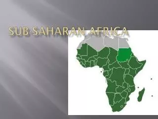
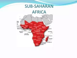
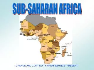
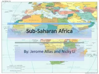
PHYSICAL CHARACTERISTICS Sub-Saharan Africa. The area SOUTH of the Sahara Desert. “Sub- Saharan”Africa. http://www.towson.edu/users/dherman/wrg/ssafrica.htm. Population – Population refers to the total number of people living in a country.

E N D
The area SOUTH of the Sahara Desert. “Sub-Saharan”Africa http://www.towson.edu/users/dherman/wrg/ssafrica.htm
Population – Population refers to the total number • of people living in a country. • Use pages 520-525 • Nigeria – 162 million • Ethiopia – 87 million • Democratic Republic of Congo – 68 million • Tanzania – 46 million • Kenya – 42 million I used Junior Scholastic 2012 for these stats!
Land Size – Land size refers to the total square miles • or kilometers of a country. • Use pages 520-525 • Sudan – 967,000 sq. miles • Democratic Republic of Congo – 905,000 sq. miles • Chad – 495,000 sq. miles • Mozambique – 305,000 sq. miles • Madagascar – 227, 000 sq. miles
GDP – Gross Domestic Product refers to the • total value of goods and services • produced in a country in one year. • South Africa - $10,700 • Gabon - $14,500 • Botswana - $14,000 I used Junior Scholastic 2012 for these stats!
The equator runs through the continent of Africa. Which countries does it run through? Use your Nystrom maps to answer: From East to West 1. Somalia 2. Kenya 3. Uganda 4. Democratic Republic of Congo 5. Republic of Congo 6. Gabon Label these on your map!
The African continent is actually one large plateau. Along the eastern side of Africa is the Great Rift Valley, an area where two tectonic plates are moving away from one another. Along this rift are several lakes, Lake Tanganyika and Lake Victoria. and huge cliffs called escarpments. When rivers flow over these cliffs they form waterfalls. Another name for these waterfalls are known as CATARACTS.
Plateaus and Escarpments Escarpment - steep slopes with nearly flat plateau on top. • These kept people OUT of interior Africa.
When rivers flow over these cliffs they form waterfalls. What is another name for these waterfalls? Cataracts! What impact do these cliffs and waterfalls have on the rivers in Africa? Rivers can not be used for transportation and trade!
Click on the link below to watch a video on Mt. Kilimanjaro! Mount Kilimanjaro http://video.nationalgeographic.com/video/tanzania_kilimanjaro THIS is why we see snow at the Equator!
Lake Victoria Lake Tanganyika World’s longest freshwater lake. Africa’s largest lake.
The interior countries of Africa are landlocked. This means they have no coastlines. Use your map on page 517 to name three landlocked countries:
African rivers This river flows more than 4,000 miles through Uganda and Sudan and into Egypt. More than 95% of Egypt’s population lives along this river. Which river is this? Nile River
African rivers This river flows more than 2,900 miles forming a large network of waterways. But a series of 32 cataracts make large portions of this river impassable. Congo River
African rivers This river provides hydroelectric power and is home to an enormous waterfall along the Zambia/Zimbabwe border. Zambezi River Victoria Falls
The Zambezi River is useful for hydroelectric power. Can you name the huge waterfall on this river? Victoria Falls
A F R I C A N C L I M A T E • There are similar climate patterns found at the north and the south of the continent EXCEPT that they’re... reversed and mirrored ---WHY??
Climate Regions of Africa Tropical Wet – The area located at or near the equator. Tropical Wet and Dry - These areas are known as savannas. Many of Africa’s nature preserves and national parks are found here. The Serengeti! ( Page 578) Semi-Arid(Steppe) - The region directly south of the Sahara Desert is Semi – Arid. Known as the Sahel! Arid(Desert) – at the extreme north and south of the continent. List the deserts: Namib Desert Kalahari Desert Sahara Desert (getting larger due to desertification)
The African continent is rich in mineral resources. Can you name any? #25 on HW Iron Ore Used for steel Chromium All found in Zimbabwe! Chromium in South Africa too. Uranium Used for nuclear power Found in Zambia & Zimbabwe Copper Used for wiring, pipes, and roofing. Gold Used for jewelry, electronics, and investing. Found in South Africa. Diamonds
The coastline of Africa is very smooth and does not have natural harbors, or safe places for ships to harbor. Is this a positive or negative influence on trading? Negative!
The soil in the rainforest areas is not fertile. Crops can be grown on rainforest soil for only a few years. What type of agriculture do you think they use? Slash & Burn
The Afar Depression (also called the Afar Triangle) is a geological depression in the Horn of Africa, where it overlaps Eritrea, the Afar Region of Ethiopia, and Djibouti.
In September, 2005, a team of geologists from the University of Addis Ababa had scarcely stepped out of their helicopter onto the desert plains of Ethiopia when the ground under their feet shook violently. Before they could scramble back into the helicopter, numerous crevices split open and raced toward them like zippers opening up in the Earth. It took mere seconds. When the ground stopped shaking, the geologists knew they had witnessed history. This was the beginning phases of the birth of an ocean...right in the midst of the African continent. A human lifetime is far too short to witness an epic event such as the birth of an ocean, river or sea, the rise of a mountain or the opening up of a valley. Yet this is precisely the process which is taking place in northern Ethiopia in a region called the Afar Triangle.
This is what Africa will look like in about one million years. Notice that the Persian Gulf does not exist and the horn of Africa is a separate peninsula. This is caused by the movement of tectonic plates.