Download
1 / 43
510 likes | 1.01k Views
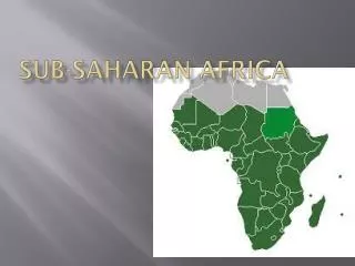
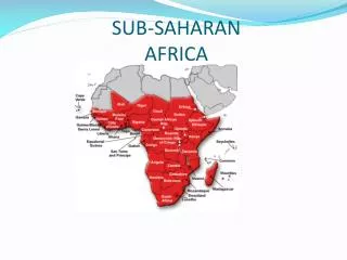
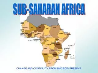
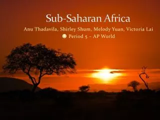
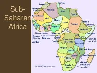
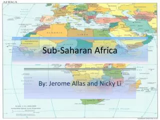
Sub-Saharan Africa. Physical Geography. Highlight the Sahara Desert on your map. Physical Geography. Highlight the Namib Desert and Kalahari Desert on your map. Deserts. 1. Sahara Desert

E N D
Physical Geography Highlight the Sahara Desert on your map.
Physical Geography Highlight the Namib Desert and Kalahari Desert on your map.
Deserts 1. Sahara Desert Only 25% of the Sahara is covered in sand. The rest is gravel-covered plains, rocky plateaus and volcanic mountains. Temperatures can range from 5° F to 136oF, and the average rainfall is 3 inches per year.
2. Kalahari Desert – 100,000 sq. miles, located in Botswana, Namibia and South Africa. It is the 14th largest desert in the world. 3. Namib Desert – The world’s oldest desert. Located in Namibia and Angola, the desert climate causes unpredictable annual rainfall.
Desert facts • Great desert transportation is via camel, which can go for up to 17 days without water. • Aquifers, huge stores of underground water, can be found throughout the desert. • Randomly, water comes to the surface in the desert…which is called an oasis.
Physical Geography Highlight the Sahel on your map.
Grasslands • Sahelalong the southern edge of the Sahara: • Large grassland • Overgrazing • Subsistence farming prevalent • Semi-arid climate 2. Serengeti Plains of northern Tanzania contain large numbers of animals such as wildebeests, gazelles, and zebras.
Physical Geography Label the Congo Rainforest on your map.
Rainforest • The Congo Rainforest sits at the equator in the area of the Congo Basin in Central Africa. • One square acre of rain forest can contain almost 100 different kinds of trees, and home to hundreds of species of birds. • Most animals live in the uppermost layer of branches, almost 150 feet above the ground…called the canopy.
Physical Geography Label the Great Rift Valley on your map. Great Rift Valley
Rift Valleys • Great Rift Valley-thin valleys. The eastern part of Africa is pulling away from the rest of Africa from Jordan to Mozambique. The valley is created by the divergent moving tectonic plates.
Label the water features to the left in blue:Also, why do you think the lakes are located on the eastern side of the continent?
Mountain • Most mountains are volcanic • Highest mountains include Mount Kenya and Mount Kilimanjaro on the eastern side of the continent.
Natural Resources Africa is rich in natural resources which include: • Precious metals Examples: Cobalt -is used in high-grade steel for aircraft and industrial engines Chromium- used to manufacture stainless steel. Gold Platinum
Oil • Natural Gas Crude Oil
Gold • Gemstones Star of Africa World’s Largest Diamond 530.20 Carats Crown Jewels of England, Royal Specter
Freshwater • Arable Land
Human-Environment Interaction Examples • Overgrazing the grasslands of the Sahel can cause the loss of grasslands and the spreading of the desert also called desertification.
Aswan High Dam • Completed in 1970, it was built to control the flood waters of the Nile. • Lake Nasser is the artificial lake created behind the dam that stretches for nearly 300 miles. The dam gives farmers a regular supply of water, and holds the Nile’s flood waters at bay.
Aswan High Dam cont. • Forced relocation of people • Ancient treasures flooded by Lake Nasser • Decreased fertility of soil • Malaria rates have increased • Millions of gallons of fresh water evaporates each year.
Human adaptations and modifications to the Rainforest include: • Slash-and-burn agricultural
3 tropical latitudes define location of the region: • Tropic of Cancer • Tropic of Capricorn • Equator Highlight and Label the tropical latitude lines.
The two biggest influences on the climate of Africa are: • Latitude • Wind Patterns
Migration Patterns • The Sahara Desert limits the migration of people from the northern part of Africa to the southern portions of the continent.
Some farmers are working hard to farm what they can in the desert. However, they can not grow enough food so a countries with mostly arid regions have a higher debt ratio because they have to import more food to their country. Farm here is tending to his grapevines. Pesticide is not needed because it’s too hot for bugs.
People who rely on subsistence farming will survive on less food per day then people in countries like the U.S. which are market-driven.
Economy and Culture • Women in rural areas are usually involved in subsistence farming. • The majority of Sub-Saharan countries engage in these primary economies.
Political Power and Population The more of one type of people there are in a country over the other, the more political power the majority population has over the minority population in governing decisions. Upper Volta Region near Burkina Faso
Review Time! • People in rural Africa most commonly work in ____________farming. Subsistence
2. Underdeveloped countries have most jobs in the _______________sector of the economy. Primary
3. Where are the majority of forests found in Africa? (N,S,E,W or Central?) Central
4. Describe the Sahel: • Large grassland • Overgrazing • Subsistence farming prevalent • Semi-arid climate
12. How were the rift valleys in Sub-Saharan Africa formed? Tectonic forces
14. What physical feature limits migration between the Northern and Southern portions of Africa? Sahara Desert
16. What natural resources are important in Sub-Saharan Africa? • Oil • Natural Gas • Fresh Water • Arable Land • Gold • Precious Metals
25. How was the Namib Desert formed? Climatic forces
26. Using the rainforest for timber, medicine and food would be an example of _________________ - ______________ interaction. Human-Environment Interaction
27. What are the primary influences on the climate of Africa? • Latitude • Wind Systems
28. If the people of Sub-Saharan Africa are no longer able to grow their own food (subsistence farming), how will they get food? Import it
Clean Up: • Put the glue and scissors in the appropriate place. • Put the marker and map pencils in the appropriate place. • Slack your group maps on top of each other so that I can roll them up together. • Pick up stray paper off the floor and throw it away. • EVERYONE MUST BE SEATED SO WE CAN RELEASE.