Download

1 / 13
130 likes | 258 Views
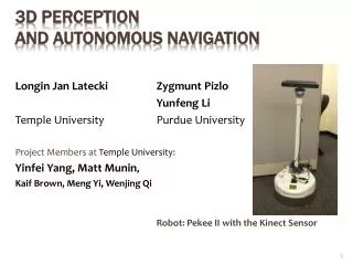
II. Signal Processing And Application. Terrain Classification Based On Structure For Autonomous Navigation in Complex Environments. Duong V.Nguyen 1 , Lars Kuhnert 2 , Markus Ax 2 , and Klaus-Dieter Kuhnert 2 1 Research School MOSES, University of Siegen, Germany

E N D
II. Signal Processing And Application Terrain Classification Based On Structure For Autonomous Navigation in Complex Environments Duong V.Nguyen1, Lars Kuhnert2, Markus Ax2, and Klaus-Dieter Kuhnert2 1Research School MOSES, University of Siegen, Germany 2Institute for Real-Time-Learning Systems, University of Siegen, Germany
Outline • Introduction • Methodology • Graph-Cut • Feature Extraction • Neighbor Distance Variation Inside Edgeless Areas • Conditional Local Point Statistics • Support Vector Machine • Experiments and Results • Conclusion • Reference
Introduction What is unmanned system ? autonomous operation Or: complete task without direct control by a human • Bomb-defusing • Vacuum cleaning • Forest exploration …etc Why do we need Terrain Classification? • Variety of terrain • Avoid obstacles • Maintain rollover stability • Manage power …etc AMOR: 1st prize of innovation awards, ELROB-2010, Hammelburg, Germany.
Introduction Recent 3-D Approaches PMD camera Laser Scanner Stereo Cameras
Problems: Beam scattering effects Only used for static scenes Object detection purely based on structure is not really robust in some scenes. Solutions: Local points statistic analysis (Graph-Cut for depth image segmentation) Gaussian Mixture Model using Expectation maximization Combining 3-D and 2-D features Why should Laser Scanner be used? Introduction Advantages: • Stable data acquisition • High precision • Affordable
Methodology Terrain Classification System Diagram 3-D point cloud SVM Classifier 3-D Features Depth image segmentation ROI extraction
Methodology Graph-Cut Technique Internal difference Component difference Un-Joint Condition:
Methodology Feature Extraction 3-D point cloud SVM Classifier 3-D Features Depth image segmentation ROI extraction
Methodology Support Vector Machine 3-D point cloud SVM Classifier 3-D Features Depth image segmentation ROI extraction
Conclusion • Graph-cut Technique For Segmentation • Neighbor Distance Variation Feature • Conditional Local Point Statistics Feature Future work: • 2D&3D Calibration • Color Features
References [1] David Bradley, Ranjith Unnikrishnan, and J. Andrew (Drew) Bagnell, Vegetation Detection for Driving in Complex Environments, IEEE International Conference on Robotics and Automation, April, 2007. [2] Matthias Plaue, Analysis of the PMD Imaging System, Technical Report,Berlin, Germany, 2006. [3] Duong V.Nguyen, Lars Kuhnert, Markus Ax, and Klaus-Dieter Kuhnert,Combining distance and modulation information for detecting pedestrians in outdoor environment using a PMD camera, Proc. on the 11th IASTED International Conference Computer Graphics and Imaging, Innsbruck, Austria, Feb-2010. [4] John Tuley, Nicolas Vandapel, and Martial Hebert, Technical report CMU-RI-TR-04-44, Robotics Institute, Carnegie Mellon University, August, 2004. [5] J. F. Lalonde, N. Vandapel, D. F. Huber, M. Hebert, Natural Terrain Classification using Three-Dimensional Ladar Data for Ground Robot Mobility, Journal of Field Robotics, Volume 23 Issue 10, Pages 839 -861, Oct-2006. [6] Pedro F. Felzenszwalb, Daniel P. Huttenlocher , Efficient Graph-Based Image Segmentation, IJCV, Volume 59 Issue 2, Sept-2004. [7] R. Willstatter and A. Stoll, Utersuchungenuber Chlorophyll, Berlin: Springer, 1913. [8] Anguelov, D., Taskar, B., Chatalashev, V., Koller, D., Gupta, D., Heitz, G. Ng, A.,Discriminative Learning of Markov Random Fields for Segmentation of 3D Scan Data, ICVPR, San Diego, CA, USA, 2004. [9] Huang, J., Lee, A. Mumford, D. Statistics of Range Images, ICVPR, Los Alamitos, CA, USA, 2000. [10] Rasmussen, C., Combining Laser Range, Color and Texture Cues for Autonomous Road Following, ICRA, Washington, DC, USA. [11] N. Vandapel and M. Herbert, Natural terrain classification using 3-d ladar data, in IEEE Int. Conf. on Robotics and Automation (ICRA), 2004. [12] C. Cortes, V. Vapnik, Support vector networks. Machine Learning, vol.20, p. 273-297, 1995. [13] Quinlan, J. 1993. C4.5: Programs for Machine Learning. Morgan Kaufmann: San Mateo, CA. [14] Guoqiang Peter Zhang, Neural Networks for Classification: A Survey, IEEE Trans. on Systems, Man, and Cybernetics, Vol. 30, No. 4, Nov-2000. [15] Y. Freund and R. E. Schapire, A decision-theoretic generalization of on-line learning and an application to boosting, Journal of Computer and System Sciences, no. 55. 1997. [16] Bilmes, J., A Gentle Tutorial on the EM Algorithm and its Application to Parameter Estimation for Gaussian Mixture and Hidden Markov Models, Berkeley, CA, USA: The International Computer Science Institute, University of Berkeley, Technical Report, 1997. [17] Baudat. G and Anouar. F Kernel-Based Methods and Function Approximation, International Joint Conference on Neural Networks, USA, pp. 1244 - 1249, 2001.