Download
1 / 30
310 likes | 466 Views
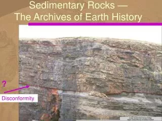
Holocene Sedimentary History of Chilliwack Valley, Northern Cascade Mountains. Jon Tunnicliffe & Michael Church UBC Geography GSA, October, 2008. Objectives. to determine the post-glacial sediment budget

E N D
Holocene Sedimentary Historyof Chilliwack Valley,Northern Cascade Mountains Jon Tunnicliffe & Michael Church UBC Geography GSA, October, 2008
Objectives • to determine the post-glacial sediment budget • to establish connectivity and changing rate of sediment yield with scale in the paraglacial sediment cascade • to develop a mobile-bed sediment transport model that simulates the topographic and textural evolution of the valley mainstem
Some consequential technical issues • can we adequately reconstruct an end-Pleistocene initial condition? • can we account for variable system forcing, or do we need to? • can we model 13 000 years of sedimentary system dynamics?
Chilliwack Lake Lower valley Foley Chilliwack Lake Chipmunk Sumas Valley Liumchen Tamihi Slesse Nooksack Valley Upper valley Mt. Baker
low order drainage Upper valley
Sediment yield from low-order drainage Church and Slaymaker, 1989. British Columbia; Decadal timescale Chilliwack R debris flow fluvial dominance dominance
Lacustrine Zone Tamihi Moraine ? Outwash Delta Net Deposition
Lower valley sediment budget millions m3
Vedder Fan: endpoint deposit North Mapping from Levson et al. 1995
Holocene sediment routing We route sediments through the lower valley, from Foley Creek to Vedder Crossing (31 km distance) the exercise includes initial evacuation of the Pleistocene valley fill
Modelling criteria Known conditions: • initial and final profiles • sediment budget (mass constraint) • sediment fining gradient • subsurface sand content • lithological composition Model parameters: (selectable) • abrasion rate • water discharge • sediment feed rates • feed sediment calibre
Valley Width = Wv Active Channel Width = Wc Sinuosity = Ω Abrasion = Ã 1D modelling framework finite difference formulation Δx Wc Wv Parker (1990)
Transport function:Wilcock and Crowe formulation Sand fraction effect Percent Sand (surface) Hiding function Wilcock and Crowe (2003)
Bed texture and rates of abrasion β = 0.015 β = 0.030 Percent coarser
Model stratigraphy Knickpoint 450 400 Upper Sandur 350 Delta Front 300 Modern Profile Lacustrine Beds Elevation (m) 250 200 Moraine 150 Fluvial Gravels + Moraine 100 Major Tributaries 50 Tamihi Cr 0 35 25 20 15 10 30 5 0 Distance (km)
Model solution strategy • we have a number of adjustable system parameters • therefore, we do not expect a unique solution (i.e., a unique set of parameters that produces the present-day morphology and sedimentology) • our lack of knowledge of Holocene variations in system forcing is an important reason for that • therefore, we attempt to gain insight by finding a parametric solution space that reasonably satisfies the current system configuration
Evolution of the bed 300 450 280 Reconstructed Profile 260 400 Elevation (m) 240 350 220 300 200 0 1 2 3 4 Modern Profile Model Time Step (x105) Elevation (m) 250 200 150 100 50 0 35 25 20 15 10 30 5 0 Distance (km)
Model Runscontemporary long profile is the primary criterion for model fit Reference Runs (Circled) Qw = 225 m3/s Qs = 1x Budgeted Quantities α = 0.02 km-1 +128 mm Load = +3% Sand Load (-4 mm) = - 5%
Cumulative post-glacial sediment yieldVedder fan data 65 000 m3 bulk rate
Perspective • Much of sediment delivered from steepland headwater sources remains in storage • Glacial sediments continue to influence patterns of sediment yield • Many aspects of long-range fluvial evolution can be captured in a 1D framework • The evolution of degrading river systems can be modelled but remains an important challenge
Conclusions • we can reconstruct an end-Pleistocene condition that is sufficiently accurate for studying the Holocene sedimentary history • It appears that a detailed knowledge of variable system forcing is not necessary for first order reconstructions • we can constrain the Holocene sedimentary history relatively narrowly, but we cannot (yet) arrive at a complete and precise reconstruction
Acknowledgements • Ron Clowes and Phil Hammer, EOS UBC • Janet Demarcke, City of Chilliwack • Randy Enkin and Judith Baker, GSC-Pacific, Sidney • Natalie Helmstetter, BJ Kelly and Ted Hickin, SFU Geography • Rob Huggins, Geometrics, Sunnyvale CA • Vic Levson, BCGS, Victoria • Brian Menounos and Melanie Grubb UNBC • Bruce Thomson, BC MWLAP, Surrey • Murray Hicks and Jeremy Walsh,NIWA, Christchurch • NSERC Research Grant to M. Church • UBC Graduate Scholarship to Jon Tunnicliffe In the Field: • Sydney Kjellander, Dason Commodore, Kathryn Black • André Zimmermann, Dave Campbell, Jason Rempel, Brett Eaton, Josh Caulkins, Bonnie Smith, Kristiann Allen
Chilliwack Lake Radium Creek Paleface Creek Centre Creek US Border Depot Creek Little Chilliwack Creek Bear Creek
Depot Cr fan Paleface Cr fan Holocene fill Last glacial deposits Preglacial valley Chilliwack Lake
(a) Chilliwack Lake sedimentation (a) rate, based on 5 cores and (b) volume based on seismic stratigraphy (b)