Download
1 / 13
130 likes | 239 Views
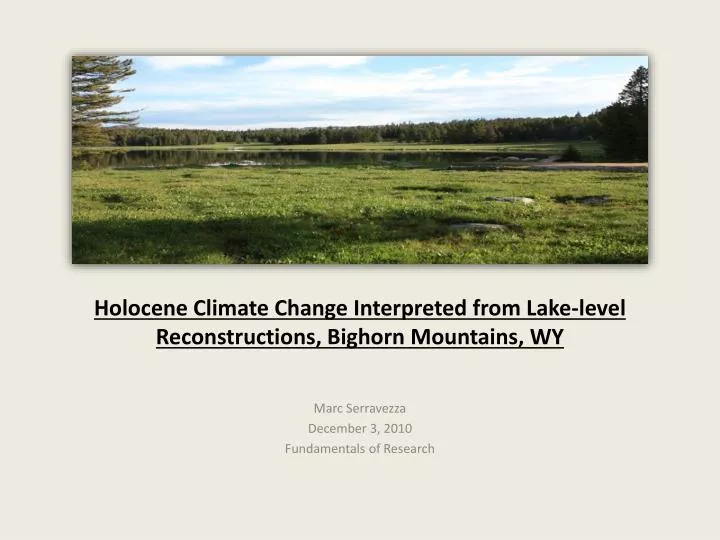
Holocene Climate Change Interpreted from Lake-level Reconstructions, Bighorn Mountains, WY. Marc Serravezza December 3, 2010 Fundamentals of Research. Outline for today’s talk. Motivation for research: Why study Holocene climate change?

E N D
Holocene Climate Change Interpreted from Lake-level Reconstructions, Bighorn Mountains, WY Marc Serravezza December 3, 2010 Fundamentals of Research
Outline for today’s talk • Motivation for research: Why study Holocene climate change? • Brief background: What do we need to estimate paleolake-levels? • Study site: the Bighorn Mountains! • Methods and Results: What we will produce and how we will do it.
Motivation/Relevance of ResearchWhy study Holocene climate change? Retrieved from www.usgs.go v • Water resource planners are very interested in quantifying the possible effects of future climate changes on their state’s or municipality’s water supply. • By studying contemporaneous changes to lake levels caused by climate changing events during the past, we can attain a better understanding of the effect that a similar event would have on our water supply in the future.
BackgroundWhat do we need for estimating paleolake-levels? We need a lake with the following characteristics: • Small lake (<50 hectares) located at the outlet of a small catchment. • Shallow and wide (<10 m deep). • Minimal surface water inputs/outputs; a ‘quiet’ hydrology dominated by groundwater flow. • Solid, homogenous bedrock under basin sediments. These characteristics help us isolate climatic inputs to lake level change from local inputs, as well as…
…allow for the preservation of lacustrine facies: Specifically, we need to observe nearshore lacustrine facies: • Forms in the shallow waters near the lake’s current shoreline, due to wave action and currents. • Contains relatively coarse sediment, minimal organic content, and a higher bulk density. • Contains macrofossils unique to shallow freshwater environments; e.g. nymphaea(lily pads) and alisma(water weeds). • Relatively low sedimentation rate. • Facies should extend nearly continuously around the lake.
Proposed Study Sites 2 1 3 4
Proposed Research/Expected Results Here are the results that we expect to generate during completion of this project: • 3-D lake basin profiles, using ground penetrating radar (GPR), for both Lower Paint Rock Lake and Trigger Lake (Lower Medicine Lodge Lake and/or Bear Lake if alternate sites are selected). • Nearshorefacies correlations along a transect for each lake identifying past landward or lakeward shifts of the shoreline. Facies identification will be based on laboratory analysis for grain size distribution, organic content, bulk density, macrofossil content, and sedimentation rate. • A time-line of lake-level changes throughout the Holocene for each lake. • Analysis of contemporaneous changes in lake-levels with previously studied sites within the Northwest Rocky Mountain region, indicating past climate changing events during the Holocene.
1) GPR profiles Shuman (2009) • Light and dark contrasts indicate boundaries between sediments with different dielectric constants. • Thickness of bands gives an idea of sedimentation rate • Light colored bands may correspond to nearshorefacies. • We can generate 3-D GPR profiles fairly quick (within 1 to 2 days), and thus analyze them immediately in the field for: • Lake basin characteristics • Potential nearshorefacies and onlap/offlap sequences • If the GPR images look good, we can continue with collecting sediment cores along a transect on that lake. • If the GPR images look poor, we can move on to one of the alternate lake sites.
2) Analyses of Sediment Cores / NearshoreFacies Correlation Transects of sediment cores will be collected with a 70mm piston corer, and taken back to the Shuman Lab for analyses… Nearshore lacustrine facies will be identified based on: Coarse sediment content (>63µm) – measure wt. % of subsample (+/- 0.1%) after wet sieving and drying. Organic content – measure % loss on ignition (+/- 0.1%). Bulk density – measured by gamma ray attenuation (+/- 0.1g/cm3) Sedimentation rate – measured by radiocarbon dating of sedimentary charcoal. Macrofossils – identification of plant macrofossils unique to shallow freshwater environments.
Now, with the nearshorefacies clearly identified… Courtesy of J. Marsicek …we can correlate the facies along our transects, extending from the current shoreline out to the lake’s depocenter. The final correlation produced for each lake will indicate both magnitude and direction of past shifts in the lake shoreline. It should agree fairly well with observations from the 3-D GPR profiles…
3) Time-line of Holocene lake-level changes Each shift of the shoreline corresponds to a change in lake-level. We can then bracket the time that these changes occurred using radiocarbon dating of sedimentary charcoal (ubiquitious in western lacustrine sediments). Thus, the end result is a Holocene time-line of lake-level changes, produced for each lake.
4) Contemporaneous changes in lake-level with previously studied sites Analyzing for past climate change during the Holocene Previously studied sites: 1) Foy Lake, MT (Shuman et al., 2009); 2) Park Pond, WY (Lynch, 1988); 3) Bear Lake, ID (Rosenbaum, 2010); 4) Long Lake, WY (Shuman et al., in progress); 5)Hidden Lake, CO (Shuman et al., 2009) 1 We will isolate climatic inputs to lake-level change from local inputs by correlating with multiple lakes in different watersheds, but within the same climate region. This should provide us with an improved understanding of climate change within Wyoming during the Holocene. 2 3 4 5
References Lynch, E.A. (1998). Origin of a park-forest vegetation mosaic in the Wind River Range, Wyoming, Ecology, 79,1320-1338. Rosenbaum, J.G. (2010). Paleo-lake levels of Bear Lake (Utah/Idaho): a record of Holocene aridity. 2010 GSA Denver Annual Meeting (31 October – 3 November 2010). Shuman, B., Henderson, A.K., Colman, S.M., Stone, J.R., Fritz, S.C., Stevens, L.R., Power, M.J., and Whitlock, C. (2009). Holocene lake-level trends in the Rocky Mountains, U.S.A. Quaternary Science Reviews, 28,1861-1879.