Download
1 / 24
240 likes | 451 Views
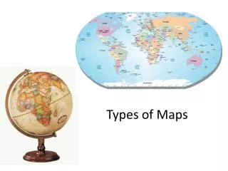
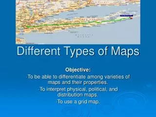
Types of Maps. Vocabulary Words. Geography — The study of earth Cardinal directions — North, south, east, west Latitude — North or south of the earth’s equator, in degrees Longitude — East or west of the prime meridian, in degrees Hemisphere— Half of the earth Parallel—

E N D
Vocabulary Words • Geography— • The study of earth • Cardinal directions— • North, south, east, west • Latitude— • North or south of the earth’s equator, in degrees • Longitude— • East or west of the prime meridian, in degrees • Hemisphere— • Half of the earth • Parallel— • Line of latitude • Meridian— • Line of longitude
vocabulary words • Scale : a measuring line that helps find distance on the map. • Distortion: loss accuracy • Geographic information System: computer based systems that provide information about locations. • Projection : a way to map Earth on a flat surface. • Compass rose: a diagram that shows directions. • Key: a part of the map that explains the symbols.
How is the earth divided? • The earth is divided by lines of latitude and lines of longitude. • What is the 0 degree line of latitude? • The Equatoris an imaginary line that circles the earth midway between the North and South Pole. • The Equator divides the world into 2 halves or hemispheres. (Northern and Southern)
What is the 0 degree line of longitude? • The Prime Meridian which runs through Greenwich, England. • Lines of longitude run from the North Pole to the South Pole and are measured in degrees East and West (of the Prime Meridian).
Parts of a Map • A. Compass rose shows direction • B. Scale bar shows how distances on the map compare to actual distances • C. Key, or legend, explains the symbols and shadings on the map • D. Locator Globe shows on a globe the location of the area covered by the map • Title the title tells you the subject of the map.
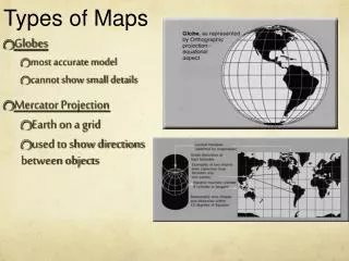
Maps and Globes • A. Globes • 1. Globes show continents and oceans much as they are • 2. Globes can’t show smaller details • B. Maps • 1. Flat maps can’t show Earth without some distortion • 2. Aerial photographs and satellite images provide information for maps, but can’t show hidden features • 3. Geographic Information Systems use computers to link information to locations
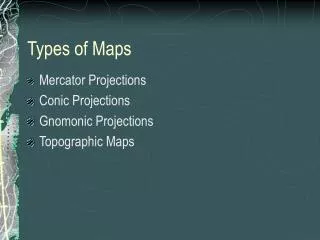
Map Projections • Map Projections • A. Mercator Projection • 1. Helped early sailors navigate • 2. Areas near the poles look bigger than they are • 3. It shows correct shapes but not true distances or sizes • B. Equal Area Projections • 1. Shows correct size of landmasses • 2. Shapes are altered and straight lines on earth may be curved on the map
Projections Cont. • C. Robinson Projection • 1. Considered the best world map available • 2. Distances, sizes, and shapes are quite accurate • 3. There are some distortions around the edges of the map • D. Other Projections • 1. Some are useful for showing small areas but not the whole world • 2. Some are good for specific purposes, such as planning a flight route
Do Now Review Activity • Go to pages FL 51; FL 53; FL54;FL55; FL56, FL 57; FL 59 • Answer the practice your geography skills questionsYou need to copy the questions in Cornell Note Style
Do Now Review Activity • Go to pages FL 51; FL 53; FL54;FL55; FL56, FL 57 • Answer the practice your geography skills questionsYou need to copy the questions in Cornell Note Style
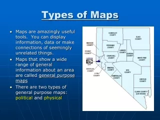
Political Maps • Show political, or human made, divisions of countries or regions.
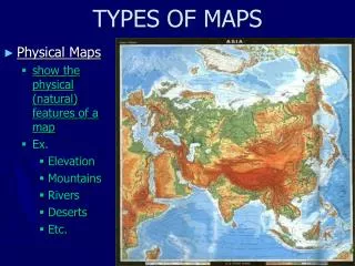
Physical Maps • Shows the physical features of an area, such as its mountains and rivers. • Colors used in physical maps are : • Brown or green for land • Blue for water • Colors may be used to show elevation.
Contour maps • Shows elevation • Have contour lines for each major level of elevation. • The most everyday use of the term is in cartography. A contour map (topographic map) uses contour lines (often just called a "contour") to join points of equal elevation (height) and thus show valleys and hills, and the steepness of slopes.
Land and Resources Maps • Shows ways of life, such as farming, manufacturing or herding. • Symbols stands for the different types of natural resources found in or on the land
Geological maps • Explains the structure of the earth and how it is believed to have been formed.
Population density maps • Uses colors to show population density, or average of people living in a square mile.
Climate map • Summarize information about an area’s rain, snow, and temperatures through the year. • Geographers divided the earth into four major climate regions; • Tropical • Dry • Mid-latitude • High latitude