Download
1 / 8
80 likes | 276 Views
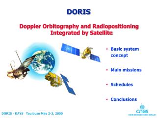
DORIS Mission. Main mission of DORIS, Doppler ORbitography Integrated by Satellite, is to provide to various users satellite Ephemerides Integrated real-time 3D navigator on-board, one block time/position/velocity/quality every 10 seconds

E N D
DORIS Mission • Main mission of DORIS, Doppler ORbitography Integrated by Satellite, is to provide to various users satellite Ephemerides • Integrated real-time 3D navigator on-board, one block time/position/velocity/quality every 10 seconds • DORIS Doppler data are processed off-line for precise orbits • Real-time time-tagging is done on-board on BCP2/4 pulses
Instrument Performances • DORIS Doppler data residuals against MOE orbit are 0.55-0.60 mm/s • Navigator accuracy is : • 20-30 cm radial RMS • Less than 1 meter 3D RMS • Performances are better than specifications (10 m RMS per axis) • DORIS Datation Accuracy is OK (on BCP2 pulse following a BCP4), • accuracy better than 15 microseconds, comparison of navigator orbit with ground orbits (MOE, POE including laser data), one microsecond error means 7mm along-track
DORIS Conclusions • Functioning and Performances of the DORIS instrument are fully nominal • Operations of DORIS are routine • DORIS Performances are better than specifications
Global OVT work • Global Orbit Validation Team work results from: • contributions from the CNES POD team in charge of the operational Precise Orbit Determination for ENVISAT • contributions from the other experts groups in Europe and in the US, benefiting from a synergy with Jason-1
POE results from CNES POD team • Mixed « DORIS + laser » POE have been generated for several orbital arcs: • Last 7-day arc of ENVISAT cycle 6 • All arcs of cycle 7 • First arc of cycle 8 • All available DORIS doppler data, all auxiliary information, and all orbit ephemeris made available to the OVT • Estimated POE accuracy is of the order of 3 to 4 cm for the radial component
Recent comparison figures from DEOS • One example of worst case: the Mid-July orbit arc • RMS differences between DEOS and CNES orbits 7 cm in the radial direction90 cm in the along-track direction • Explainations: combination of :* a sudden increase in solar activity,* gaps in the DORIS tracking, * and differences in SLR editing at DEOS and CNES • Example of Best case: Arc from July 12 to July 15 • Mean difference DEOS -CNES better than 0.5 cm in radial direction • RMS differences of the order of 1.5 to 2.5 cm • Very good 3D consistency at the level of 4.5 to 6.0 cm RMS
OVT overall conclusion • Present figures that may be agreed: • MOE: radial: better than 5 cm • « not tuned » POE: radial: better than 3 to 4 cm • Very good agreement with DEOS, GFZ and ESOC