Download
1 / 6
80 likes | 275 Views
LATITUDES and LONGITUDES. Mr. Hasan Raza Grade X The City School Gulshan Boys Campus Karachi. Physical Geography. Coordinate System.

E N D
LATITUDES andLONGITUDES Mr. HasanRaza Grade X The City School Gulshan Boys Campus Karachi • Physical Geography
Coordinate System • The world map with Latitude and longitude brings the useful information on the coordinates of some of the important places on the world, so that one can learn about their exact positions as well as their time zones. • The coordinates are the angles, which are measured in degrees - "minutes of arc" and "seconds of arc".1 Degree = 60 minutes of arc1 Minute = 60 seconds of arc
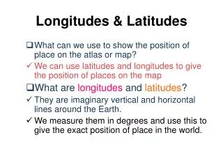
Importance of coordinate System Latitude and Longitude are two numbers or coordinates used to plot any location on this Earth. One can know about the exact position of a place through latitude and longitude. Latitude and longitude also determine the time zone of the certain place, which is calculated on the basis of its latitude and longitude.
Effect on Time • The Earth rotates around its axis by around 15 degrees per hour. As a result, when some parts of the world see the sun right at the mid-sky, there might be midnight in some other parts of the world at the same time. Therefore, when the longitudes changes as you move from one place to another, the relative position of sun keeps changing. It calls for creation of different time zones. • Longitudes can be from 0° to 180° east on one side and 180° west on the other. Every degree of change of longitude calls for 4 minutes of time adjustment. If you move towards east, you need to add the time with the existing one. Similarly, you need to subtract it from the existing time if you move towards west. The countries which are large in size may have more than one time zone.
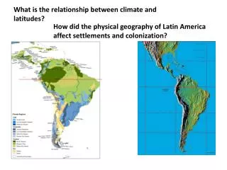
Effect on Climate • Latitudes play a pivotal role in determining the climate of a region. • As the axis of the Earth is tilted 23° 26' 21.41" to the perpendicular, specific latitude receives varied amount of sunlight with the change of seasons. • During April through September, the Northern Hemisphere receives more sunlight as it is tilted towards the Sun. • On the other hand, the Southern Hemisphere is tilted toward the Sun from October and March.
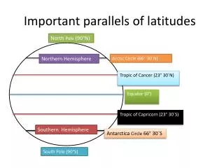
Importance of Latitudes • Though equator is the most important of all the latitudes, you will also find four others in the world map with latitude and longitude, which play a pivotal role in the geometrical relationship between the Sun and the Earth. • Arctic Circle: 66° 33' 39" N Tropic of Cancer: 23° 26' 21" N Tropic of Capricorn: 23° 26' 21" S Antarctic Circle: 66° 33' 39" SAll of the above lines lie in the Earth's axial tilt with respect to the sun (23° 26' 21.41"), and hence carry great importance.