Download
1 / 51
510 likes | 520 Views
IGIC Cadastral, Boundaries, PLSS Workgroup. Co-Chairs Lorraine Wright Rick Hill Rock Solid GIS Indiana Geological Survey. IGIC Cadastre-Boundaries-PLSS Workgroup. Workgroup Participates are From: Indiana Geographic Information Council

E N D
IGIC Cadastral, Boundaries, PLSS Workgroup Co-Chairs Lorraine Wright Rick Hill Rock Solid GIS Indiana Geological Survey
IGIC Cadastre-Boundaries-PLSS Workgroup Workgroup Participates are From: • Indiana Geographic Information Council • Indiana Society of Professional Land Surveyors • Association of County Surveyors • County Surveyors and their staff • GIS Professionals • Individual member list in Annual Reports
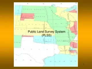
IGIC Cadastre-Boundaries-PLSS Workgroup Mission: • To develop plans, standards, and technical implementation guidance for the IndianaMAPframework data layers.
IGIC Cadastre-Boundaries-PLSS Workgroup Objectives • Develop data standards and identify appropriate standards-based data schema. • Develop plans that include the following: Refine and maintain plans as necessary. • Inventory of existing data • Stakeholder data requirements • Data stewards • Costs • Work flow • Data transfer mechanisms (with support of Data Integration Workgroup) • Update frequency • Maintenance frequency • Refine and maintain plans as necessary. • Develop metrics and review status of framework data implementation as input to the biennial report published by the State Geographic Information Officer.
IGIC Cadastre-Boundaries-PLSS Workgroup Projects • Surveyor’s Tie Card Project - Pilot completed • GIS County Boundary Project - Pilot completed • General Land Office (GLO) Historic Survey Records Preservation Project - Pilot completed • Go Fund Me Project - Marion County, IN • Title: Marion Co., IN - Making Current and Historic IN Surveying Data Available on IndianaMAP • Goal: Create current and historical IndianaMAP GIS layers using processes and standards developed during pilot projects. Data sources from Marion County, GLO. BLM and others.
Grants Applications • State Historical Restoration Board (SHRAB) • Received $5,000 for work on Original Land Records • Scanned State Archives documents available at the time • Additional documents found and need to be scanned • Not enough funds. Need to complete file naming and database with attribute information. • CLIR Proposal • Applied for but did not receive
Grant Applications(cont.) Indiana Professional Land Surveyors Fund (IPLSF) • 2016 – Applied for grant, but did not receive funds for Cadastral, Boundaries, PLSS project. • IPLSF funds helped support IndianaMAP through a grant for three years. • 2017 – Applied for grant – decision pending.
Pilot Projects Accomplishments Tie Card Project • Grid Point Layer – created state-wide grid of approximate locations of PLSS corners • Created state-wide Grid Point naming convention • Linked scanned County Tie Cards to Grid Points with state-wide naming convention • Tie Card Layer on IndianaMAP (2010-2016)
Tie Card Project Grid Points are numbered 1-80 in each section Approximation of ¼, ¼, ¼ corners
Tie Card Project Grid Points at NW Section Corner • Each section corner can have up to 4 grid points • The Grid point description depends on which section the PLSS corner was surveyed from Each Grid Point would have a different T,R, Section reference 2013
Grid Point File Naming Convention (approximate section corner and section division corners ) IN02_T23NR06E03_08 State Name and Principal Meridian – IN02 Township Number – T23 Township Direction – N Range Number – R06 Range Direction – E Section – 03 Grid Number – 08 (Grid numbering system begins with 00 in upper left hand of section and ends in 80, bottom left corner) Tie Card Project Developed State-wide Grid Point Naming Convention
4 Possible Grid Point Names at Intersection of 4 Sections Tie Card Project St. Joseph Co. Sec. 36, TWP 35 N, RNG 8 E LaGrange Co Sec. 31, TWP 36 N, RNG 8 E Grid Points IN02_T36NR08E31_72 IN02_T36NR07E36_80 80 72 08 00 IN02_T35NR07E01_08 IN02_T35NR08E06_00 Sec. 06 St. Joseph Co. Sec. 1, TWP 35 N, RNG 7 Noble County Sec. 6, TWP 35 N, RNG 8 E
Pilot Projects Accomplishments Tie Card Project (cont.) • Originally had five Counties on the IndianaMAP Tie Card Layer • Technology has changed since we began • Removed the layer late year so we could implement a better way of keeping the layers updated by hyperlinkingdirectly to County layers
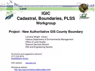
Pilot Projects Accomplishments GIS County Boundary • Worked with five counties to create a County Boundary using the County Surveyors data to determine GIS County Boundary • Scanned original Indiana laws that defined County Boundaries. • Scanned documents and created shapefile of the legal Indiana southern boundary from a Court Case. • Compiled some information on river/stream boundaries
Gibson - GIS County Boundary Point Line Polygon Gibson County County data – John Howe, March 5, 2014 Slide by Lorraine Wright, IDEM March 5, 2014
Pilot Projects Accomplishments GLO Survey Field Notes and Plats What are GLO Notes and Plats • Surveying was the first step towards distributing the land • Deputy surveyors took their instruments into the wilderness and, under miserable conditions, compiled their field notes: the complete description of the border lines of each section and the monuments marking the corners of the rectangular grid (PLSS). These notes often included cursory evaluations of the land itself, its agricultural potential, access to water or timber, types of trees, stream meanders and so on. • From these notes, the surveyors compiled plats - or maps (graphic representations) of the field notes for every township, with each section delineated showing roads, trails, rivers and streams marked. Source: BLM
Pilot Projects Accomplishments GLO Original Field Notes • Received $5,00 grant from SHRAB • Scanned documents from IN State Archives • Created file naming convention and collected metadata • Set up database with GLO Original Field Notes attributes • Still need to complete file naming and database • Provided scanned State Archive survey records to IN Northern Boundary Survey Project • Additional original notes were located, need to scan • Created a demonstration project on IndianaMAP
GLO File Names New file name of digital copy of Field Book Cover of Field Book
New effort to find funding to complete data layers for Workgroup. • Funding by County and Townships within Counties Original General Land Office Field Surveyor Notes
Plat MAP PM02 T13N R10W Prairie identified on Map
GLO Notes and Plats • There are Four Sets of Note and Plats • Original Field Notes • Transcribed Federal • Transcribed State • Transcribed County • Due to transcription errors (all four sets are not exactly the same) • Important to have all sets for comparison when conducting surveying or reaching information
GLO Notes T21N R4W -Tippecanoe County (Compared all four datasets) Example of a copy error: Source: Clayton Hogston 2/19/2016 Lorraine Wright, Rock Solid GIS IGIC Cadastral, Boundaries, PLSS Workgroup
Results of Analyzed Notes • Results of study: • T21N-R4W contains • 28 data conflicts • Total number of errors by set: • Original 3 • Federal 9 • State 16 • County 21 Source: Clayton Hogston
Accomplishments GLO Pilot Demonstration on IndianaMAP GLO Land Records Documents canned and attached to Township/Range GIS Layer 1. Select Township/Range in the dropdown box on IndianaMAP 2. For Tippecanoe County: Type in “21N4W” in the Township/Range Box on the IndianaMap demo link below. http://demo.maps.indiana.edu/index.html?URLLayers=Reference_PLSS_Townships
Accomplishments GLO Land Survey Notes Demo on IndianaMAP for Tippecanoe Co 21N4W
Utilize Processes, Lessons Learned and Standards Developed from Pilot Projects • Not enough funding to complete state-wide projects • Need to break up projects into more management pieces • Create a pilot project for a County and seek funding to complete the GIS layers for that County • Determine layers needed for current and historical County Land Records Layers • Raise funds for the County Pilot Project • Create the layers and post the information on IndianaMAP
IGIC Go Fund Me Project Accomplishment as of 5/8/2017 - raised $1,170
IGIC Go Fund Me Project Why is this project so important? • The information is useful to a wide variety of people and professions, but it is not always easy to find nor easily accessible. • Currently, the documents can be gathered (with some difficulty) from multiple sources, in various locations, and in various formats. • Our goal is to provide a state-wide public resource where all these documents are digital and easily accessible from a single source (IndianaMap) by simply pointing to a location on the map. • Historical Land Records need to be preserved and accessible
Survey Land Records Framework • 1786 - 1789 – Clarks’ Grant surveys • 1804 – 1883 - Land Survey Record Time frames • Original Field Notes • 1805 - Second Principal Meridian (PM02) Adopted • Majority of Indiana • Governing surveys -Illinois and Indiana. • Initial Point - Latitude 38-28-14, Longitude 86-27-21 • 1814 - First Principal Meridian (PM01) Adopted • Small portion of Eastern Indiana • Governing surveys - Ohio and Indiana • Initial Point - Latitude 40-59-22, Longitude 84-48-11
IGIC Go Fund Me Project • Title: “Marion County, Indiana - Making Current and Historic Indiana Surveying Data Available on IndianaMAP” • First County Project in a state-wide effort to have IndianaMAPAccess to current County Surveyor Data and Historic Land Records identified by their location. • Funds raised and not used on Marion County will go toward a new County project.
Go Fund Me Project • Marion County covers 16 different Townships • PLSS Townships in Indiana - 1102
Go Fund Me Pilot Project Marion Co. Layers • County Geospatial Information Resource Layer Government websites and contacts plus links to various government resources • Grid Point Layer Computer generated Grid Points showing the approximate location of Public Land Survey System (PLSS) points used to geo-reference scanned documents
Go Fund Me Project - Marion Co. • Tie Card Layer Grid points linked to scanned County Surveyor Tie Cards with state-wide naming convention. Click on Map for Tie Card PDF. • General Land Office (GLO) Layer(s) Field Notes and Plats Layer (Original, and transcribed Federal, State, and County notes and plats) • GLO Land Patents Layer Link to GLO Patents documents by which land was sold to private individuals (source BLM)
Go Fund Me Project - Marion Co. • Timeline Layer Traces Indiana history of land records: PLSS, GLO, GLO Districts, Treaties, and related Congressional Acts. Need this for locating historical records. • GIS County Boundary Layer Created from County Surveyor's Office data to provide best available GIS layer to support creation of seamless statewide GIS layers
Workgroup - Current activities • Monthly Webinar Meetings (listed on IGIC calendar) • Identify Possible Grants and Apply for them • Continue Raising Funds for Project: Go Fund Me Marion County, IN Historical Survey Data Project • Working with LaPorte Co. to host their Tie Cards on IndianaMAP
We Need Your Help • Need volunteers on the Cadastral, Boundaries, PLSS Workgroup • Volunteers to help in soliciting donations or identifying grant opportunities • Volunteer to help write grants • Volunteers to help accomplish 2017 goals • Need Donations for IGIC’s Go Fund Me Project • https://www.gofundme.com/MarionCo-IN-Historic-Survey-Data
IGIC Cadastre-Boundaries-PLSS Workgroup 2017 Goals and Objectives General • Update IGIC Cadastral, Boundaries, and PLSS Website • Post activities to IGIC blog • Continue to make presentations to: • the County Surveyor’s Association, ISPLS’s, and IGIC’s GIS community regardingprojects and standards. • Fund raising for all projects
IGIC Cadastre-Boundaries-PLSS Workgroup 2017 Goals and Objectives Surveyor’s Tie Card Project – (Current locations) • Definition: Tie cards describe PLSS Section Corners. • Owner: Tie Cards are maintained by County Surveyors and hosted on Counties' websites. • Continue to work on this multi-jurisdictional effort with County Surveyors’ and GIS staff to scan, geo-reference, hyperlink, and publish Surveyors’ data. • Our long term goal is to hyperlink to all County Tie Cards and make them available on IndianaMAP (PLSS Surveyor Tie Card Layer).
IGIC Cadastre-Boundaries-PLSS Workgroup 2017 Goals and Objectives GIS County Boundary Layer Project • Continue to work on this multi-jurisdictional effort with County GIS Coordinators and their County Surveyors to develop 92 authoritative GIS county boundary files. This new GIS County Boundary layer will be used to match (stitch) together other local government GIS layers that cross these boundaries.
IGIC Cadastre-Boundaries-PLSS Workgroup 2017 Goals and Objectives GIS County Boundary Layer Project (cont.) • Definition- Create a GIS County Boundary composed of County Surveyor or best available data resulting in an improved seamless GIS layer. • Continue to work with the five GIS County Boundary pilot Counties (Allen, Gibson, Marion, Noble and Wayne) as well as other Counties wanting to participate. • Work with IGS to post the new GIS County Boundary layers for the five pilot counties on IndianaMAP.
IGIC Cadastre-Boundaries-PLSS Workgroup 2017 Goals and Objectives GIS County Boundary Layer Project (cont.) • Develop How-to Documentation • Record an Informational Webinar for Counties developing and maintaining their new GIS County Boundary Layers using best available data. • Request County Surveyor participation in determining common County Boundaries with adjacent counties. • Update IndianaMAP website with this new content.
IGIC Cadastre-Boundaries-PLSS Workgroup 2017 Goals and Objectives Government Land Office (GLO) Historic Survey Records Preservation Project • Scan State Archives GLO Original and State records. Focus on Marion County as the GFM Pilot. • Continue document naming using our naming convention standard and the processes for scanning the original notes, the transcribed Federal, State and County GLO notes.
IGIC Cadastre-Boundaries-PLSS Workgroup 2017 Goals and Objectives Government Land Office (GLO) Historic Survey Records Preservation Project(cont.) • Work with IGS & UITS to publish and demonstrate Marion County GLO Pilot on IndianaMAP and Indiana Spatial Data Portal. • Record a Webinar regarding the new data on IndianaMAP and the ISDP. • Update web site with this new content.
IGIC Cadastre-Boundaries-PLSS Workgroup 2017 Goals and Objectives Government Land Office (GLO) Historic Survey Records Preservation Project(cont.) • Continue to identify donation and grant funding opportunities for publishing the remaining Original, State, Federal and County data layers on the IndianaMAP.
New Datum's coming • INDOT - INCORPS • Datum 2020 • Still need GLO original records because they are based on the actual physical location on the earth’s surface
We Need Your Help • Need volunteers on the Cadastral, Boundaries, PLSS Workgroup • Volunteers to help in soliciting donations or identifying grant opportunities • Volunteer to help write grants • Volunteers to help accomplish 2017 goals • Donations to our Go Fund Me Project • https://www.gofundme.com/MarionCo-IN-Historic-Survey-Data
IGIC Cadastral, Boundaries, PLSS Workgroup You are Invited to Join our IGIC Workgroup and Participate in our Projects Contact Co-Chairs Lorraine Wright, CPG, GISP Rick Hill Rock Solid GIS Indiana Geological Survey lorraine_wright@att.net hill2@indiana.edu
References Section is 1 mile by 1 mile Township is 6 miles by 6 miles or 480 Chains by 480 Chains Indiana PM02 T2S R3W Sec 14