Download
1 / 32
320 likes | 398 Views
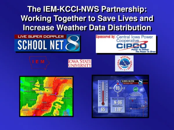
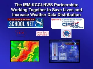
The IEM-KCCI-NWS Partnership: Working Together to Save Lives and Increase Weather Data Distribution. PROJECT REVIEW. KCCI-TV INSTALLED 44 SCHOOLNET WEATHER STATIONS BEGINNING DECEMBER OF 2000 TO PRESENT EACH STATION REPORTS CONTINOUSLY VIA THE INTERNET.

E N D
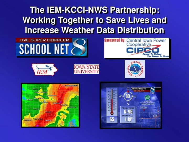
The IEM-KCCI-NWS Partnership: Working Together to Save Lives and Increase Weather Data Distribution
PROJECT REVIEW • KCCI-TV INSTALLED 44 SCHOOLNET WEATHER STATIONS BEGINNING DECEMBER OF 2000 TO PRESENT • EACH STATION REPORTS CONTINOUSLY VIA THE INTERNET. • GENERATING MORE THAN 500,000 INTERNET PAGE VIEWS EACH MONTH • INCREASED KCCI-TV IDENTITY IN RURAL COMMUNITIES. • INCREASED RATINGS DOMINANCE
Now What? • Too Much Data too watch at once! • Have to relay information to NWS via radio. • Daily notification of schools for outages. • Then along came IEM!
Iowa Environmental Mesonet • Gather, collect, compare, disseminate and archive Iowa data. • Currently gathering data from 9 networks, including KCCI’s • Archive holds over 250 million observations made in the state.
Value added data • Real Time data processing • Monitor for 50+ MPH gusts and measurable rainfall • Implement a 1 minute wind averaging scheme • Calculate rainfall accumulations
IEM Data Services • Archive EVERY observation • Convert ASCII data feed into METAR and other formats • Build unique web applications • Quality Control
IEM Tracker • Automated meta-data tracking system for IEM networks • Email alerts when sites go offline • Has stored over 4,000 pieces of IEM meta-data.
Where’s it raining? • Combine real-time 15 minute rainfall totals with current NEXRAD imagery • GIS based!!!
Improved NWS Data, Service and Education IEM NWS KCCI - TV
Benefits of Sharing • Weather Warnings • Weather Forecasts • Climate database • Hydrological Forecasts • Education & Research
Operational Data & Applications • Precipitation • 44 new real time rainfall obs • That’s a 70% increase for DMX! • IEM rainfall tables • Flash Flood Prediction • GIS Precipitation briefing tool
Operational Data & Applications • Precipitation • Wind • 44 new data points • Supplements existing network • Near Storm Environment • Enhanced boundary detection • Observation & Model comparisons
Operational Data & Applications • Precipitation • Wind • Temperature & Dew Point • 44 new data points • Supplements existing network • Near Storm Environment • Enhanced boundary detection • Observation & Model comparisons
Communication • IEM - AWIPS Alerts • Observations - LDAD - D2D • Media Radio - secondary source
Severe Weather Detection and Verification • Verify severe winds • Detection of small scale events (i.e. heat bursts) • Mesoscale analysis
Education & Preparedness • KCCI TV support of severe weather awareness programs • Promoted NOAA Weather Radio expansion • Donated tower space - addition of 4 counties to EAS
IEM Research and Climatology • GIS Weather hazard climatology • GIS Basin rainfall climatology • Assess use of sub-hourly observations
Credit is due to: Shane Searcy Information Technology Officer - NWS Des Moines Peter Corrigan Senior Hydrologist - NWS Des Moines Larry Ellis HAS - North Central River Forecast Center - NWS Julie Meyer Hydrologist - Missouri Basin River Forecast Center - NWS Central Iowa Chapter of NWA - funding support of Media radio network