Download
1 / 23

E N D
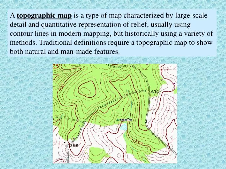
A topographic map is a type of map characterized by large-scale detail and quantitative representation of relief, usually using contour lines in modern mapping, but historically using a variety of methods. Traditional definitions require a topographic map to show both natural and man-made features.
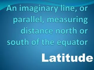
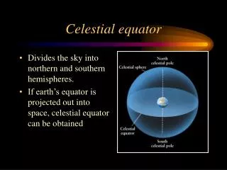
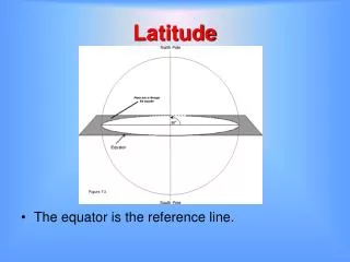
Map Grids • Latitude: Rings around Earth parallel to equator • Divided into 90°S and 90°N around the equator (0°) • Longitude: Circles that pass through both poles (MERIDIANS) • Divided into 180°E and 180°W around the Prime Meridian. The Prime Meridian passes through Grenwich, England. • Ex.) Latitude: 37°14'32"N Longitude: 97°32'15"E • Conversions: • 1 degree(°) = 60 minutes(') = 3600 seconds(")
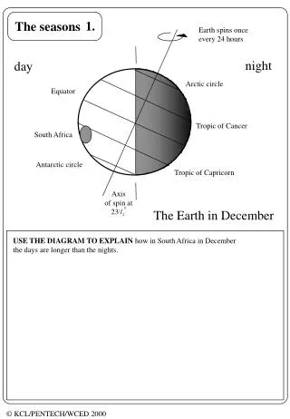
Topography – shape of the land surface True Geographic North – location of the spin axis (beneath the North Star, map arrow with a star) Magnetic North – location that the needle of a compass will point (arrow labeled MN) Grid north – location of north at the center of the US grid (arrow labeled GN) Fractional Scale – The size of the map. A 1:24,000 scale map is 24,000 times smaller than the place it represents. Elevation – Height of the land, usually given as feet above sea level Contour – for topography, a line of equal elevation. The lines show how the topography is changing. Contours cannot split or intersect
Hill V- points upstream Slope orientation changes Depression
Topographic maps are representations of surficial relief. The scale is listed in the legend, often as 1:24,000 where one inch equals 24,000 inches on the ground.
Drainage basin: is a portion of the Earth surface occupied by a main stream and its tributaries separated from adjacent basins by a drainage divide. Effluent river: a river that gets some of its water from the groundwater system. The surface of the stream directly relates to the surface of the groundwater (water table.) Influent river: a river that adds water to the groundwater system. These types of rivers are often found in arid climates, however, rivers can show influent behavior if an external variable leads to the lowering of the local water table.
The amount of water flowing in a stream is referred to as discharge. A river’s discharge is equal to its cross-sectional area multiplied by its velocity. Discharge (Q) = Velocity (V) x Cross-sectional area (D x W) Discharge generally increases downstream because water is added by tributaries joining the stream.
For example: You have measured a stream to be 25 meters wide, with an average depth of 2 meters and an average velocity of 2 m/sec. Calculate the discharge of the stream. How much water will flow by this point in 1 hour? Q = 25 m x 2 m x 2 m/sec = 100 m3/sec. 3,600 sec/hour x 100 m3/sec = 360,000 m3/hour. What would happen to the velocity of the stream if the geology of the region constricted the width of the stream to 15 m with the same depth and discharge? If Q = V x W x D then V = Q / (W x D) so… V = 100 m3/sec/(15m x 2m ) = 3.33 m/sec (1.33m/sec faster.)
Forensic Geology Example: Once a human drowns it will sink to the bottom of the water channel and remain there until the 6th day. After that time, it will become buoyant and begin to float downstream. A body found floating along a stream can be traced back to its origination point and time, if the velocity of the stream is known at several points. Also, recovery of a body can be predicted if the time and place it entered the water is known:
Roseville man's body found in Yuba By Robyn Moormeister, 12:01 a.m. PT Jun 20, 2006 A body found floating Friday night near a sandbar on the south fork of the Yuba River has been identified as Zachary Harder, the 22-year-old Roseville man who has been missing since June 10. Harder's body was found by hikers at approximately 6 p.m. Friday at Jones Bar on the Yuba River, less than a mile downstream from twin bridges, where he was last seen being swept under a large boulder in the river.
BAYOU LA BATRE, Ala. —A body believed to be the last of four children who were allegedly tossed from a coastal Alabama bridge by their father was recovered Sunday morning, authorities said. (January 20, 2008) This was approximately 2 weeks after the crime. Crime Scene Jan 7 3 2 1 • 4-month-old Danny Luong, found Jan 12. • 3-year-old Ryan Phan, found Jan 13. • 1-year-old Lindsey Luong, found Jan 16. • 2-year-old Hannah Luong, found Jan 20. 4
Groundwater Systems Water table: the upper surface of groundwater where all void spaces below are saturated. Zone of saturation: the zone in which the void spaces are filled with fluid. Zone of aeration: the zone in which the void spaces are not completely filled with water. (Vadose zone)
Ground water is primarily water held in “pores” Micropores in sandstones and carbonates Virtually no pores in granite Macropores in limestone, basalt, crystalline rocks
Permeability: the ease with which a fluid can move through a material. This is directly related to hydraulic conductivity. Cone of depression: a side-effect of pumping ground water from a well, when water is extracted from the well faster than it can be replenished by groundwater flow.
How does groundwater flow contribute to the spread of toxins?